TopoQuest Logo
Do you find TopoQuest useful?
Help keep TopoQuest running and adding new maps/features by donating!
Bitcoin:  19c7KJd3qBynnjoSw5npx9KScwjBe4ifkT
Litecoin:  LXs6TkuXGGXo1vDsWCkWVdjQX94eUKd6ui
Home View Maps Find Maps Find Places Resources & Links


Sphinx Lakes, California Topographic Map

USGS Map Title: Sphinx Lakes, CA
USGS Map MRC: 36118F5
DRG (GeoTIFF) Download: o36118f5.tif


Neighboring USGS Topographic Map Quads:


  Cedar Grove, CA  
36118G6
 

  The Sphinx, CA  
36118G5
 

  Mount Clarence King, CA  
36118G4
 

  Mount Silliman, CA  
36118F6
 

  Sphinx Lakes, CA  
36118F5
 

  Mount Brewer, CA  
36118F4
 

  Lodgepole, CA  
36118E6
 

  Triple Divide Peak, CA  
36118E5
 

  Mount Kaweah, CA  
36118E4


Map MRC Location:

N37°
W119°
N37°
W118°
H8 H7 H6 H5 H4 H3 H2 H1
G8 G7 G6 G5 G4 G3 G2 G1
F8 F7 F6 F5 F4 F3 F2 F1
E8 E7 E6 E5 E4 E3 E2 E1
D8 D7 D6 D5 D4 D3 D2 D1
C8 C7 C6 C5 C4 C3 C2 C1
B8 B7 B6 B5 B4 B3 B2 B1
A8 A7 A6 A5 A4 A3 A2 A1
N36°
W119°
N36°
W118°

Sphinx Lakes, CA USGS 1:24K Topographic Map Preview:
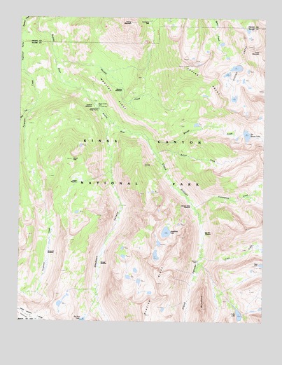
Sphinx Lakes, CA USGS Topographic Map
Click on map above to begin viewing in our Map Viewer.

This topographic map contains these locations and features:
Feature Name Type Latitude Longitude GNIS ID View Map
Avalanche PassGapN36.7485°W118.5601°218474View Map
Barton CreekStreamN36.6952°W118.5570°218712View Map
Barton PeakSummitN36.6916°W118.5991°254587View Map
Barton-Lackey CabinBuildingN36.7141°W118.5862°1667516View Map
Big Brewer LakeLakeN36.7020°W118.5098°219138View Map
Big Wet MeadowFlatN36.6627°W118.5318°254620View Map
Brewer CreekStreamN36.6999°W118.5607°219807View Map
Cement Table MeadowFlatN36.6749°W118.5395°251955View Map
Cloud CanyonValleyN36.7073°W118.5792°254750View Map
Colby LakeLakeN36.6282°W118.5130°221311View Map
Cross MountainSummitN36.7360°W118.5033°221857View Map
Cunningham CreekStreamN36.6738°W118.5376°221916View Map
Deadman CanyonValleyN36.7073°W118.5800°253663View Map
Ferguson MeadowFlatN36.6536°W118.6104°223449View Map
Josephine LakeLakeN36.6618°W118.5506°226357View Map
Lackeys CabinParkN36.7119°W118.5845°251957View Map
Moraine CreekStreamN36.7313°W118.6065°229040View Map
Moraine MeadowsFlatN36.7205°W118.5740°229042View Map
Moraine RidgeRidgeN36.7074°W118.5579°229043View Map
Palmer MountainSummitN36.7477°W118.5693°253732View Map
Ranger MeadowFlatN36.6494°W118.5845°231240View Map
Roaring River Ranger StationBuildingN36.7121°W118.5858°231665View Map
Scaffold MeadowsFlatN36.7147°W118.5873°232635View Map
Scenic MeadowFlatN36.6838°W118.5973°232638View Map
Sequoia-Kings Canyon WildernessReserveN36.7459°W118.5734°2035296View Map
Shortys CabinParkN36.6516°W118.5348°251956View Map
Sphinx CrestRidgeN36.7302°W118.5400°235190View Map
Sphinx LakesLakeN36.7296°W118.5154°235191View Map
Table CreekStreamN36.6530°W118.5326°235954View Map
TablelandAreaN36.6266°W118.6179°235967View Map
Talus LakeLakeN36.6485°W118.5017°235982View Map
West Fork Ferguson CreekStreamN36.7144°W118.6170°237470View Map
WhalebackRidgeN36.6303°W118.5312°237587View Map

Note: Coordinates in the location and feature list above are referenced to NAD83 datum.


Copyright (C) 2008-2024 Ryan Niemi / Sunset Dynamics ... All Rights Reserved