TopoQuest Logo
Do you find TopoQuest useful?
Help keep TopoQuest running and adding new maps/features by donating!
Bitcoin:  19c7KJd3qBynnjoSw5npx9KScwjBe4ifkT
Litecoin:  LXs6TkuXGGXo1vDsWCkWVdjQX94eUKd6ui
Home View Maps Find Maps Find Places Resources & Links


Spirit Lake SE, Iowa Topographic Map

USGS Map Title: Spirit Lake SE, IA
USGS Map MRC: 43095C1
DRG (GeoTIFF) Download: o43095c1.tif


Neighboring USGS Topographic Map Quads:


  Okoboji, IA  
43095D2
 

  Spirit Lake, IA  
43095D1
 

  Superior, IA  
43094D8
 

  Milford, IA  
43095C2
 

  Spirit Lake SE, IA  
43095C1
 

  Terril, IA  
43094C8
 

  Spencer, IA  
43095B2
 

  Dickens, IA  
43095B1
 

  Ruthven, IA  
43094B8


Map MRC Location:

N44°
W96°
N44°
W95°
H8 H7 H6 H5 H4 H3 H2 H1
G8 G7 G6 G5 G4 G3 G2 G1
F8 F7 F6 F5 F4 F3 F2 F1
E8 E7 E6 E5 E4 E3 E2 E1
D8 D7 D6 D5 D4 D3 D2 D1
C8 C7 C6 C5 C4 C3 C2 C1
B8 B7 B6 B5 B4 B3 B2 B1
A8 A7 A6 A5 A4 A3 A2 A1
N43°
W96°
N43°
W95°

Spirit Lake SE, IA USGS 1:24K Topographic Map Preview:
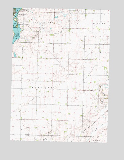
Spirit Lake SE, IA USGS Topographic Map
Click on map above to begin viewing in our Map Viewer.

This topographic map contains these locations and features:
Feature Name Type Latitude Longitude GNIS ID View Map
Adventist ChurchChurchN43.3283°W95.0233°454100View Map
Arnolds ParkPopulated PlaceN43.3727°W95.1239°454240View Map
Bull DitchCanalN43.3516°W95.0711°454973View Map
Crows Nest ResortPopulated PlaceN43.3730°W95.1236°463913View Map
D T FarmsLocaleN43.3375°W95.0342°2726808View Map
East Okoboji Lake Wildlife Management AreaParkN43.3741°W95.1150°456183View Map
Ems FarmsLocaleN43.2575°W95.0675°2727492View Map
Gingles PointCapeN43.3739°W95.1219°1907570View Map
Korey Halbur Wildlife Management AreaParkN43.3472°W95.1142°1907524View Map
Kruses BeachBeachN43.3708°W95.1225°1907571View Map
Lower Gar Lake Wildlife Management AreaParkN43.3516°W95.1181°458664View Map
M R FarmsLocaleN43.2689°W95.1225°2726804View Map
Minnewashta LakeLakeN43.3608°W95.1250°459141View Map
Minnewashta Lake State Game Mgt AreaParkN43.3602°W95.1242°459142View Map
N J FarmsLocaleN43.3575°W95.0344°2726793View Map
Olson FarmLocaleN43.2872°W95.0028°2726812View Map
Orrs Campe WinakawinLocaleN43.3605°W95.1192°1907707View Map
Pelican Ridge Mobile Home CommunityPopulated PlaceN43.3583°W95.1128°1907730View Map
Richland Cemetery (historical)CemeteryN43.3500°W95.0030°1907737View Map
Spring Run State Game Management AreaParkN43.3747°W95.0494°461908View Map
Swenson FarmsLocaleN43.2714°W95.0642°2726806View Map
Township of MilfordCivilN43.2989°W95.0914°468380View Map
Upper Gar LakeLakeN43.3686°W95.1217°462494View Map
Upper Gar Lake State Game Management AreaParkN43.3680°W95.1208°462495View Map
Woodlyn Hills Golf CourseLocaleN43.3333°W95.1225°1907741View Map

Note: Coordinates in the location and feature list above are referenced to NAD83 datum.


Copyright (C) 2008-2025 Ryan Niemi / Sunset Dynamics ... All Rights Reserved