TopoQuest Logo
Do you find TopoQuest useful?
Help keep TopoQuest running and adding new maps/features by donating!
Bitcoin:  19c7KJd3qBynnjoSw5npx9KScwjBe4ifkT
Litecoin:  LXs6TkuXGGXo1vDsWCkWVdjQX94eUKd6ui
Home View Maps Find Maps Find Places Resources & Links


Spring Canyon, New Mexico Topographic Map

USGS Map Title: Spring Canyon, NM
USGS Map MRC: 33108D1
DRG (GeoTIFF) Download: o33108d1.tif


Neighboring USGS Topographic Map Quads:


  O Bar O Canyon East, NM  
33108E2
 

  Indian Peaks West, NM  
33108E1
 

  Indian Peaks East, NM  
33107E8
 

  Black Mountain, NM  
33108D2
 

  Spring Canyon, NM  
33108D1
 

  Taylor Peak, NM  
33107D8
 

  Burnt Corral Canyon, NM  
33108C2
 

  Wall Lake, NM  
33108C1
 

  Baily Points, NM  
33107C8


Map MRC Location:

N34°
W109°
N34°
W108°
H8 H7 H6 H5 H4 H3 H2 H1
G8 G7 G6 G5 G4 G3 G2 G1
F8 F7 F6 F5 F4 F3 F2 F1
E8 E7 E6 E5 E4 E3 E2 E1
D8 D7 D6 D5 D4 D3 D2 D1
C8 C7 C6 C5 C4 C3 C2 C1
B8 B7 B6 B5 B4 B3 B2 B1
A8 A7 A6 A5 A4 A3 A2 A1
N33°
W109°
N33°
W108°

Spring Canyon, NM USGS 1:24K Topographic Map Preview:
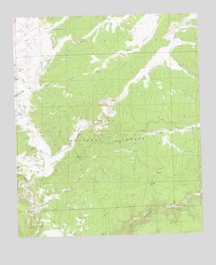
Spring Canyon, NM USGS Topographic Map
Click on map above to begin viewing in our Map Viewer.

This topographic map contains these locations and features:
Feature Name Type Latitude Longitude GNIS ID View Map
Adams CanyonValleyN33.4701°W108.0309°902987View Map
Bear CanyonValleyN33.4781°W108.1245°903635View Map
Bear Canyon WindmillLocaleN33.4926°W108.0989°903650View Map
Beaverhead LodgeLocaleN33.4287°W108.1137°898973View Map
Beaverhead Ranger StationLocaleN33.4256°W108.1117°903717View Map
Beaverhead Weather StationLocaleN33.4256°W108.1117°931848View Map
Beech Nut TankReservoirN33.4479°W108.0238°898974View Map
Bell CanyonValleyN33.4056°W108.1214°903729View Map
Boundary TankReservoirN33.4597°W108.0923°898963View Map
Cabin TankReservoirN33.4097°W108.0327°904280View Map
Chuckwagon TankReservoirN33.4309°W108.0045°898978View Map
Clay TankReservoirN33.4421°W108.0850°898964View Map
Corduroy CanyonValleyN33.4181°W108.1006°905343View Map
Corduroy TankReservoirN33.4519°W108.0624°898962View Map
Deadman TankReservoirN33.4467°W108.0470°898960View Map
Doagy CanyonValleyN33.4928°W108.0125°905790View Map
Doagy SpringSpringN33.4490°W108.0025°936732View Map
Doagy TankReservoirN33.4680°W108.0378°898965View Map
Doagy TankReservoirN33.4498°W108.0056°2038442View Map
Doagy WellWellN33.4626°W108.0417°898967View Map
Good Heavens TankReservoirN33.4076°W108.0912°898961View Map
Grogan CanyonValleyN33.4801°W108.0203°906748View Map
Houghton CanyonValleyN33.4590°W108.1198°907123View Map
Indian CorralLocaleN33.4223°W108.0470°907196View Map
Indian CreekStreamN33.3906°W108.1109°907201View Map
Indian TankReservoirN33.3854°W108.0849°907234View Map
Indian TankReservoirN33.4324°W108.0317°907235View Map
Jack TankReservoirN33.4120°W108.1123°907286View Map
Kemp MesaSummitN33.3862°W108.1037°907536View Map
Kennedy CanyonValleyN33.4595°W108.1192°907537View Map
Kennedy Mesa TankReservoirN33.3764°W108.1036°898970View Map
Kennedy WindmillLocaleN33.4976°W108.0598°907538View Map
Mule CanyonValleyN33.4862°W108.1184°908970View Map
North TankReservoirN33.3931°W108.1025°898968View Map
Old Bone TankReservoirN33.4643°W108.0564°898966View Map
Pit TankReservoirN33.4241°W108.0169°898977View Map
Sand TankReservoirN33.4969°W108.0046°898975View Map
Slash RanchLocaleN33.4453°W108.1214°911123View Map
South TankReservoirN33.3911°W108.0899°898959View Map
Spring CanyonValleyN33.4623°W108.1131°911316View Map
Spring TankReservoirN33.4684°W108.0701°911340View Map
Steeple U TankReservoirN33.3759°W108.0698°911402View Map
Steer Mesa TankReservoirN33.4034°W108.0361°911403View Map
Steer Water TankReservoirN33.4034°W108.0773°898958View Map
Stoval LakeLakeN33.3774°W108.1138°898969View Map
Taylor TankReservoirN33.4032°W108.0083°898976View Map
Thumb TankReservoirN33.4189°W108.0762°898957View Map
V-Cross-T LakeLakeN33.4664°W108.1223°912018View Map

Note: Coordinates in the location and feature list above are referenced to NAD83 datum.


Copyright (C) 2008-2024 Ryan Niemi / Sunset Dynamics ... All Rights Reserved