TopoQuest Logo
Do you find TopoQuest useful?
Help keep TopoQuest running and adding new maps/features by donating!
Bitcoin:  19c7KJd3qBynnjoSw5npx9KScwjBe4ifkT
Litecoin:  LXs6TkuXGGXo1vDsWCkWVdjQX94eUKd6ui
Home View Maps Find Maps Find Places Resources & Links


Spring City, Nevada Topographic Map

USGS Map Title: Spring City, NV
USGS Map MRC: 41117E4
DRG (GeoTIFF) Download: o41117e4.tif


Neighboring USGS Topographic Map Quads:


  Hinkey Summit, NV  
41117F5
 

  Black Ridge, NV  
41117F4
 

  Coyote Mountain, NV  
41117F3
 

  Mullinix Creek, NV  
41117E5
 

  Spring City, NV  
41117E4
 

  Hardscrabble, NV  
41117E3
 

  Paradise Valley, NV  
41117D5
 

  Little Poverty, NV  
41117D4
 

  Spring Creek, NV  
41117D3


Map MRC Location:

N42°
W118°
N42°
W117°
H8 H7 H6 H5 H4 H3 H2 H1
G8 G7 G6 G5 G4 G3 G2 G1
F8 F7 F6 F5 F4 F3 F2 F1
E8 E7 E6 E5 E4 E3 E2 E1
D8 D7 D6 D5 D4 D3 D2 D1
C8 C7 C6 C5 C4 C3 C2 C1
B8 B7 B6 B5 B4 B3 B2 B1
A8 A7 A6 A5 A4 A3 A2 A1
N41°
W118°
N41°
W117°

Spring City, NV USGS 1:24K Topographic Map Preview:
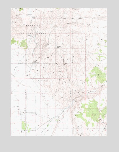
Spring City, NV USGS Topographic Map
Click on map above to begin viewing in our Map Viewer.

This topographic map contains these locations and features:
Feature Name Type Latitude Longitude GNIS ID View Map
Ansotegui RanchLocaleN41.5124°W117.4993°862951View Map
Bullion (historical)LocaleN41.5741°W117.4790°859081View Map
Buttermilk MeadowsFlatN41.6199°W117.4762°859109View Map
Buttermilk SpringsSpringN41.5979°W117.4746°859110View Map
Buttermilk SummitGapN41.6160°W117.4729°859111View Map
Cerri RanchLocaleN41.5068°W117.4651°862952View Map
China GradeSlopeN41.5357°W117.4198°859237View Map
China RoadTrailN41.5688°W117.3896°862578View Map
Coal Pit CreekStreamN41.6249°W117.4124°859278View Map
Coal Pit PeakSummitN41.6213°W117.4460°859279View Map
Deadman GulchValleyN41.5535°W117.3773°862520View Map
Dry CanyonValleyN41.5380°W117.4460°859561View Map
Dry CreekStreamN41.5702°W117.4710°859571View Map
Gouge EyePopulated PlaceN41.5713°W117.4707°859861View Map
Humboldt County Fish Hatchery (historical)LocaleN41.5271°W117.4287°862983View Map
Old Mill RanchLocaleN41.5157°W117.4387°860833View Map
Paradise Mill (historical)LocaleN41.5155°W117.4387°862993View Map
Paradise Mining DistrictCivilN41.5852°W117.4579°862994View Map
Paradise Valley Mining DistrictCivilN41.6082°W117.4537°858502View Map
Queen City (historical)Populated PlaceN41.5307°W117.4218°858423View Map
Red HillsRangeN41.5649°W117.4396°861083View Map
Secret SpringSpringN41.5128°W117.3789°861306View Map
Spring City (historical)Populated PlaceN41.5899°W117.4529°861539View Map
Spring City CanyonValleyN41.5632°W117.4765°863964View Map
Spring City CreekStreamN41.5185°W117.4929°843931View Map
Spring City Post Office (historical)Post OfficeN41.5899°W117.4529°864643View Map
SugarloafSummitN41.5424°W117.4073°861620View Map
Sugarloaf DamDamN41.5377°W117.4135°862984View Map
Wagon Wheel CreekStreamN41.5391°W117.4096°861865View Map
Wagon Wheel SpringSpringN41.5870°W117.4419°861866View Map

Note: Coordinates in the location and feature list above are referenced to NAD83 datum.


Copyright (C) 2008-2025 Ryan Niemi / Sunset Dynamics ... All Rights Reserved