TopoQuest Logo
Do you find TopoQuest useful?
Help keep TopoQuest running and adding new maps/features by donating!
Bitcoin:  19c7KJd3qBynnjoSw5npx9KScwjBe4ifkT
Litecoin:  LXs6TkuXGGXo1vDsWCkWVdjQX94eUKd6ui
Home View Maps Find Maps Find Places Resources & Links


Spring Coulee, Montana Topographic Map

USGS Map Title: Spring Coulee, MT
USGS Map MRC: 47109E7
DRG (GeoTIFF) Download: o47109e7.tif


Neighboring USGS Topographic Map Quads:


  Last Chance Bench, MT  
47109F8
 

  Starve Out Flat, MT  
47109F7
 

  P N Ranch, MT  
47109F6
 

  Steele Lake Coulee, MT  
47109E8
 

  Spring Coulee, MT  
47109E7
 

  Wolf Creek Falls, MT  
47109E6
 

  Possum Run Creek, MT  
47109D8
 

  Soda Spring Coulee, MT  
47109D7
 

  Wild Bill Flat West, MT  
47109D6


Map MRC Location:

N48°
W110°
N48°
W109°
H8 H7 H6 H5 H4 H3 H2 H1
G8 G7 G6 G5 G4 G3 G2 G1
F8 F7 F6 F5 F4 F3 F2 F1
E8 E7 E6 E5 E4 E3 E2 E1
D8 D7 D6 D5 D4 D3 D2 D1
C8 C7 C6 C5 C4 C3 C2 C1
B8 B7 B6 B5 B4 B3 B2 B1
A8 A7 A6 A5 A4 A3 A2 A1
N47°
W110°
N47°
W109°

Spring Coulee, MT USGS 1:24K Topographic Map Preview:
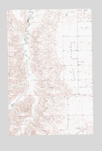
Spring Coulee, MT USGS Topographic Map
Click on map above to begin viewing in our Map Viewer.

This topographic map contains these locations and features:
Feature Name Type Latitude Longitude GNIS ID View Map
20N15E10CDCD01 WellWellN47.5047°W109.8013°823455View Map
21N15E26BCDC01 WellWellN47.5625°W109.7691°823784View Map
Big CouleeValleyN47.5036°W109.8524°768766View Map
Birkland CouleeValleyN47.5136°W109.8471°768896View Map
Coffee CreekStreamN47.5439°W109.8482°781472View Map
Coppedge School (historical)SchoolN47.5897°W109.8424°1722748View Map
Dossett CouleeValleyN47.6241°W109.8746°770725View Map
Engellant CouleeValleyN47.5997°W109.8549°771226View Map
Evers RanchLocaleN47.6236°W109.7594°771260View Map
Everson (historical)Populated PlaceN47.6236°W109.7591°1722864View Map
Everson BenchBenchN47.5500°W109.7702°771261View Map
Everson CemeteryCemeteryN47.5836°W109.7727°771262View Map
Everson Community HallLocaleN47.5689°W109.7719°771263View Map
Everson Post Office (historical)Post OfficeN47.6236°W109.7591°1722863View Map
Lincoln School (historical)SchoolN47.5400°W109.7777°773361View Map
Melton CouleeValleyN47.5211°W109.8371°774096View Map
Miller CouleeValleyN47.5744°W109.8516°774237View Map
Nance CouleeValleyN47.5989°W109.8510°774546View Map
Pleasant View School (historical)SchoolN47.5839°W109.7941°1722747View Map
Shake SpringSpringN47.6191°W109.7892°776393View Map
Slide CouleeValleyN47.5611°W109.8396°776639View Map
Spring CouleeValleyN47.5489°W109.8388°776959View Map
Wilson CouleeValleyN47.6064°W109.8682°778567View Map
Woodcock CouleeValleyN47.5544°W109.8494°778671View Map

Note: Coordinates in the location and feature list above are referenced to NAD83 datum.


Copyright (C) 2008-2025 Ryan Niemi / Sunset Dynamics ... All Rights Reserved