TopoQuest Logo
Do you find TopoQuest useful?
Help keep TopoQuest running and adding new maps/features by donating!
Bitcoin:  19c7KJd3qBynnjoSw5npx9KScwjBe4ifkT
Litecoin:  LXs6TkuXGGXo1vDsWCkWVdjQX94eUKd6ui
Home View Maps Find Maps Find Places Resources & Links


Springer, New Mexico Topographic Map

USGS Map Title: Springer, NM
USGS Map MRC: 36104C5
DRG (GeoTIFF) Download: o36104c5.tif


Neighboring USGS Topographic Map Quads:


  Springer Lake, NM  
36104D6
 

  French, NM  
36104D5
 

  Abbott NW, NM  
36104D4
 

  Pinon Hills, NM  
36104C6
 

  Springer, NM  
36104C5
 

  Taylor Springs, NM  
36104C4
 

  Colmor, NM  
36104B6
 

  Stony Lake, NM  
36104B5
 

  Jaritas Ranch, NM  
36104B4


Map MRC Location:

N37°
W105°
N37°
W104°
H8 H7 H6 H5 H4 H3 H2 H1
G8 G7 G6 G5 G4 G3 G2 G1
F8 F7 F6 F5 F4 F3 F2 F1
E8 E7 E6 E5 E4 E3 E2 E1
D8 D7 D6 D5 D4 D3 D2 D1
C8 C7 C6 C5 C4 C3 C2 C1
B8 B7 B6 B5 B4 B3 B2 B1
A8 A7 A6 A5 A4 A3 A2 A1
N36°
W105°
N36°
W104°

Springer, NM USGS 1:24K Topographic Map Preview:
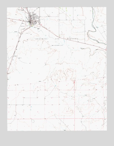
Springer, NM USGS Topographic Map
Click on map above to begin viewing in our Map Viewer.

This topographic map contains these locations and features:
Feature Name Type Latitude Longitude GNIS ID View Map
Colfax General Hospital LibraryBuildingN36.3611°W104.5953°929329View Map
Forrester Elementary SchoolSchoolN36.3611°W104.5953°933884View Map
Iglesia Bautista Betania BaptistChurchN36.3611°W104.5953°920497View Map
Maldonado PitMineN36.3434°W104.5539°916477View Map
New Mexico Boys School LibraryBuildingN36.3611°W104.5953°929430View Map
RobinsonLocaleN36.2850°W104.6205°928382View Map
Salado CreekStreamN36.3559°W104.5969°894310View Map
Santa Fe TrailTrailN36.2809°W104.5033°894573View Map
Santa Fe Trail Museum and Historical SocietyBuildingN36.3611°W104.5953°933142View Map
SpringerPopulated PlaceN36.3611°W104.5953°895273View Map
Springer Fire DepartmentBuildingN36.3638°W104.5968°2657687View Map
Springer High SchoolSchoolN36.3611°W104.5953°901361View Map
Springer Historical MarkerParkN36.3611°W104.5953°932382View Map
Springer Municipal AirportAirportN36.3277°W104.6196°937029View Map
Springer PitMineN36.3614°W104.5989°916503View Map
Springer Police DepartmentBuildingN36.3641°W104.5969°2722602View Map
Springer Post OfficePost OfficeN36.3619°W104.5947°937774View Map
Springer Volunteer Emergency Medical ServicesBuildingN36.3639°W104.5968°2657563View Map
Springer Weather StationLocaleN36.3611°W104.5953°932560View Map
State Boys School Area 1SchoolN36.3720°W104.6047°895315View Map
Town of SpringerCivilN36.3661°W104.5931°2413321View Map
Wilferth Middle SchoolSchoolN36.3611°W104.5953°901362View Map

Note: Coordinates in the location and feature list above are referenced to NAD83 datum.


Copyright (C) 2008-2025 Ryan Niemi / Sunset Dynamics ... All Rights Reserved