TopoQuest Logo
Do you find TopoQuest useful?
Help keep TopoQuest running and adding new maps/features by donating!
Bitcoin:  19c7KJd3qBynnjoSw5npx9KScwjBe4ifkT
Litecoin:  LXs6TkuXGGXo1vDsWCkWVdjQX94eUKd6ui
Home View Maps Find Maps Find Places Resources & Links


Springfield, Nebraska Topographic Map

USGS Map Title: Springfield, NE
USGS Map MRC: 41096A2
DRG (GeoTIFF) Download: o41096a2.tif


Neighboring USGS Topographic Map Quads:


  Wann, NE  
41096B3
 

  Gretna, NE  
41096B2
 

  Ralston, NE  
41096B1
 

  Ashland East, NE  
41096A3
 

  Springfield, NE  
41096A2
 

  Cedar Creek, NE  
41096A1
 

  Murdock, NE  
40096H3
 

  Manley, NE  
40096H2
 

  Weeping Water NE, NE  
40096H1


Map MRC Location:

N42°
W97°
N42°
W96°
H8 H7 H6 H5 H4 H3 H2 H1
G8 G7 G6 G5 G4 G3 G2 G1
F8 F7 F6 F5 F4 F3 F2 F1
E8 E7 E6 E5 E4 E3 E2 E1
D8 D7 D6 D5 D4 D3 D2 D1
C8 C7 C6 C5 C4 C3 C2 C1
B8 B7 B6 B5 B4 B3 B2 B1
A8 A7 A6 A5 A4 A3 A2 A1
N41°
W97°
N41°
W96°

Springfield, NE USGS 1:24K Topographic Map Preview:
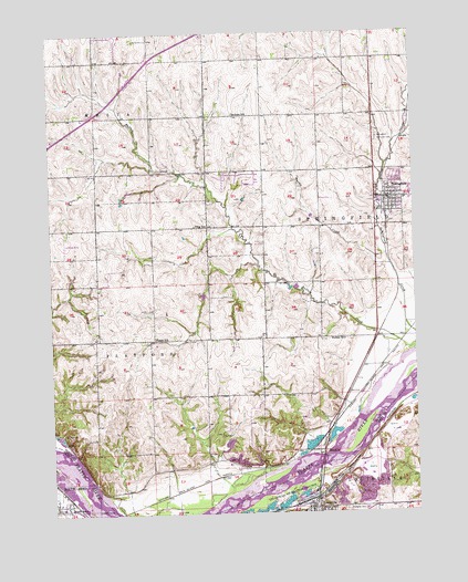
Springfield, NE USGS Topographic Map
Click on map above to begin viewing in our Map Viewer.

This topographic map contains these locations and features:
Feature Name Type Latitude Longitude GNIS ID View Map
A C Nelson CampgroundLocaleN41.0028°W96.1711°1898004View Map
Ash Grove QuarryMineN41.0103°W96.1289°2635688View Map
Ball CemeteryCemeteryN41.0205°W96.1922°827160View Map
Buffalo CreekStreamN41.0411°W96.1292°827748View Map
Buffalo Creek TributaryStreamN41.0742°W96.1874°2572179View Map
Buffalo ParkParkN41.0792°W96.1281°1898276View Map
Buffalo SchoolSchoolN41.0450°W96.1495°827759View Map
City of SpringfieldCivilN41.0853°W96.1332°2395943View Map
First United Methodist ChurchChurchN41.0819°W96.1297°1898277View Map
Grade Stabilization Dam 2DamN41.0767°W96.1603°1766939View Map
J&J AirportAirportN41.0815°W96.1540°837718View Map
KEFM-FM (Omaha)TowerN41.0708°W96.2253°837825View Map
KGBI-FM (Omaha)TowerN41.0528°W96.1933°837823View Map
Koke AirportAirportN41.0718°W96.2456°837576View Map
KPTM-TV (Omaha)TowerN41.0708°W96.2253°837840View Map
Latham ElevatorLocaleN41.0778°W96.1350°1898271View Map
LouisvilleLocaleN41.0044°W96.1600°1897952View Map
Louisville Family PhysiciansHospitalN41.0006°W96.1620°1897949View Map
Louisville Post OfficePost OfficeN41.0008°W96.1628°1897950View Map
Louisville Public LibraryBuildingN41.0006°W96.1620°1897951View Map
Louisville Public SchoolsSchoolN41.0006°W96.1650°1897955View Map
Louisville Recreation GroundsParkN41.0044°W96.1675°830918View Map
Louisville Volunteer Fire and Rescue DepartmentBuildingN41.0016°W96.1616°1897948View Map
MeadowPopulated PlaceN41.0161°W96.1567°831172View Map
Meadow (historical)LocaleN41.0161°W96.1567°1898108View Map
Meadow Post Office (historical)Post OfficeN41.0161°W96.1567°1898107View Map
Our Redeemer Lutheran ChurchChurchN41.0839°W96.1317°1898279View Map
Pflug SchoolSchoolN41.0750°W96.2006°832070View Map
Platford-Springfield Election Precinct (historical)CivilN41.0600°W96.1861°1929149View Map
Platford-Springfield I Election PrecinctCivilN41.0893°W96.1414°1929147View Map
Platford-Springfield II Election PrecinctCivilN41.0432°W96.2078°1929148View Map
Plattford (historical)Populated PlaceN41.0500°W96.2086°1898098View Map
Plattford Post Office (historical)Post OfficeN41.0500°W96.2086°1898097View Map
Plattford PrecinctCivilN41.0667°W96.1667°2702103View Map
Riverview CemeteryCemeteryN41.0008°W96.1500°832600View Map
Sanborn SchoolSchoolN41.1039°W96.1870°833152View Map
Sarpy County FairgroundsLocaleN41.0800°W96.1378°1898272View Map
South BendPopulated PlaceN41.0017°W96.2453°833542View Map
South BendLocaleN41.0056°W96.2456°1897800View Map
South Bend Post OfficePost OfficeN41.0031°W96.2458°2783232View Map
SpringfieldPopulated PlaceN41.0819°W96.1345°833737View Map
Springfield City ParkParkN41.0831°W96.1281°1898275View Map
Springfield Election PrecinctCivilN41.0853°W96.1332°1929308View Map
Springfield Elementary SchoolSchoolN41.0813°W96.1269°1898280View Map
Springfield Memorial CemeteryCemeteryN41.0975°W96.1375°833739View Map
Springfield Post OfficePost OfficeN41.0824°W96.1336°1898273View Map
Springfield Public LibraryBuildingN41.0825°W96.1325°1898274View Map
Springfield Volunteer Fire and RescueBuildingN41.0825°W96.1326°2553465View Map
Township of MeliaCivilN41.0833°W96.2170°1898126View Map
Township of PlatfordCivilN41.0417°W96.2170°1898125View Map
Township of SpringfieldCivilN41.0833°W96.1364°1898124View Map
Turtle CreekStreamN41.0642°W96.1333°834227View Map
Turtle Creek Reservoir 2ReservoirN41.0772°W96.1604°1766940View Map
United Methodist ChurchChurchN41.0006°W96.1595°1897953View Map
Village of South BendCivilN41.0022°W96.2474°2399842View Map
Xenia Post Office (historical)Post OfficeN41.0458°W96.2142°1898085View Map
Xenia SchoolSchoolN41.0456°W96.2147°834900View Map

Note: Coordinates in the location and feature list above are referenced to NAD83 datum.


Copyright (C) 2008-2024 Ryan Niemi / Sunset Dynamics ... All Rights Reserved