TopoQuest Logo
Do you find TopoQuest useful?
Help keep TopoQuest running and adding new maps/features by donating!
Bitcoin:  19c7KJd3qBynnjoSw5npx9KScwjBe4ifkT
Litecoin:  LXs6TkuXGGXo1vDsWCkWVdjQX94eUKd6ui
Home View Maps Find Maps Find Places Resources & Links


Springfield South, Georgia Topographic Map

USGS Map Title: Springfield South, GA
USGS Map MRC: 32081C3
DRG (GeoTIFF) Download: o32081c3.tif


Neighboring USGS Topographic Map Quads:


  Egypt, GA  
32081D4
 

  Springfield North, GA  
32081D3
 

  Hardeeville NW, SC  
32081D2
 

  Guyton, GA  
32081C4
 

  Springfield South, GA  
32081C3
 

  Rincon, GA  
32081C2
 

  Eden, GA  
32081B4
 

  Meldrim, GA  
32081B3
 

  Port Wentworth, GA  
32081B2


Map MRC Location:

N33°
W82°
N33°
W81°
H8 H7 H6 H5 H4 H3 H2 H1
G8 G7 G6 G5 G4 G3 G2 G1
F8 F7 F6 F5 F4 F3 F2 F1
E8 E7 E6 E5 E4 E3 E2 E1
D8 D7 D6 D5 D4 D3 D2 D1
C8 C7 C6 C5 C4 C3 C2 C1
B8 B7 B6 B5 B4 B3 B2 B1
A8 A7 A6 A5 A4 A3 A2 A1
N32°
W82°
N32°
W81°

Springfield South, GA USGS 1:24K Topographic Map Preview:
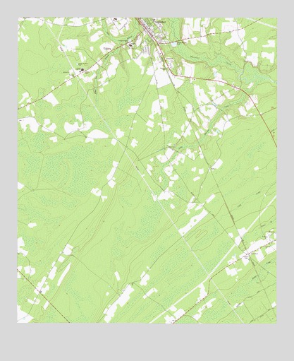
Springfield South, GA USGS Topographic Map
Click on map above to begin viewing in our Map Viewer.

This topographic map contains these locations and features:
Feature Name Type Latitude Longitude GNIS ID View Map
BlandfordPopulated PlaceN32.2785°W81.2632°354767View Map
Central Junior High SchoolSchoolN32.3746°W81.3276°350207View Map
City of SpringfieldCivilN32.3642°W81.3079°2405512View Map
Dasher School (historical)SchoolN32.2805°W81.3523°334649View Map
Effingham AcademySchoolN32.3621°W81.3301°313869View Map
Effingham CountyCivilN32.3673°W81.3413°350219View Map
Effingham County CourthouseBuildingN32.3732°W81.3143°350220View Map
Effingham County Fire Rescue Station 4BuildingN32.2858°W81.3512°2735606View Map
Effingham County High SchoolSchoolN32.3472°W81.3511°350222View Map
Effingham County Hospital HeliportAirportN32.3485°W81.3198°351910View Map
Effingham County JailBuildingN32.3647°W81.3167°2734064View Map
Effingham County Middle SchoolSchoolN32.3536°W81.3442°2453144View Map
Effingham County PrisonBuildingN32.3658°W81.3172°2502474View Map
Effingham County Sheriff's DepartmentBuildingN32.3648°W81.3168°2502319View Map
Effingham Health SystemHospitalN32.3638°W81.3209°350221View Map
Georgia State Patrol Troop I Post 42 RinconBuildingN32.3327°W81.2572°2734167View Map
Goodwill ChurchChurchN32.2813°W81.2554°314693View Map
Guyton-Springfield DivisionCivilN32.3636°W81.3362°1936301View Map
Harris Hinesly Wastewater Treatment PlantLocaleN32.3433°W81.2528°2502456View Map
Holy Samaritan ChurchChurchN32.3707°W81.3246°350234View Map
Jacks BranchStreamN32.3732°W81.2998°315987View Map
Little Ebenezer CreekStreamN32.3491°W81.2582°317063View Map
Live Oak Public Library System Effingham County BranchBuildingN32.3612°W81.3316°2502213View Map
Northside ChurchChurchN32.3746°W81.3229°350253View Map
RahnsPopulated PlaceN32.3144°W81.2812°332781View Map
Saint Marys ChurchChurchN32.2855°W81.2543°322197View Map
Saint Matthew's Parish (historical)CivilN32.3669°W81.3332°1953684View Map
Shiloh School (historical)SchoolN32.3257°W81.3362°334655View Map
Spring BranchPopulated PlaceN32.3585°W81.3132°350266View Map
SpringfieldPopulated PlaceN32.3724°W81.3115°333107View Map
Springfield City HallBuildingN32.3710°W81.3123°350267View Map
Springfield Police DepartmentBuildingN32.3674°W81.3104°2733651View Map
Springfield Post OfficePost OfficeN32.3632°W81.3072°350269View Map
Springfield Volunteer Fire DepartmentBuildingN32.3710°W81.3121°2603951View Map
WGEC-FM (Springfield)TowerN32.3674°W81.3048°352784View Map
White Deer BranchStreamN32.3641°W81.3259°325155View Map

Note: Coordinates in the location and feature list above are referenced to NAD83 datum.


Copyright (C) 2008-2024 Ryan Niemi / Sunset Dynamics ... All Rights Reserved