TopoQuest Logo
Do you find TopoQuest useful?
Help keep TopoQuest running and adding new maps/features by donating!
Bitcoin:  19c7KJd3qBynnjoSw5npx9KScwjBe4ifkT
Litecoin:  LXs6TkuXGGXo1vDsWCkWVdjQX94eUKd6ui
Home View Maps Find Maps Find Places Resources & Links


Squaw Creek, Colorado Topographic Map

USGS Map Title: Squaw Creek, CO
USGS Map MRC: 39106G2
DRG (GeoTIFF) Download: o39106g2.tif


Neighboring USGS Topographic Map Quads:


  King Creek, CO  
39106H3
 

  Battle Mountain, CO  
39106H2
 

  Sylvan Reservoir, CO  
39106H1
 

  Mount Powell, CO  
39106G3
 

  Squaw Creek, CO  
39106G2
 

  Ute Peak, CO  
39106G1
 

  Vail East, CO  
39106F3
 

  Willow Lakes, CO  
39106F2
 

  Dillon, CO  
39106F1


Map MRC Location:

N40°
W107°
N40°
W106°
H8 H7 H6 H5 H4 H3 H2 H1
G8 G7 G6 G5 G4 G3 G2 G1
F8 F7 F6 F5 F4 F3 F2 F1
E8 E7 E6 E5 E4 E3 E2 E1
D8 D7 D6 D5 D4 D3 D2 D1
C8 C7 C6 C5 C4 C3 C2 C1
B8 B7 B6 B5 B4 B3 B2 B1
A8 A7 A6 A5 A4 A3 A2 A1
N39°
W107°
N39°
W106°

Squaw Creek, CO USGS 1:24K Topographic Map Preview:
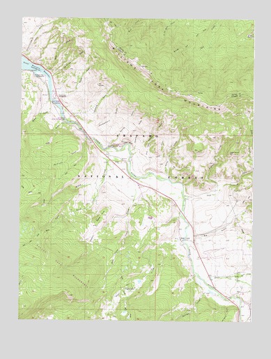
Squaw Creek, CO USGS Topographic Map
Click on map above to begin viewing in our Map Viewer.

This topographic map contains these locations and features:
Feature Name Type Latitude Longitude GNIS ID View Map
Acorn CreekStreamN39.7658°W106.1500°175965View Map
Bar CanyonValleyN39.8120°W106.1720°197413View Map
Big Four MineMineN39.8347°W106.2047°1684175View Map
Big GulchValleyN39.7845°W106.1566°175678View Map
Blue River State Wildlife AreaParkN39.8258°W106.2134°197409View Map
Bordoux GulchValleyN39.7569°W106.1387°196747View Map
Brush CreekStreamN39.8217°W106.2036°175640View Map
Butler GulchValleyN39.8362°W106.2333°197422View Map
Charlie GulchValleyN39.8201°W106.1913°196762View Map
Chokecherry GulchValleyN39.8270°W106.2098°197411View Map
Davis Springs CampgroundLocaleN39.8378°W106.2311°197421View Map
Doig GulchValleyN39.8330°W106.2269°197416View Map
Eagle RoostCliffN39.8197°W106.1381°175683View Map
Erwin GulchValleyN39.8161°W106.1874°197418View Map
Flat TopSummitN39.8214°W106.1559°175682View Map
Gore Range TrailTrailN39.8025°W106.2428°202310View Map
Harrigan CreekStreamN39.7655°W106.1500°175723View Map
Hay Camp CreekStreamN39.7933°W106.1922°175688View Map
Kansas Gulch Grandview CemeteryCemeteryN39.8294°W106.2191°2734643View Map
Lloyd GulchValleyN39.8162°W106.1835°197414View Map
Lonesome GulchValleyN39.8286°W106.2126°196714View Map
Lund GulchValleyN39.7692°W106.1546°197419View Map
McDonald Flats CampgroundLocaleN39.8505°W106.2378°197425View Map
McDonald GulchValleyN39.8508°W106.2337°197420View Map
McKinley GulchValleyN39.8250°W106.2139°175693View Map
Miller GulchValleyN39.8091°W106.1718°175702View Map
North Acorn CreekStreamN39.7680°W106.1378°175676View Map
Palmer GulchValleyN39.8187°W106.1905°175694View Map
Palmer KnobSummitN39.7894°W106.2086°197412View Map
Pass CreekStreamN39.8014°W106.1620°175680View Map
Pasture CreekStreamN39.8039°W106.1450°175681View Map
Prairie Point CampgroundLocaleN39.8428°W106.2309°197415View Map
Shane GulchValleyN39.8449°W106.2328°175692View Map
Silverthorne DivisionCivilN39.7567°W106.1914°1935566View Map
Slate CreekPopulated PlaceN39.7842°W106.1634°1947608View Map
Slate CreekStreamN39.7830°W106.1620°175941View Map
Slate Creek Ranger StationLocaleN39.7836°W106.1647°175677View Map
South Brush CreekStreamN39.8075°W106.2061°175687View Map
Spring GulchValleyN39.8223°W106.2016°197417View Map
Squaw CreekStreamN39.8105°W106.1897°175689View Map
Target BluffCliffN39.8114°W106.1689°175690View Map
The SaddleSummitN39.8483°W106.2084°197410View Map

Note: Coordinates in the location and feature list above are referenced to NAD83 datum.


Copyright (C) 2008-2024 Ryan Niemi / Sunset Dynamics ... All Rights Reserved