TopoQuest Logo
Do you find TopoQuest useful?
Help keep TopoQuest running and adding new maps/features by donating!
Bitcoin:  19c7KJd3qBynnjoSw5npx9KScwjBe4ifkT
Litecoin:  LXs6TkuXGGXo1vDsWCkWVdjQX94eUKd6ui
Home View Maps Find Maps Find Places Resources & Links


Stanford Canyon, Arizona Topographic Map

USGS Map Title: Stanford Canyon, AZ
USGS Map MRC: 31109G4
DRG (GeoTIFF) Download: o31109g4.tif


Neighboring USGS Topographic Map Quads:


  Pat Hills South, AZ  
31109H5
 

  Fife Peak, AZ  
31109H4
 

  Rustler Park, AZ  
31109H3
 

  Squaretop Hills East, AZ  
31109G5
 

  Stanford Canyon, AZ  
31109G4
 

  Chiricahua Peak, AZ  
31109G3
 

  Swisshelm Mountain, AZ  
31109F5
 

  Bruno Peak, AZ  
31109F4
 

  Swede Peak, AZ  
31109F3


Map MRC Location:

N32°
W110°
N32°
W109°
H8 H7 H6 H5 H4 H3 H2 H1
G8 G7 G6 G5 G4 G3 G2 G1
F8 F7 F6 F5 F4 F3 F2 F1
E8 E7 E6 E5 E4 E3 E2 E1
D8 D7 D6 D5 D4 D3 D2 D1
C8 C7 C6 C5 C4 C3 C2 C1
B8 B7 B6 B5 B4 B3 B2 B1
A8 A7 A6 A5 A4 A3 A2 A1
N31°
W110°
N31°
W109°

Stanford Canyon, AZ USGS 1:24K Topographic Map Preview:
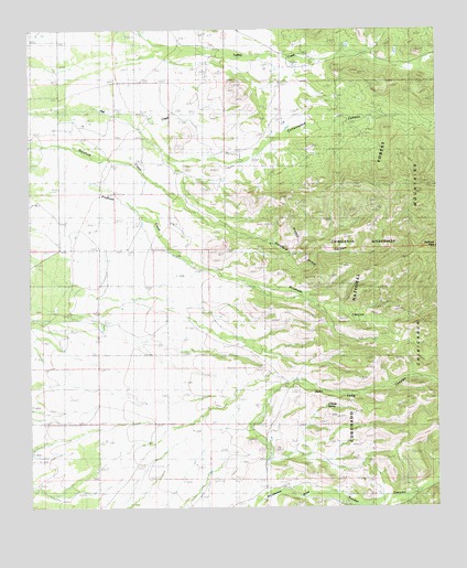
Stanford Canyon, AZ USGS Topographic Map
Click on map above to begin viewing in our Map Viewer.

This topographic map contains these locations and features:
Feature Name Type Latitude Longitude GNIS ID View Map
Camp Rucker (historical)LocaleN31.7515°W109.3840°24045View Map
Cottonwood CanyonValleyN31.8412°W109.4478°3317View Map
Dart RanchLocaleN31.7826°W109.4220°3708View Map
Davis TankReservoirN31.7634°W109.4090°22017View Map
Devils CanyonValleyN31.7540°W109.3820°3896View Map
John Long CanyonValleyN31.7765°W109.4295°6452View Map
John Ringo Historic SiteParkN31.8659°W109.4188°2675318View Map
Mormon CanyonValleyN31.8681°W109.3751°8293View Map
North TankReservoirN31.7922°W109.4201°22155View Map
O'Keefe SpringSpringN31.7764°W109.4096°8846View Map
O'Keefe TankReservoirN31.7614°W109.3988°22157View Map
Pridham CanyonValleyN31.8090°W109.4378°9775View Map
Rucker CanyonValleyN31.7529°W109.4298°10577View Map
Rusty TankReservoirN31.7715°W109.4015°22208View Map
Stanford CanyonValleyN31.8295°W109.4540°11782View Map
Turkey TankReservoirN31.8390°W109.4062°22264View Map
Winkler RanchLocaleN31.7551°W109.4128°13927View Map

Note: Coordinates in the location and feature list above are referenced to NAD83 datum.


Copyright (C) 2008-2024 Ryan Niemi / Sunset Dynamics ... All Rights Reserved