TopoQuest Logo
Do you find TopoQuest useful?
Help keep TopoQuest running and adding new maps/features by donating!
Bitcoin:  19c7KJd3qBynnjoSw5npx9KScwjBe4ifkT
Litecoin:  LXs6TkuXGGXo1vDsWCkWVdjQX94eUKd6ui
Home View Maps Find Maps Find Places Resources & Links


Steamboat Mountain, Montana Topographic Map

USGS Map Title: Steamboat Mountain, MT
USGS Map MRC: 47112C5
DRG (GeoTIFF) Download: o47112c5.tif


Neighboring USGS Topographic Map Quads:


  Double Falls, MT  
47112D6
 

  Nilan Reservoir, MT  
47112D5
 

  Augusta, MT  
47112D4
 

  Jakie Creek, MT  
47112C6
 

  Steamboat Mountain, MT  
47112C5
 

  Bean Lake, MT  
47112C4
 

  Heart Lake, MT  
47112B6
 

  Caribou Peak, MT  
47112B5
 

  Blowout Mountain, MT  
47112B4


Map MRC Location:

N48°
W113°
N48°
W112°
H8 H7 H6 H5 H4 H3 H2 H1
G8 G7 G6 G5 G4 G3 G2 G1
F8 F7 F6 F5 F4 F3 F2 F1
E8 E7 E6 E5 E4 E3 E2 E1
D8 D7 D6 D5 D4 D3 D2 D1
C8 C7 C6 C5 C4 C3 C2 C1
B8 B7 B6 B5 B4 B3 B2 B1
A8 A7 A6 A5 A4 A3 A2 A1
N47°
W113°
N47°
W112°

Steamboat Mountain, MT USGS 1:24K Topographic Map Preview:
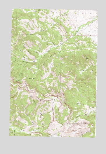
Steamboat Mountain, MT USGS Topographic Map
Click on map above to begin viewing in our Map Viewer.

This topographic map contains these locations and features:
Feature Name Type Latitude Longitude GNIS ID View Map
Bailey BasinBasinN47.3066°W112.5942°800374View Map
Bailey CreekStreamN47.3258°W112.5859°800375View Map
Beaver MeadowsFlatN47.2833°W112.5250°800431View Map
Blacktail CreekStreamN47.2563°W112.6186°800480View Map
Bunch Grass CreekStreamN47.3255°W112.6170°800511View Map
C Bar N CampLocaleN47.2724°W112.5128°800525View Map
Cataract BasinBasinN47.3083°W112.6120°800564View Map
Cataract CreekStreamN47.3238°W112.6039°800565View Map
Cataract FallsFallsN47.3221°W112.6037°800566View Map
Cyanide CreekStreamN47.3413°W112.5509°800665View Map
Delta Queen DamDamN47.3299°W112.5759°798718View Map
Devils GlenValleyN47.2511°W112.5567°800696View Map
East Fork Cyanide CreekStreamN47.3291°W112.5553°800733View Map
Elk Creek RanchLocaleN47.3338°W112.5720°800759View Map
Frost (historical)Populated PlaceN47.2916°W112.5842°1789174View Map
Grizzly CreekStreamN47.2508°W112.5609°800894View Map
Horse CreekStreamN47.3238°W112.6039°800959View Map
Horse MountainSummitN47.3380°W112.6081°800962View Map
Lead GulchValleyN47.3288°W112.5836°801044View Map
Lone Chief MountainSummitN47.3208°W112.5770°801089View Map
Milky StreamStreamN47.2563°W112.5859°801168View Map
No Grass CreekStreamN47.2530°W112.5953°801221View Map
Rocky StreamStreamN47.2558°W112.5784°801381View Map
Sawmill CreekStreamN47.3386°W112.5617°801408View Map
Sheep MountainSummitN47.3280°W112.5173°801440View Map
Short CreekStreamN47.3241°W112.6067°801447View Map
Skull GulchValleyN47.2513°W112.5500°801464View Map
Sky Mountain RanchLocaleN47.3236°W112.6053°801465View Map
Steamboat MountainSummitN47.2863°W112.5631°801533View Map
Twin ButtesSummitN47.2516°W112.5209°801628View Map
West Fork Blacktail CreekStreamN47.2547°W112.6186°801673View Map

Note: Coordinates in the location and feature list above are referenced to NAD83 datum.


Copyright (C) 2008-2025 Ryan Niemi / Sunset Dynamics ... All Rights Reserved