TopoQuest Logo
Do you find TopoQuest useful?
Help keep TopoQuest running and adding new maps/features by donating!
Bitcoin:  19c7KJd3qBynnjoSw5npx9KScwjBe4ifkT
Litecoin:  LXs6TkuXGGXo1vDsWCkWVdjQX94eUKd6ui
Home View Maps Find Maps Find Places Resources & Links


Steinhatchee SW, Florida Topographic Map

USGS Map Title: Steinhatchee SW, FL
USGS Map MRC: 29083E4
DRG (GeoTIFF) Download: o29083e4.tif


Neighboring USGS Topographic Map Quads:


  Crooked Point, FL  
29083F5
 

  Steinhatchee, FL  
29083F4
 

  Jena, FL  
29083F3


  Steinhatchee SW, FL  
29083E4
 

  Steinhatchee SE, FL  
29083E3


  Horseshoe Beach, FL  
29083D3


Map MRC Location:

N30°
W84°
N30°
W83°
H8 H7 H6 H5 H4 H3 H2 H1
G8 G7 G6 G5 G4 G3 G2 G1
F8 F7 F6 F5 F4 F3 F2 F1
E8 E7 E6 E5 E4 E3 E2 E1
D8 D7 D6 D5 D4 D3 D2 D1
C8 C7 C6 C5 C4 C3 C2 C1
B8 B7 B6 B5 B4 B3 B2 B1
A8 A7 A6 A5 A4 A3 A2 A1
N29°
W84°
N29°
W83°

Steinhatchee SW, FL USGS 1:24K Topographic Map Preview:
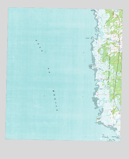
Steinhatchee SW, FL USGS Topographic Map
Click on map above to begin viewing in our Map Viewer.

This topographic map contains these locations and features:
Feature Name Type Latitude Longitude GNIS ID View Map
Bird IslandIslandN29.5975°W83.4099°278801View Map
Bowlegs PointCapeN29.5202°W83.3982°279291View Map
Buck CreekStreamN29.5505°W83.4001°279560View Map
Bull CoveBayN29.5283°W83.3978°279635View Map
Cow CreekStreamN29.5141°W83.3837°280923View Map
Days CreekGutN29.5677°W83.3971°281351View Map
Halfway PointCapeN29.5050°W83.3793°283611View Map
Hardy PointCapeN29.6244°W83.4049°283734View Map
Jena Wildlife Management AreaParkN29.5616°W83.3918°304921View Map
Rocky CreekStreamN29.6000°W83.4015°289891View Map
Sink CreekGutN29.5569°W83.3965°291170View Map
Tater IslandIslandN29.5697°W83.4062°292053View Map

Note: Coordinates in the location and feature list above are referenced to NAD83 datum.


Copyright (C) 2008-2025 Ryan Niemi / Sunset Dynamics ... All Rights Reserved