TopoQuest Logo
Do you find TopoQuest useful?
Help keep TopoQuest running and adding new maps/features by donating!
Bitcoin:  19c7KJd3qBynnjoSw5npx9KScwjBe4ifkT
Litecoin:  LXs6TkuXGGXo1vDsWCkWVdjQX94eUKd6ui
Home View Maps Find Maps Find Places Resources & Links


Stony Ridge, California Topographic Map

USGS Map Title: Stony Ridge, CA
USGS Map MRC: 40120B4
DRG (GeoTIFF) Download: o40120b4.tif


Neighboring USGS Topographic Map Quads:


  Janesville, CA  
40120C5
 

  Standish, CA  
40120C4
 

  Wendel Hot Springs, CA  
40120C3
 

  Antelope Lake, CA  
40120B5
 

  Stony Ridge, CA  
40120B4
 

  Milford, CA  
40120B3
 

  Babcock Peak, CA  
40120A5
 

  Squaw Valley Peak, CA  
40120A4
 

  Ferris Creek, CA  
40120A3


Map MRC Location:

N41°
W121°
N41°
W120°
H8 H7 H6 H5 H4 H3 H2 H1
G8 G7 G6 G5 G4 G3 G2 G1
F8 F7 F6 F5 F4 F3 F2 F1
E8 E7 E6 E5 E4 E3 E2 E1
D8 D7 D6 D5 D4 D3 D2 D1
C8 C7 C6 C5 C4 C3 C2 C1
B8 B7 B6 B5 B4 B3 B2 B1
A8 A7 A6 A5 A4 A3 A2 A1
N40°
W121°
N40°
W120°

Stony Ridge, CA USGS 1:24K Topographic Map Preview:
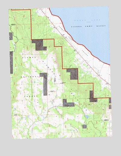
Stony Ridge, CA USGS Topographic Map
Click on map above to begin viewing in our Map Viewer.

This topographic map contains these locations and features:
Feature Name Type Latitude Longitude GNIS ID View Map
Bell SpringSpringN40.1355°W120.4088°218991View Map
Big FlatFlatN40.1505°W120.4591°219185View Map
Big Flat SpringSpringN40.1471°W120.4611°219188View Map
Brockman CanyonValleyN40.1991°W120.4144°219867View Map
Cedar SpringSpringN40.1541°W120.4949°220797View Map
Clark RanchLocaleN40.2296°W120.4416°221164View Map
Cottonwood CreekStreamN40.1527°W120.4547°221636View Map
Cottonwood MountainSummitN40.1693°W120.4516°221654View Map
Cottonwood PeakSummitN40.1771°W120.4366°221655View Map
Dinky SpringSpringN40.1791°W120.4713°222401View Map
Doyle ReservoirReservoirN40.1446°W120.4068°222581View Map
Fitch Middle SchoolValleyN40.1527°W120.4547°223557View Map
Juniper SpringSpringN40.1463°W120.4813°226400View Map
Left Hand CanyonValleyN40.1552°W120.4449°227004View Map
Lone SpringSpringN40.1313°W120.4241°227513View Map
Lone Spring MountainSummitN40.1335°W120.4191°227514View Map
Right Hand CanyonValleyN40.1555°W120.4486°231581View Map
Round MountainSummitN40.1474°W120.4941°231964View Map
Round Mountain SpringSpringN40.1452°W120.4891°231968View Map
Stony CreekStreamN40.1430°W120.4613°235545View Map
Stony RidgeRidgeN40.1743°W120.4877°235551View Map
Wales CanyonValleyN40.2310°W120.4463°237167View Map

Note: Coordinates in the location and feature list above are referenced to NAD83 datum.


Copyright (C) 2008-2025 Ryan Niemi / Sunset Dynamics ... All Rights Reserved