TopoQuest Logo
Do you find TopoQuest useful?
Help keep TopoQuest running and adding new maps/features by donating!
Bitcoin:  19c7KJd3qBynnjoSw5npx9KScwjBe4ifkT
Litecoin:  LXs6TkuXGGXo1vDsWCkWVdjQX94eUKd6ui
Home View Maps Find Maps Find Places Resources & Links


Strasburg, Missouri Topographic Map

USGS Map Title: Strasburg, MO
USGS Map MRC: 38094G2
DRG (GeoTIFF) Download: o38094g2.tif


Neighboring USGS Topographic Map Quads:


  Lake Jacomo, MO  
38094H3
 

  Tarsney Lakes, MO  
38094H2
 

  Chapel Hill, MO  
38094H1
 

  Pleasant Hill, MO  
38094G3
 

  Strasburg, MO  
38094G2
 

  Elm, MO  
38094G1
 

  Harrisonville, MO  
38094F3
 

  East Lynne, MO  
38094F2
 

  Kingsville, MO  
38094F1


Map MRC Location:

N39°
W95°
N39°
W94°
H8 H7 H6 H5 H4 H3 H2 H1
G8 G7 G6 G5 G4 G3 G2 G1
F8 F7 F6 F5 F4 F3 F2 F1
E8 E7 E6 E5 E4 E3 E2 E1
D8 D7 D6 D5 D4 D3 D2 D1
C8 C7 C6 C5 C4 C3 C2 C1
B8 B7 B6 B5 B4 B3 B2 B1
A8 A7 A6 A5 A4 A3 A2 A1
N38°
W95°
N38°
W94°

Strasburg, MO USGS 1:24K Topographic Map Preview:
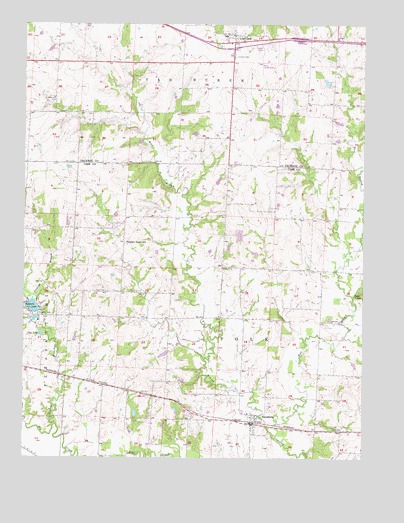
Strasburg, MO USGS Topographic Map
Click on map above to begin viewing in our Map Viewer.

This topographic map contains these locations and features:
Feature Name Type Latitude Longitude GNIS ID View Map
Baldwin DamDamN38.7933°W94.2436°762814View Map
Baldwin LakeReservoirN38.7934°W94.2470°713597View Map
Baldwin ParkPopulated PlaceN38.7939°W94.2455°1669589View Map
Bee Hive School (historical)SchoolN38.8193°W94.1408°745913View Map
City of Lone JackCivilN38.8725°W94.1741°2395750View Map
City of StrasburgCivilN38.7599°W94.1648°2395983View Map
Duncan BranchStreamN38.7595°W94.2386°717174View Map
East Branch Crawford CreekStreamN38.7567°W94.1580°717256View Map
Hazel Grove School (historical)SchoolN38.8536°W94.2394°746667View Map
Lone JackPopulated PlaceN38.8708°W94.1738°758307View Map
Lone Jack Fire Protection DistrictBuildingN38.8705°W94.1746°2620258View Map
Lone Jack High SchoolSchoolN38.8631°W94.1725°2545438View Map
Lone Jack Post OfficePost OfficeN38.8729°W94.1726°2782973View Map
Lone Jack Primary SchoolSchoolN38.8716°W94.1765°2545338View Map
Lone Pine Farm Lake DamDamN38.8583°W94.1386°763147View Map
Pleasant Grove School (historical)SchoolN38.8120°W94.2127°729945View Map
Rising Star School (historical)SchoolN38.7620°W94.2349°745912View Map
Rockhill School (historical)SchoolN38.8178°W94.1766°745914View Map
SkaggsLocaleN38.8045°W94.1447°740272View Map
Skaggs Post Office (historical)Post OfficeN38.8045°W94.1447°745621View Map
Sloan CemeteryCemeteryN38.7981°W94.2249°726554View Map
Soldiers CemeteryCemeteryN38.8659°W94.1726°726685View Map
StrasburgPopulated PlaceN38.7600°W94.1663°729971View Map
Strasburg Elementary SchoolSchoolN38.7628°W94.1674°745915View Map
Strasburg Police DepartmentBuildingN38.7600°W94.1657°2752208View Map
Township of PolkCivilN38.7678°W94.1789°766443View Map
Van LakeReservoirN38.7857°W94.2442°728118View Map
Village of Baldwin ParkCivilN38.7939°W94.2467°2398023View Map
West Branch Crawford CreekStreamN38.7567°W94.1580°728533View Map

Note: Coordinates in the location and feature list above are referenced to NAD83 datum.


Copyright (C) 2008-2025 Ryan Niemi / Sunset Dynamics ... All Rights Reserved