TopoQuest Logo
Do you find TopoQuest useful?
Help keep TopoQuest running and adding new maps/features by donating!
Bitcoin:  19c7KJd3qBynnjoSw5npx9KScwjBe4ifkT
Litecoin:  LXs6TkuXGGXo1vDsWCkWVdjQX94eUKd6ui
Home View Maps Find Maps Find Places Resources & Links


Stratford, California Topographic Map

USGS Map Title: Stratford, CA
USGS Map MRC: 36119B7
DRG (GeoTIFF) Download: o36119b7.tif


Neighboring USGS Topographic Map Quads:


  Vanguard, CA  
36119C8
 

  Lemoore, CA  
36119C7
 

  Hanford, CA  
36119C6
 

  Westhaven, CA  
36119B8
 

  Stratford, CA  
36119B7
 

  Guernsey, CA  
36119B6
 

  Kettleman City, CA  
36119A8
 

  Stratford SE, CA  
36119A7
 

  El Rico Ranch, CA  
36119A6


Map MRC Location:

N37°
W120°
N37°
W119°
H8 H7 H6 H5 H4 H3 H2 H1
G8 G7 G6 G5 G4 G3 G2 G1
F8 F7 F6 F5 F4 F3 F2 F1
E8 E7 E6 E5 E4 E3 E2 E1
D8 D7 D6 D5 D4 D3 D2 D1
C8 C7 C6 C5 C4 C3 C2 C1
B8 B7 B6 B5 B4 B3 B2 B1
A8 A7 A6 A5 A4 A3 A2 A1
N36°
W120°
N36°
W119°

Stratford, CA USGS 1:24K Topographic Map Preview:
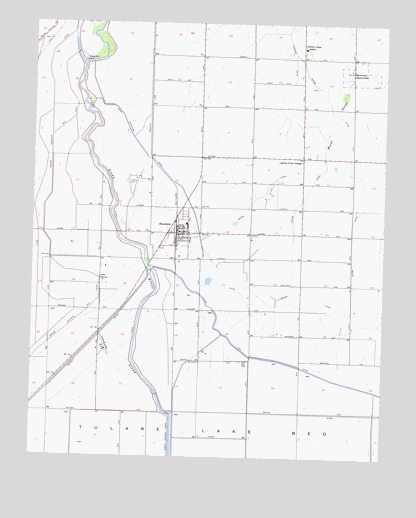
Stratford, CA USGS Topographic Map
Click on map above to begin viewing in our Map Viewer.

This topographic map contains these locations and features:
Feature Name Type Latitude Longitude GNIS ID View Map
Avila And Fernandes DairyLocaleN36.2464°W119.7972°2515625View Map
Benfica DairyLocaleN36.2456°W119.7972°2703499View Map
Central Union GrangeLocaleN36.2105°W119.7810°240439View Map
Central Union SchoolSchoolN36.2430°W119.7807°240441View Map
Cuneo (historical)Populated PlaceN36.2483°W119.8343°1665683View Map
Empire CanalCanalN36.2016°W119.7937°242021View Map
Empire School (historical)SchoolN36.2402°W119.8340°1665685View Map
Empire Weir Number OneDamN36.2387°W119.8577°1654632View Map
Empire Weir Number TwoDamN36.1789°W119.8333°242023View Map
Empire Westside Main CanalCanalN36.2175°W119.8696°242025View Map
Jacobs CanalCanalN36.1994°W119.7810°243978View Map
Jacobs School (historical)SchoolN36.2105°W119.7804°1665689View Map
Jones Farms AirportAirportN36.2046°W119.8423°1654033View Map
Kings County Fire Department Station 10 StratfordBuildingN36.1894°W119.8217°2624079View Map
Machado Dusters AirportAirportN36.1616°W119.8120°1654035View Map
Marsala (historical)LocaleN36.2202°W119.8343°1665692View Map
Newton FieldAirportN36.1553°W119.8490°1654031View Map
Parreira DairyLocaleN36.2089°W119.7600°2703643View Map
Pedro DairyLocaleN36.1653°W119.7961°2703644View Map
Santa Rosa RancheriaCivilN36.2361°W119.7551°247949View Map
StratfordPopulated PlaceN36.1894°W119.8232°1661510View Map
Stratford Branch Kings County LibraryBuildingN36.1894°W119.8232°1809219View Map
Stratford CanalCanalN36.2005°W119.8226°249975View Map
Stratford Census Designated PlaceCensusN36.1884°W119.8224°2410009View Map
Stratford Elementary SchoolSchoolN36.1922°W119.8212°1809220View Map
Stratford Industrial AreaLocaleN36.1836°W119.8229°1809221View Map
Stratford Post OfficePost OfficeN36.1898°W119.8234°1809222View Map

Note: Coordinates in the location and feature list above are referenced to NAD83 datum.


Copyright (C) 2008-2025 Ryan Niemi / Sunset Dynamics ... All Rights Reserved