TopoQuest Logo
Do you find TopoQuest useful?
Help keep TopoQuest running and adding new maps/features by donating!
Bitcoin:  19c7KJd3qBynnjoSw5npx9KScwjBe4ifkT
Litecoin:  LXs6TkuXGGXo1vDsWCkWVdjQX94eUKd6ui
Home View Maps Find Maps Find Places Resources & Links


Strongs, Michigan Topographic Map

USGS Map Title: Strongs, MI
USGS Map MRC: 46084C8
DRG (GeoTIFF) Download: o46084c8.tif


Neighboring USGS Topographic Map Quads:


  Piatt Lake, MI  
46085D1
 

  McNearney Lake, MI  
46084D8
 

  Pendills Lake, MI  
46084D7
 

  Eckerman, MI  
46085C1
 

  Strongs, MI  
46084C8
 

  Sullivan Creek, MI  
46084C7
 

  Trout Lake, MI  
46085B1
 

  Ozark, MI  
46084B8
 

  Ozark NE, MI  
46084B7


Map MRC Location:

N47°
W85°
N47°
W84°
H8 H7 H6 H5 H4 H3 H2 H1
G8 G7 G6 G5 G4 G3 G2 G1
F8 F7 F6 F5 F4 F3 F2 F1
E8 E7 E6 E5 E4 E3 E2 E1
D8 D7 D6 D5 D4 D3 D2 D1
C8 C7 C6 C5 C4 C3 C2 C1
B8 B7 B6 B5 B4 B3 B2 B1
A8 A7 A6 A5 A4 A3 A2 A1
N46°
W85°
N46°
W84°

Strongs, MI USGS 1:24K Topographic Map Preview:
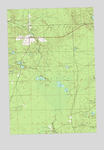
Strongs, MI USGS Topographic Map
Click on map above to begin viewing in our Map Viewer.

This topographic map contains these locations and features:
Feature Name Type Latitude Longitude GNIS ID View Map
Arbutus LakeLakeN46.3161°W84.9158°1619036View Map
Betchler LakesLakeN46.2967°W84.9237°1619175View Map
Brown LakeLakeN46.3220°W84.9806°1619333View Map
Chippewa County Ambulance ServiceBuildingN46.3454°W84.9686°2662055View Map
Coburn CemeteryCemeteryN46.3469°W84.9788°1619548View Map
Community ChurchChurchN46.3550°W84.9690°1622726View Map
Creek Number EightStreamN46.3567°W84.9801°1619616View Map
Crego LakeLakeN46.2690°W84.8792°1619619View Map
Dick PondLakeN46.3343°W84.9033°1619716View Map
Jones SchoolSchoolN46.3536°W84.9690°1620387View Map
Little Salt LakeLakeN46.3354°W84.9976°1622727View Map
Lost LakeLakeN46.3125°W84.9964°1620634View Map
Rice LakesLakeN46.3052°W84.9584°1621380View Map
Salt LakeLakeN46.3317°W84.9928°1621497View Map
StrongsPopulated PlaceN46.3578°W84.9695°1621799View Map
Strongs CornerPopulated PlaceN46.3461°W84.9692°1621800View Map
Strongs Post Office (historical)Post OfficeN46.3578°W84.9694°2354317View Map
Strongs StationLocaleN46.3578°W84.9689°2354316View Map
Stump LakeLakeN46.3644°W84.8751°1621803View Map
Three Lakes CampgroundLocaleN46.3195°W84.9776°1622728View Map
Walker LakeLakeN46.3174°W84.9802°1622049View Map
West LakeLakeN46.3183°W84.9986°1622115View Map
Whitmarsh LakeLakeN46.3210°W84.9845°1622151View Map

Note: Coordinates in the location and feature list above are referenced to NAD83 datum.


Copyright (C) 2008-2025 Ryan Niemi / Sunset Dynamics ... All Rights Reserved