TopoQuest Logo
Do you find TopoQuest useful?
Help keep TopoQuest running and adding new maps/features by donating!
Bitcoin:  19c7KJd3qBynnjoSw5npx9KScwjBe4ifkT
Litecoin:  LXs6TkuXGGXo1vDsWCkWVdjQX94eUKd6ui
Home View Maps Find Maps Find Places Resources & Links


Strouf Island, Montana Topographic Map

USGS Map Title: Strouf Island, MT
USGS Map MRC: 47110D1
DRG (GeoTIFF) Download: o47110d1.tif


Neighboring USGS Topographic Map Quads:


  Square Butte, MT  
47110E2
 

  Square Butte SE, MT  
47110E1
 

  Steele Lake Coulee, MT  
47109E8
 

  Pownal, MT  
47110D2
 

  Strouf Island, MT  
47110D1
 

  Possum Run Creek, MT  
47109D8
 

  Arrow Creek, MT  
47110C2
 

  Coffee Creek, MT  
47110C1
 

  Denton, MT  
47109C8


Map MRC Location:

N48°
W111°
N48°
W110°
H8 H7 H6 H5 H4 H3 H2 H1
G8 G7 G6 G5 G4 G3 G2 G1
F8 F7 F6 F5 F4 F3 F2 F1
E8 E7 E6 E5 E4 E3 E2 E1
D8 D7 D6 D5 D4 D3 D2 D1
C8 C7 C6 C5 C4 C3 C2 C1
B8 B7 B6 B5 B4 B3 B2 B1
A8 A7 A6 A5 A4 A3 A2 A1
N47°
W111°
N47°
W110°

Strouf Island, MT USGS 1:24K Topographic Map Preview:
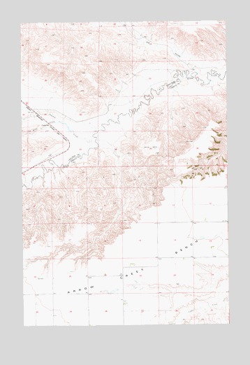
Strouf Island, MT USGS Topographic Map
Click on map above to begin viewing in our Map Viewer.

This topographic map contains these locations and features:
Feature Name Type Latitude Longitude GNIS ID View Map
19N13E01DA__01 WellWellN47.4339°W110.0016°822893View Map
19N13E12CDC_01 WellWellN47.4072°W110.0152°822714View Map
19N13E22BAC_01 WellWellN47.3991°W110.0580°822669View Map
19N13E22BBDA01 WellWellN47.4011°W110.0585°822678View Map
19N13E29AAAA01 WellWellN47.3878°W110.0866°822604View Map
19N13E29BABB01 WellWellN47.3878°W110.1010°822605View Map
19N13E29BCAA01 WellWellN47.3861°W110.1013°822599View Map
19N13E29BCBD01 WellWellN47.3825°W110.1069°822567View Map
19N13E29BCCC01 WellWellN47.3805°W110.1074°822556View Map
19N14E07BCB_01 WellWellN47.4275°W110.0008°822843View Map
20N13E20CACA01 WellWellN47.4736°W110.1021°823253View Map
20N13E25BAAA01 WellWellN47.4691°W110.0121°823199View Map
20N13E26AAD_01 WellWellN47.4664°W110.0238°823180View Map
20N13E27ABC_01 WellWellN47.4664°W110.0549°823181View Map
Arrow Creek BenchBenchN47.3980°W110.0469°779146View Map
Big CouleeValleyN47.4797°W110.0185°779784View Map
Butte CreekStreamN47.4594°W110.1021°780699View Map
Cafe Mocha DamDamN47.3883°W110.0741°798484View Map
Coffee Mate DamDamN47.3900°W110.0691°798485View Map
Cowboy CreekStreamN47.4500°W110.0841°781799View Map
Dieanira DamDamN47.4566°W110.0974°798586View Map
Strouf IslandBenchN47.4475°W110.0463°791607View Map
White Arrow School (historical)SchoolN47.4072°W110.0096°1722707View Map

Note: Coordinates in the location and feature list above are referenced to NAD83 datum.


Copyright (C) 2008-2025 Ryan Niemi / Sunset Dynamics ... All Rights Reserved