TopoQuest Logo
Do you find TopoQuest useful?
Help keep TopoQuest running and adding new maps/features by donating!
Bitcoin:  19c7KJd3qBynnjoSw5npx9KScwjBe4ifkT
Litecoin:  LXs6TkuXGGXo1vDsWCkWVdjQX94eUKd6ui
Home View Maps Find Maps Find Places Resources & Links


Styron Bay, North Carolina Topographic Map

USGS Map Title: Styron Bay, NC
USGS Map MRC: 34076G3
DRG (GeoTIFF) Download: o34076g3.tif


Neighboring USGS Topographic Map Quads:


  Long Bay, NC  
34076H4
 

  Atlantic, NC  
34076H3


  Davis, NC  
34076G4
 

  Styron Bay, NC  
34076G3


  Horsepen Point, NC  
34076F4


Map MRC Location:

N35°
W77°
N35°
W76°
H8 H7 H6 H5 H4 H3 H2 H1
G8 G7 G6 G5 G4 G3 G2 G1
F8 F7 F6 F5 F4 F3 F2 F1
E8 E7 E6 E5 E4 E3 E2 E1
D8 D7 D6 D5 D4 D3 D2 D1
C8 C7 C6 C5 C4 C3 C2 C1
B8 B7 B6 B5 B4 B3 B2 B1
A8 A7 A6 A5 A4 A3 A2 A1
N34°
W77°
N34°
W76°

Styron Bay, NC USGS 1:24K Topographic Map Preview:
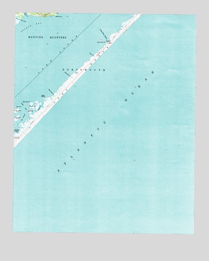
Styron Bay, NC USGS Topographic Map
Click on map above to begin viewing in our Map Viewer.

This topographic map contains these locations and features:
Feature Name Type Latitude Longitude GNIS ID View Map
Annis RunStreamN34.8710°W76.3708°980197View Map
Big MarshSwampN34.8227°W76.3621°981422View Map
Big Marsh PointCapeN34.8235°W76.3632°981424View Map
Cape Lookout National SeashoreParkN34.8264°W76.3435°1000889View Map
Carteret Rod and Gun ClubLocaleN34.8043°W76.3749°982697View Map
Cedar HammockIslandN34.8182°W76.3635°982862View Map
Cedar InletChannelN34.8216°W76.3682°982870View Map
Core BanksBarN34.8574°W76.3080°1019783View Map
Core SoundBayN34.8521°W76.3482°1019787View Map
Cross Shoal ChannelChannelN34.8627°W76.3138°983791View Map
Glover CreekStreamN34.8741°W76.3674°985746View Map
Gutter CreekGutN34.8204°W76.3566°986272View Map
Horsepen CreekStreamN34.8391°W76.3363°987133View Map
Inner Grass LumpIslandN34.8141°W76.3730°987386View Map
Middle Core BanksBarN34.8650°W76.3011°2093125View Map
Negro Creek Bay (historical)BayN34.8507°W76.3202°1008301View Map
New Drum InletGutN34.8503°W76.3214°2093122View Map
Old ChannelChannelN34.8146°W76.3674°991539View Map
Old Channel PointCapeN34.8185°W76.3749°991540View Map
Ophelia BanksBarN34.8458°W76.3258°2093123View Map
Ophelia InletGutN34.8400°W76.3322°2093124View Map
Outer Grass LumpIslandN34.8196°W76.3724°991727View Map
Sheep IslandsIslandN34.8279°W76.3530°994618View Map
Sheep Pen CreekStreamN34.8285°W76.3480°994621View Map
Steep PointCapeN34.8736°W76.3467°995457View Map
Styron BayBayN34.8693°W76.3655°995632View Map
Township of Sea LevelCivilN34.8727°W76.3735°1026509View Map
Yaupon Hammock GutBayN34.8074°W76.3716°997697View Map

Note: Coordinates in the location and feature list above are referenced to NAD83 datum.


Copyright (C) 2008-2024 Ryan Niemi / Sunset Dynamics ... All Rights Reserved