TopoQuest Logo
Do you find TopoQuest useful?
Help keep TopoQuest running and adding new maps/features by donating!
Bitcoin:  19c7KJd3qBynnjoSw5npx9KScwjBe4ifkT
Litecoin:  LXs6TkuXGGXo1vDsWCkWVdjQX94eUKd6ui
Home View Maps Find Maps Find Places Resources & Links


Sublett Troughs, Idaho Topographic Map

USGS Map Title: Sublett Troughs, ID
USGS Map MRC: 42112C8
DRG (GeoTIFF) Download: o42112c8.tif


Neighboring USGS Topographic Map Quads:


  North Heglar Canyon, ID  
42113D1
 

  Hartley Peak, ID  
42112D8
 

  Roy NE, ID  
42112D7
 

  Sublett Reservoir, ID  
42113C1
 

  Sublett Troughs, ID  
42112C8
 

  Roy, ID  
42112C7
 

  Sweetzer Canyon, ID  
42113B1
 

  Juniper, ID  
42112B8
 

  Badger Hole Spring, ID  
42112B7


Map MRC Location:

N43°
W113°
N43°
W112°
H8 H7 H6 H5 H4 H3 H2 H1
G8 G7 G6 G5 G4 G3 G2 G1
F8 F7 F6 F5 F4 F3 F2 F1
E8 E7 E6 E5 E4 E3 E2 E1
D8 D7 D6 D5 D4 D3 D2 D1
C8 C7 C6 C5 C4 C3 C2 C1
B8 B7 B6 B5 B4 B3 B2 B1
A8 A7 A6 A5 A4 A3 A2 A1
N42°
W113°
N42°
W112°

Sublett Troughs, ID USGS 1:24K Topographic Map Preview:
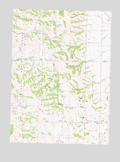
Sublett Troughs, ID USGS Topographic Map
Click on map above to begin viewing in our Map Viewer.

This topographic map contains these locations and features:
Feature Name Type Latitude Longitude GNIS ID View Map
Alney CanyonValleyN42.3649°W112.8858°376565View Map
Beaver Dam CanyonValleyN42.3299°W112.9997°377266View Map
Elbow CanyonValleyN42.3299°W112.9500°381297View Map
Eyrie CanyonValleyN42.3094°W112.9397°381521View Map
Eyrie PeakSummitN42.3052°W112.9494°381522View Map
Eyrie SpringSpringN42.3060°W112.9425°381523View Map
Kossman CanyonValleyN42.3199°W112.9422°384303View Map
Kossman SeepSpringN42.3130°W112.9489°384304View Map
North Fork Sublett CreekStreamN42.3313°W112.9978°387797View Map
Parke CanyonValleyN42.2891°W112.9305°388216View Map
Parke SpringSpringN42.2872°W112.9407°388217View Map
Pine CreekStreamN42.2524°W112.9364°388477View Map
Pine Creek ReservoirReservoirN42.2741°W112.9342°388507View Map
Pine SpringsSpringN42.2866°W112.9228°388527View Map
Sager SpringSpringN42.2930°W112.9055°389816View Map
South Fork SpringSpringN42.3302°W112.9844°391033View Map
South Fork Sublett CreekStreamN42.3313°W112.9978°391038View Map
Station ForkStreamN42.3555°W112.9736°391380View Map
Sublett Forest Service StationLocaleN42.3560°W112.9711°391575View Map
Sublett RangeRangeN42.2999°W112.9161°391576View Map
Sublett TroughsSpringN42.2721°W112.8919°391577View Map
Summit SpringsSpringN42.2980°W112.9394°391641View Map
Summit Springs PassGapN42.2966°W112.9367°391642View Map
Sunnyside SpringSpringN42.2730°W112.9078°391663View Map
Twin CanyonsValleyN42.3305°W112.9719°393930View Map
Twin CanyonsValleyN42.3305°W112.9736°393931View Map
Ward CanyonValleyN42.3671°W112.9697°392827View Map
Wild Horse SpringSpringN42.2871°W112.9075°393427View Map
Yellow Jacket SpringSpringN42.2777°W112.9064°393747View Map
Young SpringSpringN42.2960°W112.9125°393773View Map

Note: Coordinates in the location and feature list above are referenced to NAD83 datum.


Copyright (C) 2008-2025 Ryan Niemi / Sunset Dynamics ... All Rights Reserved