TopoQuest Logo
Do you find TopoQuest useful?
Help keep TopoQuest running and adding new maps/features by donating!
Bitcoin:  19c7KJd3qBynnjoSw5npx9KScwjBe4ifkT
Litecoin:  LXs6TkuXGGXo1vDsWCkWVdjQX94eUKd6ui
Home View Maps Find Maps Find Places Resources & Links


Sumas, Washington Topographic Map

USGS Map Title: Sumas, WA
USGS Map MRC: 48122H3
DRG (GeoTIFF) Download: o48122h3.tif


Neighboring USGS Topographic Map Quads:


  Lynden, WA  
48122H4
 

  Sumas, WA  
48122H3
 

  Kendall, WA  
48122H2
 

  Bellingham North, WA  
48122G4
 

  Lawrence, WA  
48122G3
 

  Deming, WA  
48122G2


Map MRC Location:

N49°
W123°
N49°
W122°
H8 H7 H6 H5 H4 H3 H2 H1
G8 G7 G6 G5 G4 G3 G2 G1
F8 F7 F6 F5 F4 F3 F2 F1
E8 E7 E6 E5 E4 E3 E2 E1
D8 D7 D6 D5 D4 D3 D2 D1
C8 C7 C6 C5 C4 C3 C2 C1
B8 B7 B6 B5 B4 B3 B2 B1
A8 A7 A6 A5 A4 A3 A2 A1
N48°
W123°
N48°
W122°

Sumas, WA USGS 1:24K Topographic Map Preview:
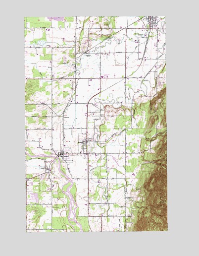
Sumas, WA USGS Topographic Map
Click on map above to begin viewing in our Map Viewer.

This topographic map contains these locations and features:
Feature Name Type Latitude Longitude GNIS ID View Map
Advent Christian ChurchChurchN48.9926°W122.2638°2609877View Map
Almar DairyLocaleN48.9033°W122.3117°2704102View Map
Berendsen DairyLocaleN48.9625°W122.3181°2703905View Map
Bone CreekStreamN48.9912°W122.2563°1503472View Map
Breckenridge CreekStreamN48.9268°W122.3127°1516927View Map
Breckenridge FarmLocaleN48.9283°W122.3058°2704184View Map
Bri Lon DairyLocaleN48.9258°W122.3544°2703610View Map
Christ Fellowship ChurchChurchN48.9199°W122.3225°2609470View Map
City of EversonCivilN48.9069°W122.3576°2410471View Map
City of NooksackCivilN48.9277°W122.3213°2411263View Map
City of SumasCivilN48.9955°W122.2695°2412000View Map
ClearbrookPopulated PlaceN48.9787°W122.3224°1510880View Map
Clearbrook Lutheran ChurchChurchN48.9926°W122.3309°2609639View Map
Dale CreekStreamN48.8929°W122.3040°1518459View Map
De Bruin DairyLocaleN48.9722°W122.2847°2703563View Map
Doubly Good DairyLocaleN48.9428°W122.3153°2703942View Map
Dykstra FarmsLocaleN48.9108°W122.3236°2704179View Map
Dyna Moo DairyLocaleN48.8936°W122.3475°2704156View Map
Eldridge FarmLocaleN48.9247°W122.2758°2704386View Map
Ever Lyn FarmLocaleN48.9344°W122.3503°2704161View Map
Evernook DairyLocaleN48.9119°W122.3369°2703946View Map
EversonPopulated PlaceN48.9201°W122.3427°1504794View Map
Everson City HallBuildingN48.9199°W122.3438°2610590View Map
Everson Elementary SchoolSchoolN48.9097°W122.3601°1514370View Map
Everson First Presbyterian Christian ChurchChurchN48.9212°W122.3422°2609471View Map
Everson LibraryBuildingN48.9196°W122.3418°2610219View Map
Everson Mobile Home EstatesPopulated PlaceN48.9172°W122.3400°2607220View Map
Everson Police DepartmentBuildingN48.9200°W122.3435°2610606View Map
Everson Post OfficePost OfficeN48.9193°W122.3383°2606949View Map
Everson Seventh Day Adventist ChurchChurchN48.9117°W122.3572°2609472View Map
Everson Sewage Treatment PlantLocaleN48.9200°W122.3508°2610671View Map
Faith Christian Fellowship ChurchChurchN48.9222°W122.3433°2609473View Map
Feenstra FarmsLocaleN48.9031°W122.3122°2704177View Map
Forest Grove FarmLocaleN48.9297°W122.2986°2704391View Map
HamptonPopulated PlaceN48.9421°W122.3421°1511019View Map
Hoines PitMineN48.8760°W122.3004°2605657View Map
Holmquist Hazelnut OrchardsLocaleN48.9975°W122.3542°2703546View Map
Hopewell Community ChurchChurchN48.8870°W122.3039°2609475View Map
Hoy Sand and Gravel QuarryMineN48.9366°W122.2984°2605703View Map
Johnson Creek DairyLocaleN48.9861°W122.2933°2703604View Map
Judson LakeLakeN48.9999°W122.3461°1505877View Map
Kingdom Hall of Jehovahs WitnessesChurchN48.9341°W122.2882°2609477View Map
Kinney CreekStreamN48.9521°W122.2832°1505991View Map
Lenssen DairyLocaleN48.9828°W122.3714°2703920View Map
Lynden Calvary ChapelChurchN48.9630°W122.3622°2609478View Map
Maarhuis DairyLocaleN48.9850°W122.2572°2703562View Map
Mapleville DairyLocaleN48.9886°W122.2692°2703564View Map
Mar G DairyLocaleN48.9922°W122.3556°2703596View Map
Marmel DairyLocaleN48.9650°W122.3025°2703921View Map
Minaker Berry FarmLocaleN48.8892°W122.3181°2704169View Map
Mission Road QuarryMineN48.8876°W122.3562°2605659View Map
Mountain Ridge DairyLocaleN48.9506°W122.3350°2704113View Map
NooksackPopulated PlaceN48.9276°W122.3215°1507007View Map
Nooksack Advent Christian ChurchChurchN48.9259°W122.3235°2609709View Map
Nooksack CemeteryCemeteryN48.9251°W122.3095°2605505View Map
Nooksack City HallBuildingN48.9273°W122.3229°2610605View Map
Nooksack Elementary SchoolSchoolN48.9263°W122.3072°2518422View Map
Nooksack Post OfficePost OfficeN48.9281°W122.3221°2606988View Map
Nooksack QuarryMineN48.9335°W122.3089°2605704View Map
Nooksack ReservationCivilN48.8843°W122.3458°2419035View Map
Nooksack Valley Assembly of God ChurchChurchN48.9324°W122.3212°2609710View Map
Nooksack Valley High SchoolSchoolN48.9647°W122.3074°1531038View Map
Nooksack Valley Middle SchoolSchoolN48.9206°W122.3274°2518420View Map
Nooksack Valley Reformed ChurchChurchN48.9281°W122.3180°2609711View Map
Nooksack Valley United Methodist ChurchChurchN48.9291°W122.3192°2608430View Map
O K DairyLocaleN48.9625°W122.2850°2703939View Map
Pangborn LakeSwampN48.9850°W122.3614°1512824View Map
Pen Rod DairyLocaleN48.9781°W122.3647°2703609View Map
Perry FarmsLocaleN48.9664°W122.3278°2704178View Map
Rhody DairyLocaleN48.9697°W122.2600°2703566View Map
Ridgeline DairyLocaleN48.8853°W122.3083°2704107View Map
Rollin Hill FarmLocaleN48.9697°W122.3336°2704183View Map
Roorda DairyLocaleN48.9297°W122.3628°2703954View Map
Saint Innocent ChurchChurchN48.9116°W122.2880°2609479View Map
Seventh Day Adventist Community CenterBuildingN48.9109°W122.3572°2605512View Map
Singer QuarryMineN48.8953°W122.3689°2605661View Map
Siper and Heutink QuarryMineN48.8801°W122.2989°2605662View Map
Squaw CreekStreamN48.9690°W122.3288°1508663View Map
StrandellPopulated PlaceN48.9121°W122.3582°1511340View Map
Sumas City HallBuildingN48.9993°W122.2653°2610578View Map
Sumas DivisionCivilN48.9409°W122.3009°1939647View Map
Sumas Elementary SchoolSchoolN48.9940°W122.2596°1515174View Map
Sumas LibraryBuildingN48.9980°W122.2595°2610225View Map
Sumas Police DepartmentBuildingN48.9993°W122.2653°2606789View Map
Sumas Post OfficePost OfficeN48.9986°W122.2657°2607030View Map
Swift CreekStreamN48.9179°W122.3096°1526863View Map
The Church of Jesus Christ of Latter Day SaintsChurchN48.9141°W122.3551°2609480View Map
Trapline Road QuarryMineN48.9762°W122.3467°2605663View Map
Udder Pride DairyLocaleN48.9431°W122.3236°2703561View Map
Valleys Edge DairyLocaleN48.9803°W122.2522°2703603View Map
Van Buren QuarryMineN48.9779°W122.3398°2605664View Map
Van Dellen FarmsLocaleN48.8906°W122.3236°2703560View Map
Van Hofwegen DairyLocaleN48.9372°W122.3411°2704152View Map
Van Weerdhuizen DairyLocaleN48.9858°W122.2778°2703901View Map
Veldman DairyLocaleN48.9444°W122.3181°2703587View Map
Westwind AirportAirportN48.8864°W122.3286°2443296View Map
Whatcom County Fire District 1 Station 81BuildingN48.9204°W122.3422°2643671View Map
Whatcom County Fire District 14 Station 91 SumasBuildingN48.9961°W122.2633°2643599View Map

Note: Coordinates in the location and feature list above are referenced to NAD83 datum.


Copyright (C) 2008-2025 Ryan Niemi / Sunset Dynamics ... All Rights Reserved