TopoQuest Logo
Do you find TopoQuest useful?
Help keep TopoQuest running and adding new maps/features by donating!
Bitcoin:  19c7KJd3qBynnjoSw5npx9KScwjBe4ifkT
Litecoin:  LXs6TkuXGGXo1vDsWCkWVdjQX94eUKd6ui
Home View Maps Find Maps Find Places Resources & Links


Sunnyside, Nevada Topographic Map

USGS Map Title: Sunnyside, NV
USGS Map MRC: 38115D1
DRG (GeoTIFF) Download: o38115d1.tif


Neighboring USGS Topographic Map Quads:


  Moorman Spring, NV  
38115E2
 

  Moorman Spring SE, NV  
38115E1
 

  Shingle Pass, NV  
38114E8
 

  Sunnyside NW, NV  
38115D2
 

  Sunnyside, NV  
38115D1
 

  Cave Valley Well, NV  
38114D8
 

  Hot Creek Butte, NV  
38115C2
 

  Gap Mountain, NV  
38115C1
 

  Silver King Well, NV  
38114C8


Map MRC Location:

N39°
W116°
N39°
W115°
H8 H7 H6 H5 H4 H3 H2 H1
G8 G7 G6 G5 G4 G3 G2 G1
F8 F7 F6 F5 F4 F3 F2 F1
E8 E7 E6 E5 E4 E3 E2 E1
D8 D7 D6 D5 D4 D3 D2 D1
C8 C7 C6 C5 C4 C3 C2 C1
B8 B7 B6 B5 B4 B3 B2 B1
A8 A7 A6 A5 A4 A3 A2 A1
N38°
W116°
N38°
W115°

Sunnyside, NV USGS 1:24K Topographic Map Preview:
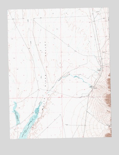
Sunnyside, NV USGS Topographic Map
Click on map above to begin viewing in our Map Viewer.

This topographic map contains these locations and features:
Feature Name Type Latitude Longitude GNIS ID View Map
Adams-McGill ReservoirReservoirN38.3809°W115.1062°857883View Map
Butterfield SpringsSpringN38.4397°W115.0119°856205View Map
CCC CampLocaleN38.4355°W115.0231°851030View Map
Dacey DamDamN38.3899°W115.1158°863488View Map
Dacey ReservoirReservoirN38.3984°W115.1171°857953View Map
Flag SpringsSpringN38.4226°W115.0232°840498View Map
Hendrix RanchLocaleN38.4175°W115.0281°851041View Map
SunnysidePopulated PlaceN38.4233°W115.0211°845690View Map
Sunnyside CreekStreamN38.4111°W115.0864°844100View Map
Sunnyside Post Office (historical)Post OfficeN38.4230°W115.0222°864929View Map
Sunnyside Whipple RanchLocaleN38.4411°W115.0125°848337View Map
Sunnyside-Kirch Wildlife Management Area Airport (historical)AirportN38.4147°W115.0367°864086View Map
Trough Spring CanyonValleyN38.3880°W115.0117°844421View Map
Wayne E Kirch Wildlife Management AreaParkN38.3883°W115.1167°863948View Map
Whipple RanchLocaleN38.4230°W115.0225°851032View Map

Note: Coordinates in the location and feature list above are referenced to NAD83 datum.


Copyright (C) 2008-2025 Ryan Niemi / Sunset Dynamics ... All Rights Reserved