TopoQuest Logo
Do you find TopoQuest useful?
Help keep TopoQuest running and adding new maps/features by donating!
Bitcoin:  19c7KJd3qBynnjoSw5npx9KScwjBe4ifkT
Litecoin:  LXs6TkuXGGXo1vDsWCkWVdjQX94eUKd6ui
Home View Maps Find Maps Find Places Resources & Links


Superior, Montana Topographic Map

USGS Map Title: Superior, MT
USGS Map MRC: 47114B8
DRG (GeoTIFF) Download: o47114b8.tif


Neighboring USGS Topographic Map Quads:


  Saint Regis, MT  
47115C1
 

  Keystone Peak, MT  
47114C8
 

  Quinns Hot Springs, MT  
47114C7
 

  Wilson Gulch, MT  
47115B1
 

  Superior, MT  
47114B8
 

  Idaho Gulch, MT  
47114B7
 

  Illinois Peak, MT  
47115A1
 

  Landowner Mountain, MT  
47114A8
 

  Lozeau, MT  
47114A7


Map MRC Location:

N48°
W115°
N48°
W114°
H8 H7 H6 H5 H4 H3 H2 H1
G8 G7 G6 G5 G4 G3 G2 G1
F8 F7 F6 F5 F4 F3 F2 F1
E8 E7 E6 E5 E4 E3 E2 E1
D8 D7 D6 D5 D4 D3 D2 D1
C8 C7 C6 C5 C4 C3 C2 C1
B8 B7 B6 B5 B4 B3 B2 B1
A8 A7 A6 A5 A4 A3 A2 A1
N47°
W115°
N47°
W114°

Superior, MT USGS 1:24K Topographic Map Preview:
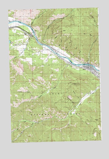
Superior, MT USGS Topographic Map
Click on map above to begin viewing in our Map Viewer.

This topographic map contains these locations and features:
Feature Name Type Latitude Longitude GNIS ID View Map
16N19W10DBAC01 WellWellN47.1505°W114.9824°821043View Map
Ashmore (historical)LocaleN47.2383°W114.9996°1781691View Map
Ashmore School (historical)SchoolN47.2383°W114.9996°1781692View Map
Bear GulchValleyN47.1477°W114.9212°779540View Map
Blacktail CreekStreamN47.1649°W114.9704°780055View Map
Charette GulchValleyN47.2163°W114.9385°781165View Map
Chimney RockSummitN47.1446°W114.8801°769841View Map
Club GulchValleyN47.2155°W114.8854°781421View Map
Curran GulchValleyN47.1533°W114.9176°794320View Map
Deer Lick CreekStreamN47.1660°W114.8962°782260View Map
Dry CreekStreamN47.2255°W114.9657°782589View Map
Dry Creek Fishing Access SiteLocaleN47.2244°W114.9601°1744341View Map
Eva Horning ParkParkN47.1910°W114.8871°1781586View Map
Flat CreekStreamN47.1991°W114.8910°783496View Map
Frank James ParkParkN47.1944°W114.8982°1781575View Map
Funston (historical)LocaleN47.2041°W114.9321°1781650View Map
Interchange 43CrossingN47.2255°W114.9701°1781723View Map
Interchange 47CrossingN47.1952°W114.8926°1781722View Map
Iron Mountain Post Office (historical)Post OfficeN47.1883°W114.8857°1781638View Map
Iron Mountain School (historical)SchoolN47.1883°W114.8857°1781639View Map
Jehovah's Witness Kingdom HallChurchN47.1888°W114.8821°1781583View Map
Jim GulchValleyN47.2013°W114.9051°785485View Map
Kelly GulchValleyN47.2044°W114.9124°785661View Map
Keystone CreekStreamN47.2338°W114.9704°785704View Map
Marlin (historical)LocaleN47.1985°W114.8982°1781628View Map
Mary Queen of Heaven Catholic ChurchChurchN47.1946°W114.8887°1781579View Map
McIntyre GulchValleyN47.1646°W114.9032°787068View Map
Mineral Community HospitalHospitalN47.1853°W114.8766°1781676View Map
Mineral Community Nursing HomeHospitalN47.1852°W114.8765°1781678View Map
Mineral CountyCivilN47.1472°W114.9983°1720030View Map
Mineral County CourthouseBuildingN47.1930°W114.8901°1781702View Map
Mineral County FairgroundsLocaleN47.1874°W114.8787°1781703View Map
Mineral County MuseumBuildingN47.1946°W114.8960°1781736View Map
Mineral County Parish of United Methodist ChurchChurchN47.1952°W114.8912°1781584View Map
Mineral County Public LibraryBuildingN47.1946°W114.8960°1781735View Map
Mineral County Sheriff's OfficeBuildingN47.1928°W114.8904°1781706View Map
Murphy CreekStreamN47.2197°W114.9749°787858View Map
Oregon (historical)LocaleN47.1430°W114.9676°1781621View Map
Oregon GulchValleyN47.1433°W114.9699°788486View Map
Pardee CreekStreamN47.2174°W114.9571°788629View Map
Riverside Medical ClinicHospitalN47.1902°W114.8793°1781571View Map
Riverview Trailer ParkPopulated PlaceN47.1949°W114.8862°1781572View Map
Shaw GulchValleyN47.2105°W114.9229°790296View Map
Spring GulchPopulated PlaceN47.2302°W114.9807°791282View Map
Spring Gulch School (historical)SchoolN47.2302°W114.9807°1781602View Map
SuperiorLocaleN47.1883°W114.8857°1781601View Map
SuperiorPopulated PlaceN47.1916°W114.8918°791730View Map
Superior Assembly of God ChurchChurchN47.1944°W114.8851°1781582View Map
Superior Baptist ChurchChurchN47.1908°W114.8835°1781580View Map
Superior CemeteryCemeteryN47.1999°W114.8898°1781759View Map
Superior Church of ChristChurchN47.1883°W114.8857°1781578View Map
Superior Community ChurchChurchN47.1949°W114.9010°1781581View Map
Superior Elementary SchoolSchoolN47.1866°W114.8776°1781708View Map
Superior EMSBuildingN47.1862°W114.8762°2766764View Map
Superior Fishing Access SiteLocaleN47.1894°W114.8799°1744263View Map
Superior High SchoolSchoolN47.1888°W114.8793°1781711View Map
Superior Post OfficePost OfficeN47.1937°W114.8901°1781600View Map
Superior Volunteer Fire CompanyBuildingN47.1863°W114.8760°2546511View Map
Superior Volunteer Fire DepartmentBuildingN47.1947°W114.8897°1781704View Map
Tamarack Medical ClinicHospitalN47.1852°W114.8765°1781677View Map
The Church of Jesus Christ of Latter Day SaintsChurchN47.1883°W114.8851°1781577View Map
Thompson CreekStreamN47.1996°W114.9160°792087View Map
Thompson PeakSummitN47.1763°W114.9190°792098View Map
Timberman ParkParkN47.1955°W114.9024°1781573View Map
Town of SuperiorCivilN47.1935°W114.8920°2413356View Map
Trinity Lutheran ChurchChurchN47.1902°W114.8837°1781585View Map
Upham CreekStreamN47.1535°W114.9165°792601View Map
Water GulchValleyN47.2144°W114.9312°792869View Map
Westside FieldParkN47.1955°W114.9021°1781574View Map
Whitemarsh GulchValleyN47.1599°W114.9093°806826View Map

Note: Coordinates in the location and feature list above are referenced to NAD83 datum.


Copyright (C) 2008-2025 Ryan Niemi / Sunset Dynamics ... All Rights Reserved