TopoQuest Logo
Do you find TopoQuest useful?
Help keep TopoQuest running and adding new maps/features by donating!
Bitcoin:  19c7KJd3qBynnjoSw5npx9KScwjBe4ifkT
Litecoin:  LXs6TkuXGGXo1vDsWCkWVdjQX94eUKd6ui
Home View Maps Find Maps Find Places Resources & Links


Sutherland Reservoir NW, Nebraska Topographic Map

USGS Map Title: Sutherland Reservoir NW, NE
USGS Map MRC: 41101B2
DRG (GeoTIFF) Download: o41101b2.tif


Neighboring USGS Topographic Map Quads:


  Big Bald Hill SE, NE  
41101C3
 

  Applegate Ranch, NE  
41101C2
 

  Green Ranch, NE  
41101C1
 

  Paxton North, NE  
41101B3
 

  Sutherland Reservoir NW, NE  
41101B2
 

  Hershey West, NE  
41101B1
 

  Paxton South, NE  
41101A3
 

  Sutherland Reservoir West, NE  
41101A2
 

  Sutherland Reservoir East, NE  
41101A1


Map MRC Location:

N42°
W102°
N42°
W101°
H8 H7 H6 H5 H4 H3 H2 H1
G8 G7 G6 G5 G4 G3 G2 G1
F8 F7 F6 F5 F4 F3 F2 F1
E8 E7 E6 E5 E4 E3 E2 E1
D8 D7 D6 D5 D4 D3 D2 D1
C8 C7 C6 C5 C4 C3 C2 C1
B8 B7 B6 B5 B4 B3 B2 B1
A8 A7 A6 A5 A4 A3 A2 A1
N41°
W102°
N41°
W101°

Sutherland Reservoir NW, NE USGS 1:24K Topographic Map Preview:
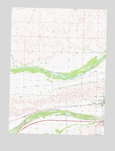
Sutherland Reservoir NW, NE USGS Topographic Map
Click on map above to begin viewing in our Map Viewer.

This topographic map contains these locations and features:
Feature Name Type Latitude Longitude GNIS ID View Map
Bull DitchCanalN41.1742°W101.1982°827769View Map
Community Care at SutherlandHospitalN41.1583°W101.1260°1838655View Map
Danseys (historical)LocaleN41.1256°W101.2060°1838528View Map
Dexter (historical)LocaleN41.1500°W101.1977°1838522View Map
East Clear CreekStreamN41.1905°W101.2382°828951View Map
Grace Lutheran ChurchChurchN41.1581°W101.1282°1838650View Map
Hope Baptist ChurchChurchN41.1639°W101.1296°1838649View Map
Interchange 158CrossingN41.1386°W101.1265°1838683View Map
Maxine White Public LibraryBuildingN41.1586°W101.1265°1838648View Map
Oregon Trail Park CampgroundLocaleN41.1569°W101.1263°1838641View Map
Presbyterian ChurchChurchN41.1594°W101.1268°1838651View Map
Railroad ParkParkN41.1567°W101.1277°1838640View Map
Sacred Heart Catholic ChurchChurchN41.1603°W101.1332°1838653View Map
Scoular Grain Company ElevatorLocaleN41.1572°W101.1268°1838646View Map
SutherlandLocaleN41.1567°W101.1268°1838644View Map
SutherlandPopulated PlaceN41.1569°W101.1263°833959View Map
Sutherland CemeteryCemeteryN41.1358°W101.1360°833961View Map
Sutherland DamDamN41.1267°W101.1371°1768768View Map
Sutherland Election PrecinctCivilN41.1722°W101.1841°1929327View Map
Sutherland Medical ClinicHospitalN41.1583°W101.1260°1838656View Map
Sutherland Post OfficePost OfficeN41.1574°W101.1265°1838645View Map
Sutherland Public SchoolsSchoolN41.1603°W101.1263°1838647View Map
Sutherland Reservoir CampgroundsLocaleN41.1258°W101.1377°1838499View Map
Sutherland Reservoir ParkParkN41.1258°W101.1374°833963View Map
Sutherland Volunteer Fire and RescueBuildingN41.1579°W101.1252°1838643View Map
Trego AirportAirportN41.2099°W101.1498°837727View Map
West ParkParkN41.1564°W101.1296°1838639View Map

Note: Coordinates in the location and feature list above are referenced to NAD83 datum.


Copyright (C) 2008-2025 Ryan Niemi / Sunset Dynamics ... All Rights Reserved