TopoQuest Logo
Do you find TopoQuest useful?
Help keep TopoQuest running and adding new maps/features by donating!
Bitcoin:  19c7KJd3qBynnjoSw5npx9KScwjBe4ifkT
Litecoin:  LXs6TkuXGGXo1vDsWCkWVdjQX94eUKd6ui
Home View Maps Find Maps Find Places Resources & Links


Swain Mountain, California Topographic Map

USGS Map Title: Swain Mountain, CA
USGS Map MRC: 40121D1
DRG (GeoTIFF) Download: o40121d1.tif


Neighboring USGS Topographic Map Quads:


  Bogard Buttes, CA  
40121E2
 

  Pine Creek Valley, CA  
40121E1
 

  Antelope Mountain, CA  
40120E8
 

  Red Cinder, CA  
40121D2
 

  Swain Mountain, CA  
40121D1
 

  Pegleg Mountain, CA  
40120D8
 

  Chester, CA  
40121C2
 

  Westwood West, CA  
40121C1
 

  Westwood East, CA  
40120C8


Map MRC Location:

N41°
W122°
N41°
W121°
H8 H7 H6 H5 H4 H3 H2 H1
G8 G7 G6 G5 G4 G3 G2 G1
F8 F7 F6 F5 F4 F3 F2 F1
E8 E7 E6 E5 E4 E3 E2 E1
D8 D7 D6 D5 D4 D3 D2 D1
C8 C7 C6 C5 C4 C3 C2 C1
B8 B7 B6 B5 B4 B3 B2 B1
A8 A7 A6 A5 A4 A3 A2 A1
N40°
W122°
N40°
W121°

Swain Mountain, CA USGS 1:24K Topographic Map Preview:
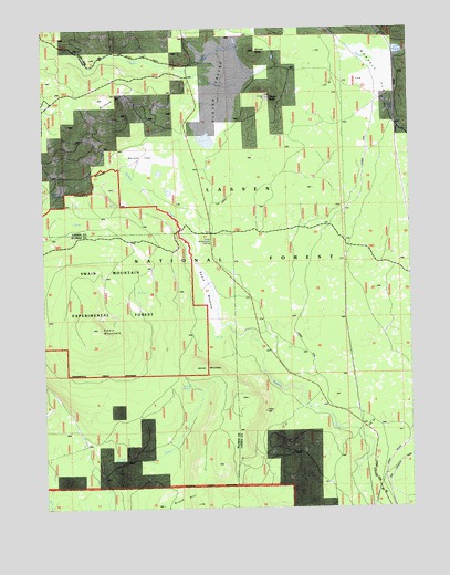
Swain Mountain, CA USGS Topographic Map
Click on map above to begin viewing in our Map Viewer.

This topographic map contains these locations and features:
Feature Name Type Latitude Longitude GNIS ID View Map
Barnes FlatFlatN40.4666°W121.0922°1665829View Map
Barrel SpringSpringN40.3835°W121.0347°1665830View Map
Bennett KnollSummitN40.4938°W121.0530°1665832View Map
Brush HillSummitN40.3760°W121.0761°219931View Map
Clover ButteSummitN40.4824°W121.0511°221240View Map
Clover ValleyValleyN40.4924°W121.0625°221250View Map
Griffith HillSummitN40.4816°W121.1069°1665863View Map
Jennie MountainSummitN40.4118°W121.0722°1658858View Map
Jennie SpringSpringN40.4071°W121.0772°226196View Map
Johnson TrailTrailN40.3832°W121.0077°276211View Map
Lake NorvellLakeN40.4940°W121.0045°1664818View Map
NorvellPopulated PlaceN40.4863°W121.0055°1659259View Map
Norvell FlatFlatN40.4835°W121.0141°229787View Map
Susan River CampgroundLocaleN40.4921°W121.0927°235835View Map
Swain MeadowFlatN40.4316°W121.0714°235858View Map
Swain MountainSummitN40.4216°W121.1097°235859View Map
Swain Mountain Experimental ForestForestN40.4332°W121.1094°1655314View Map
Swain Mountain Experimental ForestForestN40.4360°W121.1075°235860View Map
Swain Snowmobile ParkingLocaleN40.4443°W121.0708°1802890View Map

Note: Coordinates in the location and feature list above are referenced to NAD83 datum.


Copyright (C) 2008-2025 Ryan Niemi / Sunset Dynamics ... All Rights Reserved