TopoQuest Logo
Do you find TopoQuest useful?
Help keep TopoQuest running and adding new maps/features by donating!
Bitcoin:  19c7KJd3qBynnjoSw5npx9KScwjBe4ifkT
Litecoin:  LXs6TkuXGGXo1vDsWCkWVdjQX94eUKd6ui
Home View Maps Find Maps Find Places Resources & Links


Sylvia, Kansas Topographic Map

USGS Map Title: Sylvia, KS
USGS Map MRC: 37098H4
DRG (GeoTIFF) Download: o37098h4.tif


Neighboring USGS Topographic Map Quads:


  Hudson SE, KS  
38098A5
 

  Little Salt Marsh, KS  
38098A4
 

  Alden SE, KS  
38098A3
 

  Stafford, KS  
37098H5
 

  Sylvia, KS  
37098H4
 

  Plevna, KS  
37098H3
 

  Preston, KS  
37098G5
 

  Turon, KS  
37098G4
 

  Langdon, KS  
37098G3


Map MRC Location:

N38°
W99°
N38°
W98°
H8 H7 H6 H5 H4 H3 H2 H1
G8 G7 G6 G5 G4 G3 G2 G1
F8 F7 F6 F5 F4 F3 F2 F1
E8 E7 E6 E5 E4 E3 E2 E1
D8 D7 D6 D5 D4 D3 D2 D1
C8 C7 C6 C5 C4 C3 C2 C1
B8 B7 B6 B5 B4 B3 B2 B1
A8 A7 A6 A5 A4 A3 A2 A1
N37°
W99°
N37°
W98°

Sylvia, KS USGS 1:24K Topographic Map Preview:
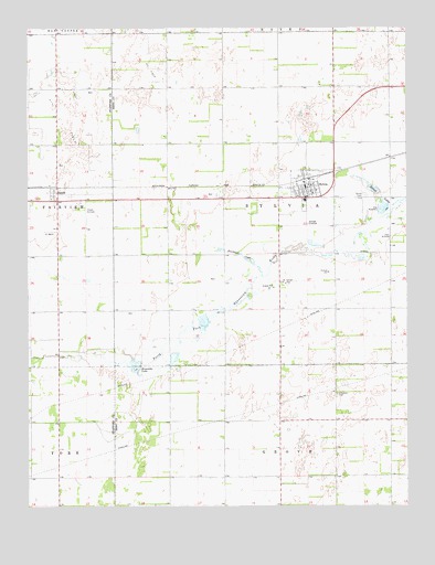
Sylvia, KS USGS Topographic Map
Click on map above to begin viewing in our Map Viewer.

This topographic map contains these locations and features:
Feature Name Type Latitude Longitude GNIS ID View Map
Brownlee LakeReservoirN37.9125°W98.4635°473594View Map
City of SylviaCivilN37.9592°W98.4088°2396021View Map
Fairfield West Elementary SchoolSchoolN37.9549°W98.4088°2497362View Map
Fairfield West Elementary SchoolSchoolN37.9549°W98.4088°480842View Map
Glendale CemeteryCemeteryN37.9043°W98.3986°473595View Map
Hall Airfield (historical)AirportN37.9428°W98.3809°473598View Map
Hayes Airfield (historical)AirportN37.9478°W98.4812°473600View Map
Kanza Co - Operative Association Grain Elevator Number 10LocaleN37.9587°W98.4950°2695347View Map
Pleasant Hill Church of the NazareneChurchN37.9574°W98.4049°2690391View Map
Reno County Fire District 6 - SylviaBuildingN37.9594°W98.4078°2111765View Map
Roberts Air FieldAirportN37.9754°W98.4003°481287View Map
Stafford County Flour Mills Grain Elevator Number 3LocaleN37.9612°W98.4070°2695433View Map
Stafford County Rural Fire Department Station 460BuildingN37.9561°W98.4908°2111901View Map
Sunset LakesReservoirN37.9580°W98.3865°473597View Map
SylviaPopulated PlaceN37.9578°W98.4081°473602View Map
Sylvia CemeteryCemeteryN37.9561°W98.3888°473599View Map
Sylvia Church of ChristChurchN37.9570°W98.4069°2690215View Map
Sylvia Post OfficePost OfficeN37.9591°W98.4089°2693988View Map
Sylvia Public LibraryBuildingN37.9591°W98.4089°2694679View Map
Sylvia United Methodist ChurchChurchN37.9572°W98.4084°2689550View Map
Sylvia Wastewater PlantLocaleN37.9475°W98.4071°2693571View Map
Township of SylviaCivilN37.9553°W98.4173°473607View Map
ZenithPopulated PlaceN37.9572°W98.4920°473601View Map
Zenith Community ChurchChurchN37.9555°W98.4925°2690820View Map
Zenithscah CreekStreamN37.9350°W98.4231°473596View Map

Note: Coordinates in the location and feature list above are referenced to NAD83 datum.


Copyright (C) 2008-2024 Ryan Niemi / Sunset Dynamics ... All Rights Reserved