TopoQuest Logo
Do you find TopoQuest useful?
Help keep TopoQuest running and adding new maps/features by donating!
Bitcoin:  19c7KJd3qBynnjoSw5npx9KScwjBe4ifkT
Litecoin:  LXs6TkuXGGXo1vDsWCkWVdjQX94eUKd6ui
Home View Maps Find Maps Find Places Resources & Links


Syndicate Hills, Texas Topographic Map

USGS Map Title: Syndicate Hills, TX
USGS Map MRC: 35102H7
DRG (GeoTIFF) Download: o35102h7.tif


Neighboring USGS Topographic Map Quads:


  Windy Hill, TX  
36102A8
 

  Wells Ranch, TX  
36102A7
 

  Canyon School, TX  
36102A6
 

  Beck Ranch, TX  
35102H8
 

  Syndicate Hills, TX  
35102H7
 

  King, TX  
35102H6
 

  Whiteaker Ranch, TX  
35102G8
 

  Middle Water, TX  
35102G7
 

  King SW, TX  
35102G6


Map MRC Location:

N36°
W103°
N36°
W102°
H8 H7 H6 H5 H4 H3 H2 H1
G8 G7 G6 G5 G4 G3 G2 G1
F8 F7 F6 F5 F4 F3 F2 F1
E8 E7 E6 E5 E4 E3 E2 E1
D8 D7 D6 D5 D4 D3 D2 D1
C8 C7 C6 C5 C4 C3 C2 C1
B8 B7 B6 B5 B4 B3 B2 B1
A8 A7 A6 A5 A4 A3 A2 A1
N35°
W103°
N35°
W102°

Syndicate Hills, TX USGS 1:24K Topographic Map Preview:
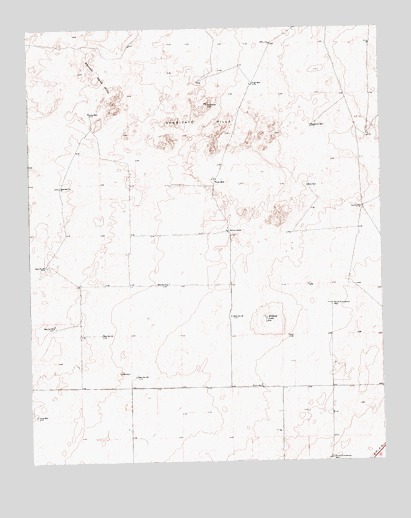
Syndicate Hills, TX USGS Topographic Map
Click on map above to begin viewing in our Map Viewer.

This topographic map contains these locations and features:
Feature Name Type Latitude Longitude GNIS ID View Map
Bennett Sand HillsSummitN35.9859°W102.8519°1351890View Map
Corral WellWellN35.9481°W102.7569°1355029View Map
Deadman WellWellN35.9717°W102.7746°1355773View Map
Gray WellWellN35.8884°W102.8735°1358353View Map
High WellWellN35.9839°W102.7949°1359193View Map
McCrory RanchLocaleN35.9411°W102.8044°1362407View Map
Mildred LakeLakeN35.9162°W102.7916°1362833View Map
Munn WellWellN35.8967°W102.7933°1363485View Map
North Summerour WellWellN35.9203°W102.7683°1364143View Map
South Summerour WellWellN35.8762°W102.7683°1368777View Map
Syndicate HillsSummitN35.9734°W102.8110°1369515View Map
Twin MillPopulated PlaceN35.9559°W102.8088°1380689View Map
Valley WellWellN35.9756°W102.8533°1370564View Map
Well Number FiftynineWellN35.8998°W102.8374°1371025View Map
Well Number FortyWellN35.9142°W102.8669°1371023View Map
Well Number ThirtynineWellN35.9120°W102.8499°1371022View Map
Well Number ThirtysixWellN35.9170°W102.8038°1371021View Map
Well Number TwentyfiveWellN35.9317°W102.8697°1371018View Map
Well Number TwentyfourWellN35.9542°W102.8641°1371017View Map
Well Number TwentysevenWellN35.9264°W102.8260°1371019View Map
West WellWellN35.9542°W102.7760°1371266View Map

Note: Coordinates in the location and feature list above are referenced to NAD83 datum.


Copyright (C) 2008-2024 Ryan Niemi / Sunset Dynamics ... All Rights Reserved