TopoQuest Logo
Do you find TopoQuest useful?
Help keep TopoQuest running and adding new maps/features by donating!
Bitcoin:  19c7KJd3qBynnjoSw5npx9KScwjBe4ifkT
Litecoin:  LXs6TkuXGGXo1vDsWCkWVdjQX94eUKd6ui
Home View Maps Find Maps Find Places Resources & Links


Tabor, Minnesota Topographic Map

USGS Map Title: Tabor, MN
USGS Map MRC: 48096A7
DRG (GeoTIFF) Download: o48096a7.tif


Neighboring USGS Topographic Map Quads:


  Alvarado, MN  
48096B8
 

  Warren, MN  
48096B7
 

  Roan, MN  
48096B6
 

  Warren SW, MN  
48096A8
 

  Tabor, MN  
48096A7
 

  Angus, MN  
48096A6
 

  Mallory, MN  
47096H8
 

  Key West, MN  
47096H7
 

  Euclid, MN  
47096H6


Map MRC Location:

N49°
W97°
N49°
W96°
H8 H7 H6 H5 H4 H3 H2 H1
G8 G7 G6 G5 G4 G3 G2 G1
F8 F7 F6 F5 F4 F3 F2 F1
E8 E7 E6 E5 E4 E3 E2 E1
D8 D7 D6 D5 D4 D3 D2 D1
C8 C7 C6 C5 C4 C3 C2 C1
B8 B7 B6 B5 B4 B3 B2 B1
A8 A7 A6 A5 A4 A3 A2 A1
N48°
W97°
N48°
W96°

Tabor, MN USGS 1:24K Topographic Map Preview:
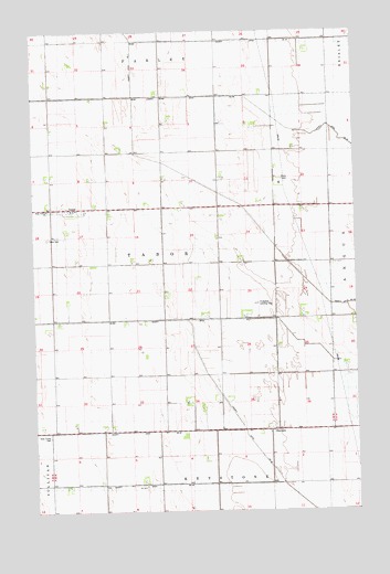
Tabor, MN USGS Topographic Map
Click on map above to begin viewing in our Map Viewer.

This topographic map contains these locations and features:
Feature Name Type Latitude Longitude GNIS ID View Map
County Ditch Number FortyfourCanalN48.0722°W96.7837°1815167View Map
County Ditch Number FortythreeCanalN48.0986°W96.7698°1815166View Map
County Ditch Number SixtysixCanalN48.0228°W96.7956°642261View Map
County Ditch Number ThirtyfiveCanalN48.1225°W96.7920°1815168View Map
Excelsior SchoolSchoolN48.0503°W96.8690°643480View Map
Holy Trinity Catholic CemeteryCemeteryN48.0781°W96.8604°2081349View Map
Holy Trinity CemeteryCemeteryN48.0197°W96.8700°645139View Map
Holy Trinity ChurchChurchN48.0786°W96.8698°1815169View Map
Osveta Post Office (historical)Post OfficeN48.0653°W96.8625°2081362View Map
Presbyterian CemeteryCemeteryN48.0786°W96.8678°2081348View Map
Pulkrabek Private Landing FieldAirportN48.0505°W96.7886°660035View Map
Roadside SchoolSchoolN48.0066°W96.8376°650159View Map
SherackPopulated PlaceN48.0208°W96.7817°654937View Map
Sherack (historical)LocaleN48.0208°W96.7814°2081353View Map
Sherack Post Office (historical)Post OfficeN48.0208°W96.7814°2081354View Map
TaborPopulated PlaceN48.0791°W96.8628°652976View Map
Tabor CemeteryCemeteryN48.0714°W96.8698°1815170View Map
Tabor Post Office (historical)Post OfficeN48.0792°W96.8625°2081350View Map
Township of TaborCivilN48.0646°W96.8249°665758View Map
Wilson SchoolSchoolN48.0494°W96.7940°654236View Map

Note: Coordinates in the location and feature list above are referenced to NAD83 datum.


Copyright (C) 2008-2024 Ryan Niemi / Sunset Dynamics ... All Rights Reserved