TopoQuest Logo
Do you find TopoQuest useful?
Help keep TopoQuest running and adding new maps/features by donating!
Bitcoin:  19c7KJd3qBynnjoSw5npx9KScwjBe4ifkT
Litecoin:  LXs6TkuXGGXo1vDsWCkWVdjQX94eUKd6ui
Home View Maps Find Maps Find Places Resources & Links


Tacubaya, Texas Topographic Map

USGS Map Title: Tacubaya, TX
USGS Map MRC: 26098H3
DRG (GeoTIFF) Download: o26098h3.tif


Neighboring USGS Topographic Map Quads:


  Palomas Ranch SW, TX  
27098A4
 

  Palomas Ranch SE, TX  
27098A3
 

  Cage Ranch, TX  
27098A2
 

  Santa Elena NW, TX  
26098H4
 

  Tacubaya, TX  
26098H3
 

  Encino, TX  
26098H2
 

  Santa Elena, TX  
26098G4
 

  Santa Elena SE, TX  
26098G3
 

  Hartland, TX  
26098G2


Map MRC Location:

N27°
W99°
N27°
W98°
H8 H7 H6 H5 H4 H3 H2 H1
G8 G7 G6 G5 G4 G3 G2 G1
F8 F7 F6 F5 F4 F3 F2 F1
E8 E7 E6 E5 E4 E3 E2 E1
D8 D7 D6 D5 D4 D3 D2 D1
C8 C7 C6 C5 C4 C3 C2 C1
B8 B7 B6 B5 B4 B3 B2 B1
A8 A7 A6 A5 A4 A3 A2 A1
N26°
W99°
N26°
W98°

Tacubaya, TX USGS 1:24K Topographic Map Preview:
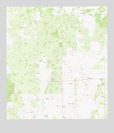
Tacubaya, TX USGS Topographic Map
Click on map above to begin viewing in our Map Viewer.

This topographic map contains these locations and features:
Feature Name Type Latitude Longitude GNIS ID View Map
Alta Mesa CampLocaleN26.9181°W98.3172°1329438View Map
Alta Mesa Oil FieldOilfieldN26.9228°W98.2933°1329440View Map
Alto Colorado RanchLocaleN26.8967°W98.3339°1329458View Map
Catravo WindmillLocaleN26.9703°W98.2511°1332340View Map
El Alto WindmillLocaleN26.8926°W98.2942°1335155View Map
El Norte WindmillLocaleN26.9398°W98.3031°1335227View Map
El Querido WindmillLocaleN26.8926°W98.2992°1335249View Map
El Rancho WindmillLocaleN26.9137°W98.2753°1335254View Map
El Yano WindmillLocaleN26.8776°W98.3045°1335291View Map
Esmeralda WellWellN26.9773°W98.3586°1335507View Map
Gonzalena WindmillLocaleN26.9053°W98.3581°1336671View Map
La Calichera WindmillLocaleN26.9148°W98.2970°1339289View Map
La Cochera WindmillLocaleN26.9159°W98.2811°1339298View Map
Leon Cito WindmillLocaleN26.9198°W98.3353°1339816View Map
Los Guicaches WindmillLocaleN26.9017°W98.2778°1340598View Map
Mala Suerte WindmillLocaleN26.9948°W98.2553°1340872View Map
Novia WindmillLocaleN26.9473°W98.2606°1342899View Map
Perez CemeteryCemeteryN26.9195°W98.2692°1343847View Map
Petal WindmillLocaleN26.9612°W98.2600°1343893View Map
Prieta TankReservoirN26.9404°W98.3591°1344562View Map
Rancho Nuevo CemeteryCemeteryN26.9381°W98.3258°1344766View Map
Rancho Nuevo WindmillLocaleN26.9381°W98.3256°1344767View Map
Realitos WindmillLocaleN26.8787°W98.3267°1344877View Map
San Pedro WellWellN26.9964°W98.2764°1346454View Map
Scott and Hopper Oil FieldOilfieldN26.9870°W98.2842°1346810View Map
TacubayaPopulated PlaceN26.9201°W98.2745°1379136View Map
Tanque Alegre WindmillLocaleN26.8831°W98.3458°1348236View Map
Tia Rosa WindmillLocaleN26.9359°W98.3031°1348543View Map

Note: Coordinates in the location and feature list above are referenced to NAD83 datum.


Copyright (C) 2008-2025 Ryan Niemi / Sunset Dynamics ... All Rights Reserved