TopoQuest Logo
Do you find TopoQuest useful?
Help keep TopoQuest running and adding new maps/features by donating!
Bitcoin:  19c7KJd3qBynnjoSw5npx9KScwjBe4ifkT
Litecoin:  LXs6TkuXGGXo1vDsWCkWVdjQX94eUKd6ui
Home View Maps Find Maps Find Places Resources & Links


Tafoya Canyon, New Mexico Topographic Map

USGS Map Title: Tafoya Canyon, NM
USGS Map MRC: 36107C4
DRG (GeoTIFF) Download: o36107c4.tif


Neighboring USGS Topographic Map Quads:


  Smouse Mesa, NM  
36107D5
 

  Gonzales Mesa, NM  
36107D4
 

  Lapis Point, NM  
36107D3
 

  Crow Mesa East, NM  
36107C5
 

  Tafoya Canyon, NM  
36107C4
 

  Otero Store, NM  
36107C3
 

  Lybrook, NM  
36107B5
 

  Counselor, NM  
36107B4
 

  Tancosa Windmill, NM  
36107B3


Map MRC Location:

N37°
W108°
N37°
W107°
H8 H7 H6 H5 H4 H3 H2 H1
G8 G7 G6 G5 G4 G3 G2 G1
F8 F7 F6 F5 F4 F3 F2 F1
E8 E7 E6 E5 E4 E3 E2 E1
D8 D7 D6 D5 D4 D3 D2 D1
C8 C7 C6 C5 C4 C3 C2 C1
B8 B7 B6 B5 B4 B3 B2 B1
A8 A7 A6 A5 A4 A3 A2 A1
N36°
W108°
N36°
W107°

Tafoya Canyon, NM USGS 1:24K Topographic Map Preview:
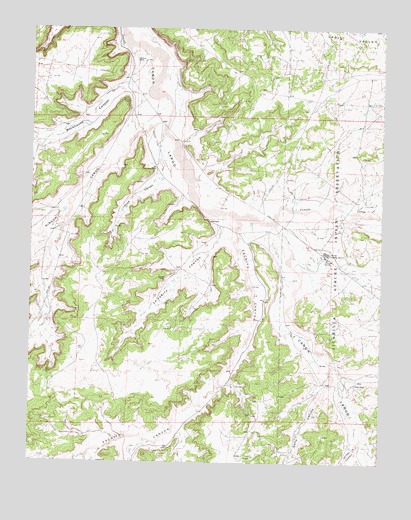
Tafoya Canyon, NM USGS Topographic Map
Click on map above to begin viewing in our Map Viewer.

This topographic map contains these locations and features:
Feature Name Type Latitude Longitude GNIS ID View Map
Caņada LargaStreamN36.3206°W107.4264°904466View Map
Canyon View RuinLocaleN36.3406°W107.4539°935724View Map
Escrito CanyonValleyN36.3206°W107.4264°888912View Map
Gallo CanyonValleyN36.2781°W107.3923°889308View Map
Haynes CanyonValleyN36.2542°W107.4631°889853View Map
Johnson CanyonValleyN36.3083°W107.4934°900559View Map
La Parita CanyonValleyN36.3211°W107.4320°890832View Map
Lapis ValleyValleyN36.3745°W107.3995°890933View Map
Lindrith 1 Water WellWellN36.3114°W107.3973°926526View Map
Lindrith 2 Water WellWellN36.3117°W107.3970°926527View Map
Lindrith 3 Water WellWellN36.3092°W107.3984°926465View Map
Lindrith H Water WellWellN36.3097°W107.3934°926464View Map
Lindrith Pumping StationLocaleN36.3103°W107.3945°891083View Map
Mestice RanchLocaleN36.3031°W107.4523°891915View Map
Old Rock RanchLocaleN36.3658°W107.4634°892890View Map
Otero RanchLocaleN36.2731°W107.3842°892963View Map
Otero SpringSpringN36.2756°W107.3850°914287View Map
Rincon LargoValleyN36.3489°W107.4531°893942View Map
Rockhouse CanyonValleyN36.3600°W107.4592°894101View Map
Tafoya CanyonValleyN36.3406°W107.4545°895486View Map
Venado CanyonValleyN36.2572°W107.3817°936864View Map

Note: Coordinates in the location and feature list above are referenced to NAD83 datum.


Copyright (C) 2008-2025 Ryan Niemi / Sunset Dynamics ... All Rights Reserved