TopoQuest Logo
Do you find TopoQuest useful?
Help keep TopoQuest running and adding new maps/features by donating!
Bitcoin:  19c7KJd3qBynnjoSw5npx9KScwjBe4ifkT
Litecoin:  LXs6TkuXGGXo1vDsWCkWVdjQX94eUKd6ui
Home View Maps Find Maps Find Places Resources & Links


Tamarack, Minnesota Topographic Map

USGS Map Title: Tamarack, MN
USGS Map MRC: 46093F2
DRG (GeoTIFF) Download: o46093f2.tif


Neighboring USGS Topographic Map Quads:


  Libby, MN  
46093G3
 

  Balsam, MN  
46093G2
 

  Little Prairie Lake, MN  
46093G1
 

  Minnewawa, MN  
46093F3
 

  Tamarack, MN  
46093F2
 

  Wright, MN  
46093F1
 

  McGregor, MN  
46093E3
 

  Lawler, MN  
46093E2
 

  Automba, MN  
46093E1


Map MRC Location:

N47°
W94°
N47°
W93°
H8 H7 H6 H5 H4 H3 H2 H1
G8 G7 G6 G5 G4 G3 G2 G1
F8 F7 F6 F5 F4 F3 F2 F1
E8 E7 E6 E5 E4 E3 E2 E1
D8 D7 D6 D5 D4 D3 D2 D1
C8 C7 C6 C5 C4 C3 C2 C1
B8 B7 B6 B5 B4 B3 B2 B1
A8 A7 A6 A5 A4 A3 A2 A1
N46°
W94°
N46°
W93°

Tamarack, MN USGS 1:24K Topographic Map Preview:
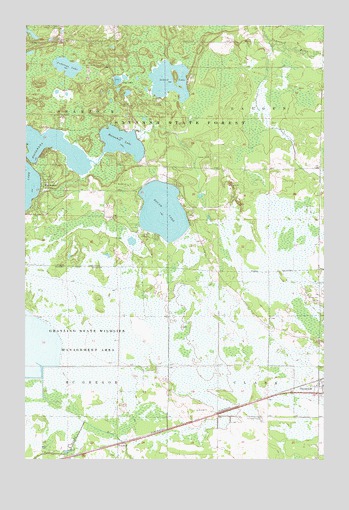
Tamarack, MN USGS Topographic Map
Click on map above to begin viewing in our Map Viewer.

This topographic map contains these locations and features:
Feature Name Type Latitude Longitude GNIS ID View Map
Anderson LakeLakeN46.7374°W93.2307°639346View Map
Camp LakeLakeN46.7342°W93.2119°640821View Map
Church of ChristChurchN46.6444°W93.1269°2074401View Map
Fairview CemeteryCemeteryN46.6372°W93.1516°643514View Map
First Presbyterian ChurchChurchN46.6444°W93.1269°2074399View Map
GraylingLocaleN46.6292°W93.2106°2070768View Map
GraylingPopulated PlaceN46.6291°W93.2108°654734View Map
Grayling Post Office (historical)Post OfficeN46.6292°W93.2106°2070769View Map
Grayling State Wildlife Management AreaParkN46.6594°W93.2269°644399View Map
Horseshoe LakeLakeN46.7164°W93.2097°645236View Map
Island LakeLakeN46.7342°W93.1899°645485View Map
Island Lake CreekStreamN46.7189°W93.1871°2747245View Map
Kivi-Mokki Seaplane BaseAirportN46.7166°W93.2102°660285View Map
Musselshell CreekStreamN46.7171°W93.2033°2059141View Map
Round LakeLakeN46.6965°W93.1926°650348View Map
Round Lake CemeteryCemeteryN46.7043°W93.2061°2070929View Map
Round Lake ChurchChurchN46.7038°W93.2072°650364View Map
SheshebeePopulated PlaceN46.7047°W93.2424°651971View Map
Sheshebee Post Office (historical)Post OfficeN46.7047°W93.2422°2070931View Map
TamarackPopulated PlaceN46.6444°W93.1272°652995View Map
Tamarack Post OfficePost OfficeN46.6473°W93.1276°2070997View Map
Township of ClarkCivilN46.6349°W93.1272°663807View Map
Township of HaugenCivilN46.7235°W93.1275°664413View Map
Whispering Pines CampgroundLocaleN46.7028°W93.2014°2071014View Map

Note: Coordinates in the location and feature list above are referenced to NAD83 datum.


Copyright (C) 2008-2024 Ryan Niemi / Sunset Dynamics ... All Rights Reserved