TopoQuest Logo
Do you find TopoQuest useful?
Help keep TopoQuest running and adding new maps/features by donating!
Bitcoin:  19c7KJd3qBynnjoSw5npx9KScwjBe4ifkT
Litecoin:  LXs6TkuXGGXo1vDsWCkWVdjQX94eUKd6ui
Home View Maps Find Maps Find Places Resources & Links


Tanners Peak, California Topographic Map

USGS Map Title: Tanners Peak, CA
USGS Map MRC: 41123C1
DRG (GeoTIFF) Download: o41123c1.tif


Neighboring USGS Topographic Map Quads:


  English Peak, CA  
41123D2
 

  Yellow Dog Peak, CA  
41123D1
 

  Etna, CA  
41122D8
 

  Sawyers Bar, CA  
41123C2
 

  Tanners Peak, CA  
41123C1
 

  Eaton Peak, CA  
41122C8
 

  Cecilville, CA  
41123B2
 

  Grasshopper Ridge, CA  
41123B1
 

  Deadman Peak, CA  
41122B8


Map MRC Location:

N42°
W124°
N42°
W123°
H8 H7 H6 H5 H4 H3 H2 H1
G8 G7 G6 G5 G4 G3 G2 G1
F8 F7 F6 F5 F4 F3 F2 F1
E8 E7 E6 E5 E4 E3 E2 E1
D8 D7 D6 D5 D4 D3 D2 D1
C8 C7 C6 C5 C4 C3 C2 C1
B8 B7 B6 B5 B4 B3 B2 B1
A8 A7 A6 A5 A4 A3 A2 A1
N41°
W124°
N41°
W123°

Tanners Peak, CA USGS 1:24K Topographic Map Preview:
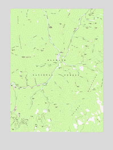
Tanners Peak, CA USGS Topographic Map
Click on map above to begin viewing in our Map Viewer.

This topographic map contains these locations and features:
Feature Name Type Latitude Longitude GNIS ID View Map
Advance MineMineN41.3371°W123.0223°218000View Map
Annie Johnson MineMineN41.2621°W123.1014°218290View Map
Applesauce GulchValleyN41.3093°W123.0675°218322View Map
Ball MineMineN41.2604°W123.1048°1657741View Map
Big Cliff MineMineN41.2960°W123.0367°219162View Map
Big Fish MineMineN41.2565°W123.1120°1657744View Map
China GulchValleyN41.3462°W123.0420°221045View Map
Cleaver MineMineN41.2562°W123.0837°221202View Map
Compressor GulchValleyN41.2618°W123.1125°221435View Map
Counts GulchValleyN41.2932°W123.0853°221677View Map
Cow CreekStreamN41.3596°W123.0339°221694View Map
Creole Belle GulchValleyN41.3049°W123.0011°221818View Map
Cub Bear MineMineN41.3554°W123.0214°221890View Map
Deacon Lee TrailTrailN41.2638°W123.0148°222092View Map
Dimmick MineMineN41.2751°W123.0659°222394View Map
East Fork Eddy GulchValleyN41.2699°W123.1206°233819View Map
East Fork Whites GulchValleyN41.2793°W123.0739°222905View Map
Eddy GulchValleyN41.2943°W123.1209°222965View Map
Etna DivisionCivilN41.3502°W123.0386°1935096View Map
Evening Star MineMineN41.2546°W123.1200°1657766View Map
Finley CampLocaleN41.3274°W123.0634°223506View Map
Finley MineMineN41.2979°W123.1200°223509View Map
Flapjack BarBarN41.2937°W123.1120°223577View Map
Harvey GulchValleyN41.2693°W123.1245°224989View Map
Hennings MineMineN41.3326°W123.0856°225179View Map
Hickey GulchValleyN41.3035°W123.0720°225231View Map
Hickey MineMineN41.2560°W123.0900°225232View Map
Highland CreekStreamN41.3238°W123.0156°225289View Map
Highland MineMineN41.3440°W123.0120°225296View Map
Hogan CreekStreamN41.3649°W123.0128°234020View Map
Hogan MineMineN41.3604°W123.0139°225422View Map
Homestake MineMineN41.3599°W123.0170°225501View Map
Idlewild CampgroundLocaleN41.3315°W123.0600°277199View Map
Incline RidgeRidgeN41.2601°W123.1067°225839View Map
Johns MeadowsFlatN41.2915°W123.0134°226290View Map
Johns Meadows CreekStreamN41.3179°W123.0431°226291View Map
Judge MineMineN41.2971°W123.1228°226368View Map
Jumbo MineMineN41.2793°W123.0775°226373View Map
Jumpoff Joe CurveLocaleN41.3687°W123.0214°226375View Map
Kalamath MineMineN41.2535°W123.1237°226413View Map
Kismet MineMineN41.3168°W123.0892°226637View Map
Lanky Bob MineMineN41.2776°W123.0684°226864View Map
Laurel MineMineN41.2585°W123.1062°1657796View Map
Little China GulchValleyN41.3382°W123.0461°227223View Map
Little Rattlesnake GulchValleyN41.2974°W123.0917°227340View Map
Live Yankee GulchValleyN41.2671°W123.1162°227432View Map
Madrone MineMineN41.2837°W123.0970°227929View Map
Malloy MineMineN41.3104°W123.1103°227986View Map
Mill CreekStreamN41.3435°W123.0714°1682769View Map
Morning Star MineMineN41.3337°W123.1237°229069View Map
Mule Bridge CampgroundLocaleN41.3562°W123.0756°229298View Map
Music CreekStreamN41.3196°W123.0250°229372View Map
North Russian CreekStreamN41.3237°W123.0614°229752View Map
One Hundred Dollar MineMineN41.3260°W123.1064°230041View Map
Overton MineMineN41.3554°W123.0123°230168View Map
Rainbow MineMineN41.3287°W123.0273°231185View Map
Rattlesnake GulchValleyN41.2971°W123.1031°231265View Map
Robinson FlatFlatN41.3149°W123.0623°231691View Map
Robinson GulchValleyN41.3182°W123.0650°231693View Map
RollinLocaleN41.2618°W123.1173°231832View Map
Rollin School (historical)SchoolN41.2674°W123.1178°1682770View Map
Salmon River MineMineN41.3207°W123.0648°232288View Map
Sawmill GulchValleyN41.3446°W123.0745°232620View Map
Security MineMineN41.2535°W123.1142°1657826View Map
Snoozer MineMineN41.3596°W123.0584°234763View Map
Snoozer RidgeRidgeN41.3726°W123.0464°234764View Map
Snowbird MineMineN41.3065°W123.1103°234782View Map
SnowdenLocaleN41.3546°W123.0370°1659804View Map
South Russian CreekStreamN41.3265°W123.0578°235106View Map
Star of the West MineMineN41.2518°W123.1187°1657830View Map
Tanners PeakSummitN41.3254°W123.1053°236014View Map
Tanners Peak TrailTrailN41.3329°W123.0873°236015View Map
Taylor CreekStreamN41.3690°W123.0281°236044View Map
Tip Top MineMineN41.2574°W123.0928°236390View Map
Trooks FlatFlatN41.2976°W123.0825°236558View Map
Uncle Sam MineMineN41.2660°W123.0953°236775View Map
West Fork Whites GulchValleyN41.2793°W123.0737°237488View Map
Whites GulchValleyN41.2976°W123.0839°237694View Map
Wilson MineMineN41.2643°W123.1203°237978View Map
Winterings MineMineN41.2926°W123.0345°1682775View Map
Yellow Dog CreekStreamN41.3690°W123.0787°238240View Map

Note: Coordinates in the location and feature list above are referenced to NAD83 datum.


Copyright (C) 2008-2024 Ryan Niemi / Sunset Dynamics ... All Rights Reserved