TopoQuest Logo
Do you find TopoQuest useful?
Help keep TopoQuest running and adding new maps/features by donating!
Bitcoin:  19c7KJd3qBynnjoSw5npx9KScwjBe4ifkT
Litecoin:  LXs6TkuXGGXo1vDsWCkWVdjQX94eUKd6ui
Home View Maps Find Maps Find Places Resources & Links


Tatum North, New Mexico Topographic Map

USGS Map Title: Tatum North, NM
USGS Map MRC: 33103C3
DRG (GeoTIFF) Download: o33103c3.tif


Neighboring USGS Topographic Map Quads:


  Johnson Ranch, NM  
33103D4
 

  Ranger Lake, NM  
33103D3
 

  Walking Cane Ranch, NM  
33103D2
 

  Simanola Valley, NM  
33103C4
 

  Tatum North, NM  
33103C3
 

  Gladiola, NM  
33103C2
 

  Alston Ranch, NM  
33103B4
 

  Tatum South, NM  
33103B3
 

  Prairieview NW, NM  
33103B2


Map MRC Location:

N34°
W104°
N34°
W103°
H8 H7 H6 H5 H4 H3 H2 H1
G8 G7 G6 G5 G4 G3 G2 G1
F8 F7 F6 F5 F4 F3 F2 F1
E8 E7 E6 E5 E4 E3 E2 E1
D8 D7 D6 D5 D4 D3 D2 D1
C8 C7 C6 C5 C4 C3 C2 C1
B8 B7 B6 B5 B4 B3 B2 B1
A8 A7 A6 A5 A4 A3 A2 A1
N33°
W104°
N33°
W103°

Tatum North, NM USGS 1:24K Topographic Map Preview:
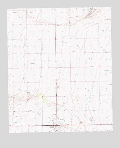
Tatum North, NM USGS Topographic Map
Click on map above to begin viewing in our Map Viewer.

This topographic map contains these locations and features:
Feature Name Type Latitude Longitude GNIS ID View Map
10700 Water WellWellN33.3257°W103.3527°929829View Map
10703 Water WellWellN33.3257°W103.3152°929828View Map
10704 Water WellWellN33.3129°W103.3152°925285View Map
10705 Water WellWellN33.3115°W103.2744°925281View Map
10706 Water WellWellN33.3257°W103.3152°929827View Map
10776 Water WellWellN33.3007°W103.3566°929809View Map
10781 Water WellWellN33.2865°W103.3519°929790View Map
10796 Water WellWellN33.3068°W103.2536°929814View Map
10797 Water WellWellN33.2962°W103.2966°929805View Map
10798 Water WellWellN33.2962°W103.3155°925292View Map
10800 Water WellWellN33.2896°W103.3172°929795View Map
10801 Water WellWellN33.2918°W103.2733°925300View Map
12783 Water WellWellN33.3068°W103.2536°929815View Map
12798 Water WellWellN33.3590°W103.2558°925231View Map
12799 Water WellWellN33.3562°W103.2533°925330View Map
12800 Water WellWellN33.3693°W103.2894°925339View Map
12801 Water WellWellN33.3621°W103.2991°925336View Map
12802 Water WellWellN33.3679°W103.3169°925222View Map
12803 Water WellWellN33.3476°W103.2502°925247View Map
12804 Water WellWellN33.3473°W103.2580°925246View Map
12805 Water WellWellN33.3371°W103.3088°929837View Map
13390 Water WellWellN33.3479°W103.3608°925249View Map
13394 Water WellWellN33.3684°W103.3438°925225View Map
13395 Water WellWellN33.3551°W103.2747°925236View Map
13396 Water WellWellN33.3301°W103.2938°929831View Map
13397 Water WellWellN33.3429°W103.3341°925252View Map
Airport WindmillLocaleN33.2712°W103.2741°885604View Map
Berryhill WindmillLocaleN33.3159°W103.2755°886261View Map
Cannon WindmillLocaleN33.3571°W103.2747°887139View Map
Church of ChristChurchN33.2571°W103.3177°920250View Map
Church of the NazareneChurchN33.2571°W103.3177°920285View Map
D Bar RanchLocaleN33.2957°W103.2741°888169View Map
Dempster WindmillLocaleN33.3437°W103.3347°888319View Map
East WindmillLocaleN33.2965°W103.2508°888750View Map
Eubanks WindmillLocaleN33.3062°W103.2505°888932View Map
First Assembly of God ChurchChurchN33.2571°W103.3177°921164View Map
First Baptist ChurchChurchN33.2571°W103.3177°920982View Map
Garden WindmillLocaleN33.2909°W103.3525°889342View Map
Home WindmillLocaleN33.3051°W103.3569°890093View Map
Middle WindmillLocaleN33.3709°W103.3686°892015View Map
Mount Zion ChurchChurchN33.2573°W103.3413°892274View Map
North Schelling WindmillLocaleN33.3626°W103.2566°892654View Map
Oil Well WindmillLocaleN33.3309°W103.2944°892819View Map
Section WindmillLocaleN33.3193°W103.3483°894697View Map
South Schelling WindmillLocaleN33.3509°W103.2591°895121View Map
TatumPopulated PlaceN33.2571°W103.3177°899943View Map
Tatum AirportAirportN33.2611°W103.2765°937031View Map
Tatum City Police DepartmentBuildingN33.2567°W103.3136°2722511View Map
Tatum ClinicHospitalN33.2571°W103.3177°901276View Map
Tatum Community LibraryBuildingN33.2571°W103.3177°929431View Map
Tatum Elementary SchoolSchoolN33.2571°W103.3177°933882View Map
Tatum High SchoolSchoolN33.2571°W103.3177°914675View Map
Tatum Junior High SchoolSchoolN33.2571°W103.3177°934242View Map
Tatum PitMineN33.2959°W103.3163°915420View Map
Tatum Post OfficePost OfficeN33.2564°W103.3187°937780View Map
Tatum Volunteer Fire DepartmentBuildingN33.2579°W103.3187°2657707View Map
Tatum Weather StationLocaleN33.2565°W103.3177°931875View Map
Tops WindmillLocaleN33.3651°W103.3000°895761View Map
Town of TatumCivilN33.2553°W103.3112°2413367View Map
Two Section WindmillLocaleN33.3296°W103.2583°895988View Map
Walls WindmillLocaleN33.3109°W103.2549°896221View Map
West Base WindmillLocaleN33.3712°W103.3444°896330View Map
West Berryhill WindmillLocaleN33.3409°W103.3097°896331View Map
West WindmillLocaleN33.3004°W103.2972°896450View Map

Note: Coordinates in the location and feature list above are referenced to NAD83 datum.


Copyright (C) 2008-2025 Ryan Niemi / Sunset Dynamics ... All Rights Reserved