TopoQuest Logo
Do you find TopoQuest useful?
Help keep TopoQuest running and adding new maps/features by donating!
Bitcoin:  19c7KJd3qBynnjoSw5npx9KScwjBe4ifkT
Litecoin:  LXs6TkuXGGXo1vDsWCkWVdjQX94eUKd6ui
Home View Maps Find Maps Find Places Resources & Links


Taylor, Iowa Topographic Map

USGS Map Title: Taylor, IA
USGS Map MRC: 41095C5
DRG (GeoTIFF) Download: o41095c5.tif


Neighboring USGS Topographic Map Quads:


  Underwood, IA  
41095D6
 

  Neola, IA  
41095D5
 

  Avoca NW, IA  
41095D4
 

  McClelland, IA  
41095C6
 

  Taylor, IA  
41095C5
 

  Oakland, IA  
41095C4
 

  Mineola, IA  
41095B6
 

  Treynor, IA  
41095B5
 

  Carson, IA  
41095B4


Map MRC Location:

N42°
W96°
N42°
W95°
H8 H7 H6 H5 H4 H3 H2 H1
G8 G7 G6 G5 G4 G3 G2 G1
F8 F7 F6 F5 F4 F3 F2 F1
E8 E7 E6 E5 E4 E3 E2 E1
D8 D7 D6 D5 D4 D3 D2 D1
C8 C7 C6 C5 C4 C3 C2 C1
B8 B7 B6 B5 B4 B3 B2 B1
A8 A7 A6 A5 A4 A3 A2 A1
N41°
W96°
N41°
W95°

Taylor, IA USGS 1:24K Topographic Map Preview:
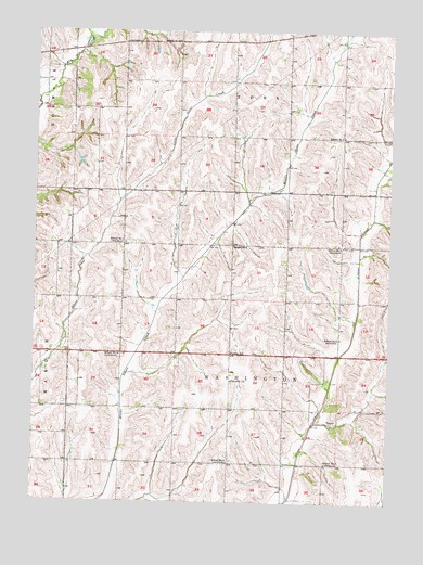
Taylor, IA USGS Topographic Map
Click on map above to begin viewing in our Map Viewer.

This topographic map contains these locations and features:
Feature Name Type Latitude Longitude GNIS ID View Map
Blair Post Office (historical)Post OfficeN41.2600°W95.5264°1949706View Map
Center SchoolSchoolN41.2897°W95.5556°455303View Map
Keown Post Office (historical)Post OfficeN41.3611°W95.6053°1949668View Map
Pottawattamie CountyCivilN41.3366°W95.5424°465266View Map
School Number Eight (historical)SchoolN41.2608°W95.5567°1949660View Map
School Number Four (historical)SchoolN41.2892°W95.5950°1949661View Map
School Number One (historical)SchoolN41.3180°W95.5169°1949665View Map
School Number SevenSchoolN41.3472°W95.5169°1949666View Map
School Number Seven (historical)SchoolN41.2606°W95.5219°1949659View Map
School Number Six (historical)SchoolN41.2939°W95.5169°1949664View Map
School Number Three (historical)SchoolN41.3189°W95.5933°1949662View Map
School Number TwoSchoolN41.3183°W95.5558°1949663View Map
TaylorPopulated PlaceN41.2714°W95.5200°464773View Map
Taylor Post Office (historical)Post OfficeN41.2714°W95.5200°1949705View Map
Taylor Station Post Office (historical)Post OfficeN41.2750°W95.5372°466567View Map
Township of WashingtonCivilN41.2892°W95.5556°468935View Map
York Township CemeteryCemeteryN41.3667°W95.5836°1949485View Map

Note: Coordinates in the location and feature list above are referenced to NAD83 datum.


Copyright (C) 2008-2024 Ryan Niemi / Sunset Dynamics ... All Rights Reserved