TopoQuest Logo
Do you find TopoQuest useful?
Help keep TopoQuest running and adding new maps/features by donating!
Bitcoin:  19c7KJd3qBynnjoSw5npx9KScwjBe4ifkT
Litecoin:  LXs6TkuXGGXo1vDsWCkWVdjQX94eUKd6ui
Home View Maps Find Maps Find Places Resources & Links


Taylor, Nebraska Topographic Map

USGS Map Title: Taylor, NE
USGS Map MRC: 41099G4
DRG (GeoTIFF) Download: o41099g4.tif


Neighboring USGS Topographic Map Quads:


  Almeria NE, NE  
41099H5
 

  Taylor NW, NE  
41099H4
 

  Taylor NE, NE  
41099H3
 

  Almeria, NE  
41099G5
 

  Taylor, NE  
41099G4
 

  Taylor SE, NE  
41099G3
 

  Walworth, NE  
41099F5
 

  Sargent West, NE  
41099F4
 

  Sargent East, NE  
41099F3


Map MRC Location:

N42°
W100°
N42°
W99°
H8 H7 H6 H5 H4 H3 H2 H1
G8 G7 G6 G5 G4 G3 G2 G1
F8 F7 F6 F5 F4 F3 F2 F1
E8 E7 E6 E5 E4 E3 E2 E1
D8 D7 D6 D5 D4 D3 D2 D1
C8 C7 C6 C5 C4 C3 C2 C1
B8 B7 B6 B5 B4 B3 B2 B1
A8 A7 A6 A5 A4 A3 A2 A1
N41°
W100°
N41°
W99°

Taylor, NE USGS 1:24K Topographic Map Preview:
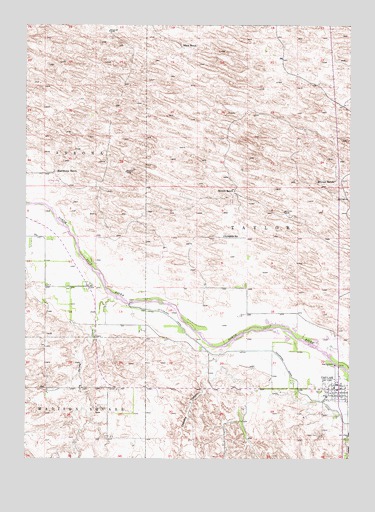
Taylor, NE USGS Topographic Map
Click on map above to begin viewing in our Map Viewer.

This topographic map contains these locations and features:
Feature Name Type Latitude Longitude GNIS ID View Map
Assembly of God ChurchChurchN41.7706°W99.3787°1845165View Map
Britton RanchLocaleN41.8272°W99.4196°827655View Map
Calvary United Methodist ChurchChurchN41.7686°W99.3821°1845164View Map
Chesbra CanyonValleyN41.7768°W99.4299°828118View Map
Hawthorne RanchLocaleN41.8325°W99.4887°829871View Map
Loup County AmbulanceBuildingN41.7707°W99.3793°2553780View Map
Loup County FairgroundsLocaleN41.7703°W99.3787°1845159View Map
Loup County Public SchoolsSchoolN41.7681°W99.3843°1845062View Map
Loup County Rural Fire DepartmentBuildingN41.7707°W99.3793°2553327View Map
Loup County Sheriff's OfficeBuildingN41.7709°W99.3812°1845157View Map
Marcia Smith AuditoriumBuildingN41.7681°W99.3843°1845166View Map
McGraw RanchLocaleN41.8300°W99.3809°831141View Map
Pioneer Memorial Log Cabin MuseumBuildingN41.7703°W99.3787°1845161View Map
Spring CreekStreamN41.7958°W99.4651°833699View Map
Sunnyside SchoolSchoolN41.8142°W99.4234°833935View Map
TaylorPopulated PlaceN41.7703°W99.3787°834041View Map
Taylor CemeteryCemeteryN41.7572°W99.3865°834043View Map
Taylor City LibraryBuildingN41.7703°W99.3787°1845158View Map
Taylor DamDamN41.7947°W99.4598°834047View Map
Taylor Evangelical Free ChurchChurchN41.7686°W99.3793°1845163View Map
Taylor Post OfficePost OfficeN41.7714°W99.3799°1845145View Map
Taylor Tourist ParkLocaleN41.7703°W99.3787°1845160View Map
Taylor-Ord Diversion DamDamN41.7950°W99.4604°1769578View Map
Taylor-Ord Diversion ReservoirReservoirN41.7950°W99.4604°1769579View Map
Township of TaylorCivilN41.8139°W99.3921°1845180View Map
Village of TaylorCivilN41.7696°W99.3814°2399957View Map
Wayne Plugge Memorial ArenaLocaleN41.7703°W99.3787°1845162View Map
Worm RanchLocaleN41.8683°W99.4396°834876View Map

Note: Coordinates in the location and feature list above are referenced to NAD83 datum.


Copyright (C) 2008-2025 Ryan Niemi / Sunset Dynamics ... All Rights Reserved