TopoQuest Logo
Do you find TopoQuest useful?
Help keep TopoQuest running and adding new maps/features by donating!
Bitcoin:  19c7KJd3qBynnjoSw5npx9KScwjBe4ifkT
Litecoin:  LXs6TkuXGGXo1vDsWCkWVdjQX94eUKd6ui
Home View Maps Find Maps Find Places Resources & Links


Tea, South Dakota Topographic Map

USGS Map Title: Tea, SD
USGS Map MRC: 43096D7
DRG (GeoTIFF) Download: o43096d7.tif


Neighboring USGS Topographic Map Quads:


  Hartford South, SD  
43096E8
 

  Sioux Falls West, SD  
43096E7
 

  Sioux Falls East, SD  
43096E6
 

  Lennox NW, SD  
43096D8
 

  Tea, SD  
43096D7
 

  Harrisburg, SD  
43096D6
 

  Lennox, SD  
43096C8
 

  Worthing, SD  
43096C7
 

  Canton SW, SD  
43096C6


Map MRC Location:

N44°
W97°
N44°
W96°
H8 H7 H6 H5 H4 H3 H2 H1
G8 G7 G6 G5 G4 G3 G2 G1
F8 F7 F6 F5 F4 F3 F2 F1
E8 E7 E6 E5 E4 E3 E2 E1
D8 D7 D6 D5 D4 D3 D2 D1
C8 C7 C6 C5 C4 C3 C2 C1
B8 B7 B6 B5 B4 B3 B2 B1
A8 A7 A6 A5 A4 A3 A2 A1
N43°
W97°
N43°
W96°

Tea, SD USGS 1:24K Topographic Map Preview:
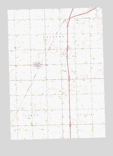
Tea, SD USGS Topographic Map
Click on map above to begin viewing in our Map Viewer.

This topographic map contains these locations and features:
Feature Name Type Latitude Longitude GNIS ID View Map
Antioch (historical)LocaleN43.4628°W96.8301°1263293View Map
Avera Behavioral Health CenterBuildingN43.4909°W96.7818°2610964View Map
Avera Heart Hospital of South DakotaBuildingN43.4909°W96.7807°2610961View Map
Chris Hofer Landing StripAirportN43.4632°W96.8619°2444005View Map
City of TeaCivilN43.4514°W96.8347°1267599View Map
Colorado Technical University - Sioux FallsSchoolN43.4968°W96.7738°2726090View Map
Evenson DamDamN43.4650°W96.7737°1259248View Map
Explorer Elementary SchoolSchoolN43.4795°W96.7756°2728780View Map
Globe UniversitySchoolN43.4990°W96.7867°2726091View Map
Interchange 1CrossingN43.4951°W96.7702°2725817View Map
Interchange 68CrossingN43.3883°W96.7964°2725659View Map
Interchange 71CrossingN43.4325°W96.7963°2725664View Map
Interchange 73CrossingN43.4610°W96.7975°2725666View Map
Interchange 75CrossingN43.4879°W96.7945°2725668View Map
KNWC-AM (Sioux Falls)TowerN43.4886°W96.7859°1259335View Map
KNWC-FM (Sioux Falls)TowerN43.4883°W96.7867°1259280View Map
Lincoln County Waterfowl Production AreaParkN43.4584°W96.8529°2765374View Map
Marv Skie-Lincoln County AirportAirportN43.4549°W96.8028°1259304View Map
National American University - Sioux FallsSchoolN43.4946°W96.7881°2726098View Map
Prairie View SchoolSchoolN43.4903°W96.7673°1257214View Map
Rader SchoolSchoolN43.4539°W96.7876°1257262View Map
Sioux Falls Fire Rescue Station 4BuildingN43.4901°W96.7598°2580815View Map
TeaPopulated PlaceN43.4464°W96.8359°1265702View Map
Tea Area Elementary SchoolSchoolN43.4501°W96.8417°2729679View Map
Tea Area High SchoolSchoolN43.4544°W96.8429°2729680View Map
Tea Area Middle SchoolSchoolN43.4544°W96.8429°2729681View Map
Tea CemeteryCemeteryN43.4230°W96.8060°1258509View Map
Tea City HallBuildingN43.4469°W96.8283°2725304View Map
Tea Community LibraryBuildingN43.4557°W96.8428°2723777View Map
Tea Fire DepartmentBuildingN43.4469°W96.8287°2580827View Map
Tea Police DepartmentBuildingN43.4461°W96.8359°2755534View Map
Tea Post OfficePost OfficeN43.4478°W96.8270°2711924View Map
Township of DelapreCivilN43.4630°W96.8470°1267964View Map
Township of PerryCivilN43.3896°W96.8645°1267963View Map
Twelve - Step Living Corporation Tallgrass Recovery CenterBuildingN43.4688°W96.7843°2610975View Map

Note: Coordinates in the location and feature list above are referenced to NAD83 datum.


Copyright (C) 2008-2025 Ryan Niemi / Sunset Dynamics ... All Rights Reserved