TopoQuest Logo
Do you find TopoQuest useful?
Help keep TopoQuest running and adding new maps/features by donating!
Bitcoin:  19c7KJd3qBynnjoSw5npx9KScwjBe4ifkT
Litecoin:  LXs6TkuXGGXo1vDsWCkWVdjQX94eUKd6ui
Home View Maps Find Maps Find Places Resources & Links


Tejon Ranch, California Topographic Map

USGS Map Title: Tejon Ranch, CA
USGS Map MRC: 35118A6
DRG (GeoTIFF) Download: o35118a6.tif


Neighboring USGS Topographic Map Quads:


  Arvin, CA  
35118B7
 

  Bear Mountain, CA  
35118B6
 

  Keene, CA  
35118B5
 

  Tejon Hills, CA  
35118A7
 

  Tejon Ranch, CA  
35118A6
 

  Cummings Mountain, CA  
35118A5
 

  Pastoria Creek, CA  
34118H7
 

  Winters Ridge, CA  
34118H6
 

  Liebre Twins, CA  
34118H5


Map MRC Location:

N36°
W119°
N36°
W118°
H8 H7 H6 H5 H4 H3 H2 H1
G8 G7 G6 G5 G4 G3 G2 G1
F8 F7 F6 F5 F4 F3 F2 F1
E8 E7 E6 E5 E4 E3 E2 E1
D8 D7 D6 D5 D4 D3 D2 D1
C8 C7 C6 C5 C4 C3 C2 C1
B8 B7 B6 B5 B4 B3 B2 B1
A8 A7 A6 A5 A4 A3 A2 A1
N35°
W119°
N35°
W118°

Tejon Ranch, CA USGS 1:24K Topographic Map Preview:
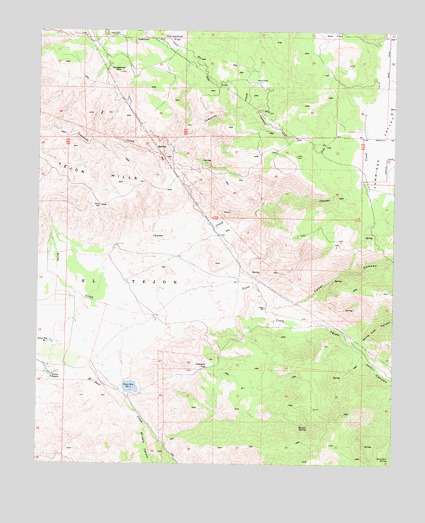
Tejon Ranch, CA USGS Topographic Map
Click on map above to begin viewing in our Map Viewer.

This topographic map contains these locations and features:
Feature Name Type Latitude Longitude GNIS ID View Map
Brodines RanchLocaleN35.1097°W118.6320°1682585View Map
Cedar CanyonValleyN35.0464°W118.6698°240383View Map
Chanac CreekStreamN35.0661°W118.7440°240465View Map
Cummings ValleyValleyN35.0811°W118.6379°241171View Map
Havala SpringSpringN35.0115°W118.6556°243279View Map
Horsethief FlatFlatN35.1233°W118.7031°243675View Map
Horsethief MountainSummitN35.1122°W118.7226°243676View Map
Indian SchoolSchoolN35.0452°W118.6706°243833View Map
Jacks CampLocaleN35.1116°W118.6729°243961View Map
Joaquin FlatFlatN35.0286°W118.6906°244067View Map
Kern County Fire Department Station 18 - Stallion SpringsBuildingN35.0842°W118.6343°2665328View Map
Oak FlatFlatN35.1225°W118.6476°246724View Map
Rosemarr SpringSpringN35.0017°W118.6269°248396View Map
Stallion SpringsPopulated PlaceN35.0889°W118.6426°1853417View Map
Stallion Springs Census Designated PlaceCensusN35.0935°W118.6477°2408801View Map
Tejon CanyonValleyN35.0508°W118.6748°250301View Map
Tejon RanchLocaleN35.0252°W118.7465°250304View Map
Tejon Reservoir Number OneReservoirN35.0350°W118.7458°254327View Map
Tejon Reservoir Number TwoReservoirN35.0221°W118.7179°254328View Map
Tejon Storage Number 1 734 DamDamN35.0355°W118.7468°1664026View Map
Tejon Storage Number 2 734-002 DamDamN35.0239°W118.7198°1664027View Map
White Cow CanyonValleyN35.0355°W118.6393°251464View Map
Winters CanyonValleyN35.0119°W118.7123°251738View Map

Note: Coordinates in the location and feature list above are referenced to NAD83 datum.


Copyright (C) 2008-2024 Ryan Niemi / Sunset Dynamics ... All Rights Reserved