TopoQuest Logo
Do you find TopoQuest useful?
Help keep TopoQuest running and adding new maps/features by donating!
Bitcoin:  19c7KJd3qBynnjoSw5npx9KScwjBe4ifkT
Litecoin:  LXs6TkuXGGXo1vDsWCkWVdjQX94eUKd6ui
Home View Maps Find Maps Find Places Resources & Links


Telegraph Mountain, Montana Topographic Map

USGS Map Title: Telegraph Mountain, MT
USGS Map MRC: 47111C8
DRG (GeoTIFF) Download: o47111c8.tif


Neighboring USGS Topographic Map Quads:


  Bowmans Corners NE, MT  
47112D1
 

  Simms, MT  
47111D8
 

  Cascade Colony, MT  
47111D7
 

  Henry Creek, MT  
47112C1
 

  Telegraph Mountain, MT  
47111C8
 

  Mount Cecelia, MT  
47111C7
 

  Coburn Mountain, MT  
47112B1
 

  Mid Canon, MT  
47111B8
 

  Hardy, MT  
47111B7


Map MRC Location:

N48°
W112°
N48°
W111°
H8 H7 H6 H5 H4 H3 H2 H1
G8 G7 G6 G5 G4 G3 G2 G1
F8 F7 F6 F5 F4 F3 F2 F1
E8 E7 E6 E5 E4 E3 E2 E1
D8 D7 D6 D5 D4 D3 D2 D1
C8 C7 C6 C5 C4 C3 C2 C1
B8 B7 B6 B5 B4 B3 B2 B1
A8 A7 A6 A5 A4 A3 A2 A1
N47°
W112°
N47°
W111°

Telegraph Mountain, MT USGS 1:24K Topographic Map Preview:
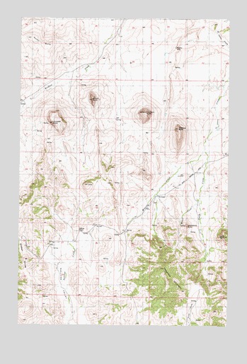
Telegraph Mountain, MT USGS Topographic Map
Click on map above to begin viewing in our Map Viewer.

This topographic map contains these locations and features:
Feature Name Type Latitude Longitude GNIS ID View Map
Bird Tail Post Office (historical)Post OfficeN47.3555°W111.9814°1762279View Map
Birdtail ButteSummitN47.3413°W111.9572°768892View Map
Birdtail DivideRidgeN47.2744°W111.9953°768894View Map
Black ButteSummitN47.2858°W111.8780°768920View Map
Buffalo FallsFallsN47.3631°W111.9079°769349View Map
Dear RanchLocaleN47.3397°W111.9972°800683View Map
Fishback ButteSummitN47.3299°W111.9061°771391View Map
Haystack ButteSummitN47.3366°W111.9253°772276View Map
Lionhead ButteSummitN47.3316°W111.9817°786211View Map
Mission CreekStreamN47.3219°W111.8900°774287View Map
Mount Angela School for Girls (historical)SchoolN47.3024°W111.9180°1762433View Map
Rocky ButteSummitN47.3638°W111.9861°775878View Map
Saddleback ButteSummitN47.2902°W111.9000°776071View Map
Saint PeterLocaleN47.3024°W111.9180°776130View Map
Saint PeterPopulated PlaceN47.3024°W111.9180°1762467View Map
Saint Peter Post Office (historical)Post OfficeN47.3024°W111.9180°1762455View Map
Saint Peters Mission (historical)ChurchN47.3024°W111.9180°1761874View Map
Saint Peters Mission CemeteryCemeteryN47.3005°W111.9208°1761875View Map
Saint Peters Mission Church (historical)ChurchN47.3024°W111.9180°1762434View Map
Smith CreekStreamN47.3219°W111.8900°776670View Map
Sullivan School (historical)SchoolN47.2886°W111.9633°801562View Map
Sullivan ValleyValleyN47.2505°W111.9711°805911View Map
Telegraph MountainSummitN47.2644°W111.9033°777451View Map
Weasel CreekStreamN47.3008°W111.8933°778162View Map

Note: Coordinates in the location and feature list above are referenced to NAD83 datum.


Copyright (C) 2008-2025 Ryan Niemi / Sunset Dynamics ... All Rights Reserved