TopoQuest Logo
Do you find TopoQuest useful?
Help keep TopoQuest running and adding new maps/features by donating!
Bitcoin:  19c7KJd3qBynnjoSw5npx9KScwjBe4ifkT
Litecoin:  LXs6TkuXGGXo1vDsWCkWVdjQX94eUKd6ui
Home View Maps Find Maps Find Places Resources & Links


Telegraph Peak, Nevada Topographic Map

USGS Map Title: Telegraph Peak, NV
USGS Map MRC: 39114F8
DRG (GeoTIFF) Download: o39114f8.tif


Neighboring USGS Topographic Map Quads:


  Franks Well, NV  
39115G1
 

  Egan Canyon, NV  
39114G8
 

  Borchert Spring, NV  
39114G7
 

  Hunter Point, NV  
39115F1
 

  Telegraph Peak, NV  
39114F8
 

  Monte Neva Hot Springs, NV  
39114F7
 

  Combs Creek, NV  
39115E1
 

  Steptoe Ranch, NV  
39114E8
 

  Steptoe, NV  
39114E7


Map MRC Location:

N40°
W115°
N40°
W114°
H8 H7 H6 H5 H4 H3 H2 H1
G8 G7 G6 G5 G4 G3 G2 G1
F8 F7 F6 F5 F4 F3 F2 F1
E8 E7 E6 E5 E4 E3 E2 E1
D8 D7 D6 D5 D4 D3 D2 D1
C8 C7 C6 C5 C4 C3 C2 C1
B8 B7 B6 B5 B4 B3 B2 B1
A8 A7 A6 A5 A4 A3 A2 A1
N39°
W115°
N39°
W114°

Telegraph Peak, NV USGS 1:24K Topographic Map Preview:
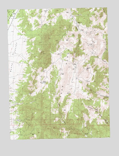
Telegraph Peak, NV USGS Topographic Map
Click on map above to begin viewing in our Map Viewer.

This topographic map contains these locations and features:
Feature Name Type Latitude Longitude GNIS ID View Map
April Fool SpringSpringN39.6297°W114.9736°848887View Map
Billy Pope SpringSpringN39.6282°W114.9062°848886View Map
Blaine (historical)LocaleN39.6263°W114.9036°850912View Map
Boneyard SpringSpringN39.6514°W114.8922°848884View Map
Cherry SpringSpringN39.6523°W114.9331°848883View Map
Frenchy MeadowsFlatN39.6791°W114.9575°848880View Map
Hunter (historical)Populated PlaceN39.6435°W114.9886°854706View Map
Hunter MineMineN39.6405°W114.9784°852856View Map
Hunter Post Office (historical)Post OfficeN39.6435°W114.9886°864774View Map
Hunter SpringsSpringN39.6691°W114.9759°848881View Map
Meadow SpringSpringN39.6871°W114.9352°848879View Map
Mustang SpringSpringN39.7460°W114.9272°848873View Map
North SpringSpringN39.7194°W114.9256°848732View Map
Pipe SpringSpringN39.7061°W114.9365°848875View Map
Quakies Sheep CampLocaleN39.6969°W114.9161°848876View Map
Rock SpringSpringN39.6687°W114.9259°848882View Map
Steptoe Post Office (historical)Post OfficeN39.6263°W114.9036°864844View Map
Telegraph Mining DistrictCivilN39.7235°W114.9134°853256View Map
Telegraph PeakSummitN39.6905°W114.9039°848877View Map
Telegraph Shearing CorralsLocaleN39.7355°W114.9139°848874View Map
Truckee SpringSpringN39.6419°W114.8797°848885View Map
Valley View MineMineN39.6272°W114.9281°852833View Map
Westside SpringSpringN39.6908°W114.9570°848878View Map

Note: Coordinates in the location and feature list above are referenced to NAD83 datum.


Copyright (C) 2008-2025 Ryan Niemi / Sunset Dynamics ... All Rights Reserved