TopoQuest Logo
Do you find TopoQuest useful?
Help keep TopoQuest running and adding new maps/features by donating!
Bitcoin:  19c7KJd3qBynnjoSw5npx9KScwjBe4ifkT
Litecoin:  LXs6TkuXGGXo1vDsWCkWVdjQX94eUKd6ui
Home View Maps Find Maps Find Places Resources & Links


Termination Point, Washington Topographic Map

USGS Map Title: Termination Point, WA
USGS Map MRC: 45121H8
DRG (GeoTIFF) Download: o45121h8.tif


Neighboring USGS Topographic Map Quads:


  Cedar Flats, WA  
46122A1
 

  Burnt Peak, WA  
46121A8
 

  Lone Butte, WA  
46121A7
 

  Bare Mountain, WA  
45122H1
 

  Termination Point, WA  
45121H8
 

  Gifford Peak, WA  
45121H7
 

  Lookout Mountain, WA  
45122G1
 

  Stabler, WA  
45121G8
 

  Big Huckleberry Mountain, WA  
45121G7


Map MRC Location:

N46°
W122°
N46°
W121°
H8 H7 H6 H5 H4 H3 H2 H1
G8 G7 G6 G5 G4 G3 G2 G1
F8 F7 F6 F5 F4 F3 F2 F1
E8 E7 E6 E5 E4 E3 E2 E1
D8 D7 D6 D5 D4 D3 D2 D1
C8 C7 C6 C5 C4 C3 C2 C1
B8 B7 B6 B5 B4 B3 B2 B1
A8 A7 A6 A5 A4 A3 A2 A1
N45°
W122°
N45°
W121°

Termination Point, WA USGS 1:24K Topographic Map Preview:
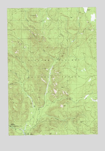
Termination Point, WA USGS Topographic Map
Click on map above to begin viewing in our Map Viewer.

This topographic map contains these locations and features:
Feature Name Type Latitude Longitude GNIS ID View Map
Big Hollow CreekStreamN45.9218°W121.9809°1516518View Map
Black CreekStreamN45.9109°W121.8851°1516600View Map
Bourbon CreekStreamN45.9246°W121.9843°1516879View Map
Bubbling Mike SpringSpringN45.8831°W121.9955°1531584View Map
Dry CreekStreamN45.8807°W121.9779°1518947View Map
Falls CreekStreamN45.9090°W121.9498°1519458View Map
Falls Creek FallsFallsN45.9101°W121.9134°1529516View Map
Falls Creek TrailTrailN45.9143°W121.8865°1519470View Map
Government Mineral SpringsLocaleN45.8821°W121.9909°1520174View Map
Government Spring Guard StationLocaleN45.8843°W121.9995°1533320View Map
Home Guard StationLocaleN45.8826°W121.9929°1533319View Map
Howe RidgeRidgeN45.9101°W121.9959°1521001View Map
Juice CreekStreamN45.9498°W121.9306°1521493View Map
Lava ButteSummitN45.9521°W121.9220°1521943View Map
Lava Butte TrailTrailN45.9454°W121.8967°1521944View Map
McClellan MeadowsFlatN45.9979°W121.8895°1522867View Map
Middle ButteSummitN45.9218°W121.9293°1523051View Map
Ninemile CreekStreamN45.8907°W121.9606°1523670View Map
North ButteSummitN45.9368°W121.9293°1523729View Map
Oldman CreekStreamN45.9629°W121.9131°1524020View Map
Oldman PassGapN45.9901°W121.9129°1528764View Map
Paradise CreekStreamN45.9454°W121.9337°1524186View Map
Paradise Creek CampgroundLocaleN45.9487°W121.9354°1524188View Map
Paradise HillsRangeN45.9779°W121.9920°1524190View Map
Paradise TrailTrailN45.9515°W121.9684°1524194View Map
Pete GulchValleyN45.9751°W121.9006°1524351View Map
Proverbial CreekStreamN45.9693°W121.9601°1524671View Map
Ridge TrailTrailN45.9776°W121.8765°1530234View Map
Rock PointSummitN45.9643°W121.9829°1525149View Map
South ButteSummitN45.9032°W121.9242°1526137View Map
Termination PointSummitN45.9918°W121.9626°1527012View Map
Trapper CreekStreamN45.8787°W121.9806°1527356View Map
Tyee SpringsSpringN45.8757°W121.9712°1527589View Map
Upper Wind River Winter Sports AreaParkN45.9993°W121.9137°1529442View Map
Wind River MineMineN45.9398°W121.9473°1528763View Map

Note: Coordinates in the location and feature list above are referenced to NAD83 datum.


Copyright (C) 2008-2024 Ryan Niemi / Sunset Dynamics ... All Rights Reserved