TopoQuest Logo
Do you find TopoQuest useful?
Help keep TopoQuest running and adding new maps/features by donating!
Bitcoin:  19c7KJd3qBynnjoSw5npx9KScwjBe4ifkT
Litecoin:  LXs6TkuXGGXo1vDsWCkWVdjQX94eUKd6ui
Home View Maps Find Maps Find Places Resources & Links


The Basin, Texas Topographic Map

USGS Map Title: The Basin, TX
USGS Map MRC: 29103C3
DRG (GeoTIFF) Download: o29103c3.tif


Neighboring USGS Topographic Map Quads:


  Christmas Mountains, TX  
29103D4
 

  Sombrero Peak, TX  
29103D3
 

  Grapevine Hills, TX  
29103D2
 

  Tule Mountain, TX  
29103C4
 

  The Basin, TX  
29103C3
 

  Panther Junction, TX  
29103C2
 

  Cerro Castellan, TX  
29103B4
 

  Emory Peak, TX  
29103B3
 

  Glenn Spring, TX  
29103B2


Map MRC Location:

N30°
W104°
N30°
W103°
H8 H7 H6 H5 H4 H3 H2 H1
G8 G7 G6 G5 G4 G3 G2 G1
F8 F7 F6 F5 F4 F3 F2 F1
E8 E7 E6 E5 E4 E3 E2 E1
D8 D7 D6 D5 D4 D3 D2 D1
C8 C7 C6 C5 C4 C3 C2 C1
B8 B7 B6 B5 B4 B3 B2 B1
A8 A7 A6 A5 A4 A3 A2 A1
N29°
W104°
N29°
W103°

The Basin, TX USGS 1:24K Topographic Map Preview:
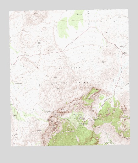
The Basin, TX USGS Topographic Map
Click on map above to begin viewing in our Map Viewer.

This topographic map contains these locations and features:
Feature Name Type Latitude Longitude GNIS ID View Map
Ash CreekStreamN29.3374°W103.3680°1329792View Map
Ash SpringSpringN29.3129°W103.3302°1329801View Map
Basin JunctionPopulated PlaceN29.3344°W103.2566°1377975View Map
Basin LoopTrailN29.2655°W103.3035°2033020View Map
Blacktail PeakSummitN29.2645°W103.3462°1330814View Map
Boot CanyonValleyN29.2514°W103.2682°1372679View Map
Carter PeakSummitN29.2772°W103.3317°1377784View Map
Casa Grande PeakSummitN29.2677°W103.2873°1332272View Map
Cattail CanyonValleyN29.2733°W103.3352°1372976View Map
Cattail FallsFallsN29.2735°W103.3346°1372978View Map
Cattail Falls SpringSpringN29.2735°W103.3352°1998632View Map
Chisos Mountain LodgeLocaleN29.2708°W103.2988°1332784View Map
Croton PeakSummitN29.3723°W103.3481°1333733View Map
Croton SpringSpringN29.3454°W103.3460°1333734View Map
Crown MountainSummitN29.2605°W103.2599°1333747View Map
Gano SpringSpringN29.3083°W103.3685°1377790View Map
Government SpringSpringN29.3405°W103.2560°1377791View Map
Juniper Canyon TrailTrailN29.2519°W103.2755°2033457View Map
Kibbe SpringSpringN29.2735°W103.2881°1339074View Map
Lost Mine PeakSummitN29.2756°W103.2584°1340644View Map
Lost Mine TrailTrailN29.2705°W103.2691°2033414View Map
Maple CanyonValleyN29.2930°W103.2734°1377797View Map
Mount HuffmanSummitN29.2806°W103.2897°1384880View Map
Oak CanyonValleyN29.2819°W103.3360°1342946View Map
Oak SpringSpringN29.2821°W103.3367°1377800View Map
Old RanchLocaleN29.2794°W103.3699°1377801View Map
Paint GapGapN29.3738°W103.2977°1377804View Map
Panther PassGapN29.2744°W103.2855°1343548View Map
Pulliam BluffCliffN29.3016°W103.2888°1344625View Map
Pulliam PeakSummitN29.2933°W103.2948°1377808View Map
Rough MountainSummitN29.3344°W103.2709°1377885View Map
Rough SpringSpringN29.3269°W103.2763°1345653View Map
The BasinBasinN29.2752°W103.3046°1377816View Map
The WindowCliffN29.2810°W103.3302°1348464View Map
The Window TrailTrailN29.2785°W103.3268°2033171View Map
Toll MountainSummitN29.2545°W103.2914°1348621View Map
Vernon Bailey PeakSummitN29.2833°W103.3211°1377819View Map
Ward MountainSummitN29.2570°W103.3354°1349475View Map
Window SpringsSpringN29.2799°W103.3293°1998644View Map

Note: Coordinates in the location and feature list above are referenced to NAD83 datum.


Copyright (C) 2008-2025 Ryan Niemi / Sunset Dynamics ... All Rights Reserved