TopoQuest Logo
Do you find TopoQuest useful?
Help keep TopoQuest running and adding new maps/features by donating!
Bitcoin:  19c7KJd3qBynnjoSw5npx9KScwjBe4ifkT
Litecoin:  LXs6TkuXGGXo1vDsWCkWVdjQX94eUKd6ui
Home View Maps Find Maps Find Places Resources & Links


Blue Bunch Mountain, Idaho Topographic Map

USGS Map Title: Blue Bunch Mountain, ID
USGS Map MRC: 44115D3
DRG (GeoTIFF) Download: o44115d3.tif


Neighboring USGS Topographic Map Quads:


  Honeymoon Lake, ID  
44115E4
 

  Big Soldier Mountain, ID  
44115E3
 

  Soldier Creek, ID  
44115E2
 

  Bear Valley Mountain, ID  
44115D4
 

  Blue Bunch Mountain, ID  
44115D3
 

  Cape Horn Lakes, ID  
44115D2
 

  Cache Creek, ID  
44115C4
 

  Bull Trout Point, ID  
44115C3
 

  Banner Summit, ID  
44115C2


Map MRC Location:

N45°
W116°
N45°
W115°
H8 H7 H6 H5 H4 H3 H2 H1
G8 G7 G6 G5 G4 G3 G2 G1
F8 F7 F6 F5 F4 F3 F2 F1
E8 E7 E6 E5 E4 E3 E2 E1
D8 D7 D6 D5 D4 D3 D2 D1
C8 C7 C6 C5 C4 C3 C2 C1
B8 B7 B6 B5 B4 B3 B2 B1
A8 A7 A6 A5 A4 A3 A2 A1
N44°
W116°
N44°
W115°

Blue Bunch Mountain, ID USGS 1:24K Topographic Map Preview:
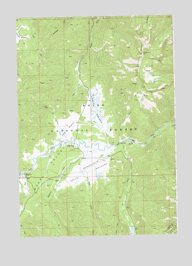
Blue Bunch Mountain, ID USGS Topographic Map
Click on map above to begin viewing in our Map Viewer.

This topographic map contains these locations and features:
Feature Name Type Latitude Longitude GNIS ID View Map
Ayers CreekStreamN44.4260°W115.3048°376789View Map
Ayers MeadowsSwampN44.4489°W115.3138°376790View Map
Bear ValleyValleyN44.4268°W115.2765°377199View Map
Bear Valley CampgroundLocaleN44.4110°W115.3698°397419View Map
Bear Valley Creek TrailTrailN44.4380°W115.2582°394057View Map
Blue Bunch MountainSummitN44.4782°W115.2751°377888View Map
Blue Bunch RidgeRidgeN44.4710°W115.2782°377889View Map
Blue Bunch TrailTrailN44.4518°W115.2823°394404View Map
Bruce MeadowsFlatN44.4102°W115.3229°378305View Map
Bruce Meadows AirportAirportN44.4149°W115.3182°400938View Map
Bruce Meadows CampgroundLocaleN44.4266°W115.3318°394557View Map
Camptender TrailTrailN44.4766°W115.3532°394058View Map
Chip CreekStreamN44.4293°W115.3415°379313View Map
Cold CreekStreamN44.4255°W115.3115°379514View Map
Cy SpringsSpringN44.4554°W115.2750°380200View Map
Elk CreekStreamN44.4107°W115.3723°381357View Map
Fir CreekStreamN44.4282°W115.2909°381702View Map
Fir Creek CampgroundLocaleN44.4282°W115.2851°381705View Map
Mountain MeadowFlatN44.4891°W115.3721°387293View Map
Poker CreekStreamN44.4291°W115.3353°2785429View Map
Poker MeadowsFlatN44.4355°W115.3368°388659View Map
Poker Meadows CampgroundLocaleN44.4266°W115.3315°388660View Map
Wyoming CreekStreamN44.4257°W115.3215°393726View Map

Note: Coordinates in the location and feature list above are referenced to NAD83 datum.


Copyright (C) 2008-2024 Ryan Niemi / Sunset Dynamics ... All Rights Reserved