TopoQuest Logo
Do you find TopoQuest useful?
Help keep TopoQuest running and adding new maps/features by donating!
Bitcoin:  19c7KJd3qBynnjoSw5npx9KScwjBe4ifkT
Litecoin:  LXs6TkuXGGXo1vDsWCkWVdjQX94eUKd6ui
Home View Maps Find Maps Find Places Resources & Links


The Hogsback, Wyoming Topographic Map

USGS Map Title: The Hogsback, WY
USGS Map MRC: 42110C3
DRG (GeoTIFF) Download: o42110c3.tif


Neighboring USGS Topographic Map Quads:


  Pine Grove Ridge, WY  
42110D4
 

  Cretaceous Mountain, WY  
42110D3
 

  Chimney Butte, WY  
42110D2
 

  Lake Mountain, WY  
42110C4
 

  The Hogsback, WY  
42110C3
 

  La Barge, WY  
42110C2
 

  Fort Hill, WY  
42110B4
 

  Red Gap, WY  
42110B3
 

  Names Hill, WY  
42110B2


Map MRC Location:

N43°
W111°
N43°
W110°
H8 H7 H6 H5 H4 H3 H2 H1
G8 G7 G6 G5 G4 G3 G2 G1
F8 F7 F6 F5 F4 F3 F2 F1
E8 E7 E6 E5 E4 E3 E2 E1
D8 D7 D6 D5 D4 D3 D2 D1
C8 C7 C6 C5 C4 C3 C2 C1
B8 B7 B6 B5 B4 B3 B2 B1
A8 A7 A6 A5 A4 A3 A2 A1
N42°
W111°
N42°
W110°

The Hogsback, WY USGS 1:24K Topographic Map Preview:
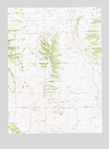
The Hogsback, WY USGS Topographic Map
Click on map above to begin viewing in our Map Viewer.

This topographic map contains these locations and features:
Feature Name Type Latitude Longitude GNIS ID View Map
Beaver Dam CreekStreamN42.3558°W110.3188°1598074View Map
Big MesaSummitN42.3588°W110.2724°1585482View Map
Buckman HollowValleyN42.2580°W110.3438°1586035View Map
CalpetPopulated PlaceN42.2838°W110.2591°1586282View Map
Calpet Census Designated PlaceCensusN42.2906°W110.2826°2407939View Map
Cedar CreekStreamN42.2894°W110.2696°1586486View Map
Conway CreekStreamN42.2661°W110.3738°1598881View Map
Dry Piney CampLocaleN42.3491°W110.3441°1587869View Map
Gentle Annies SpringSpringN42.3294°W110.3438°1588854View Map
Graphite HollowValleyN42.2924°W110.3674°1600038View Map
Grassy Hollow CreekStreamN42.2638°W110.3746°1600046View Map
Guyette Ditch Number 1CanalN42.2658°W110.3541°1605296View Map
Hogsback RidgeRidgeN42.3061°W110.3271°1597191View Map
Hogsback Spring Number 1SpringN42.2808°W110.3002°1605309View Map
Hogsback Spring Number 2SpringN42.2697°W110.3066°1605310View Map
Jory HillSummitN42.2963°W110.2941°1590238View Map
La Barge Gas and Oil FieldOilfieldN42.2874°W110.2602°1590443View Map
North La Barge Gas and Oil FieldOilfieldN42.3397°W110.2902°1592230View Map
Oreana SpringSpringN42.3274°W110.3077°1592462View Map
Pine HollowValleyN42.2916°W110.3682°1602162View Map
Rainbow CampLocaleN42.2647°W110.2588°1593127View Map
Saddle RidgeRidgeN42.3499°W110.2985°1593739View Map
Sayley MineMineN42.2524°W110.3182°1746400View Map
South Fork Birch CreekStreamN42.2819°W110.2513°1594624View Map
South Fork Dry Piney CreekStreamN42.3602°W110.2974°1891227View Map
Spring BranchStreamN42.2830°W110.3646°1594813View Map
The HogsbackRidgeN42.3288°W110.3196°1595431View Map
Viola - LaBarge CemeteryCemeteryN42.2665°W110.3675°2774431View Map
Viola Area MineMineN42.2666°W110.2932°1746401View Map
Western CampLocaleN42.3333°W110.2941°1596261View Map

Note: Coordinates in the location and feature list above are referenced to NAD83 datum.


Copyright (C) 2008-2024 Ryan Niemi / Sunset Dynamics ... All Rights Reserved