TopoQuest Logo
Do you find TopoQuest useful?
Help keep TopoQuest running and adding new maps/features by donating!
Bitcoin:  19c7KJd3qBynnjoSw5npx9KScwjBe4ifkT
Litecoin:  LXs6TkuXGGXo1vDsWCkWVdjQX94eUKd6ui
Home View Maps Find Maps Find Places Resources & Links


The Rocks, Wyoming Topographic Map

USGS Map Title: The Rocks, WY
USGS Map MRC: 44104D5
DRG (GeoTIFF) Download: o44104d5.tif


Neighboring USGS Topographic Map Quads:


  Devils Tower, WY  
44104E6
 

  Sherrard Hill, WY  
44104E5
 

  Black Hills, WY  
44104E4
 

  Wonder View, WY  
44104D6
 

  The Rocks, WY  
44104D5
 

  Sundance West, WY  
44104D4
 

  Iron Mountain, WY  
44104C6
 

  Linden, WY  
44104C5
 

  Pfeiffer Hill, WY  
44104C4


Map MRC Location:

N45°
W105°
N45°
W104°
H8 H7 H6 H5 H4 H3 H2 H1
G8 G7 G6 G5 G4 G3 G2 G1
F8 F7 F6 F5 F4 F3 F2 F1
E8 E7 E6 E5 E4 E3 E2 E1
D8 D7 D6 D5 D4 D3 D2 D1
C8 C7 C6 C5 C4 C3 C2 C1
B8 B7 B6 B5 B4 B3 B2 B1
A8 A7 A6 A5 A4 A3 A2 A1
N44°
W105°
N44°
W104°

The Rocks, WY USGS 1:24K Topographic Map Preview:
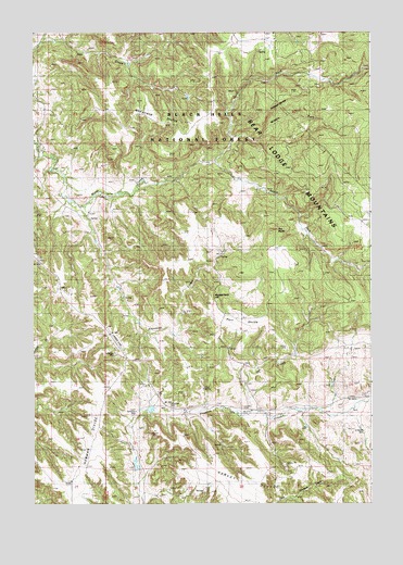
The Rocks, WY USGS Topographic Map
Click on map above to begin viewing in our Map Viewer.

This topographic map contains these locations and features:
Feature Name Type Latitude Longitude GNIS ID View Map
Arkansas CreekStreamN44.4542°W104.6069°1597800View Map
Bear Lodge RanchLocaleN44.4975°W104.5352°1598019View Map
Haley RanchLocaleN44.4511°W104.6055°1600166View Map
Harvey DivideRidgeN44.3808°W104.5477°1600225View Map
Houston DamDamN44.4000°W104.5805°1608452View Map
Houston ReservoirReservoirN44.4001°W104.5819°1608453View Map
Loafman ParkFlatN44.4588°W104.5482°1601071View Map
Lost LakeLakeN44.4750°W104.5233°1601146View Map
Macumba DamDamN44.3833°W104.5872°1607638View Map
Macumba ReservoirReservoirN44.3846°W104.5872°1607639View Map
McFarland DivideRidgeN44.4786°W104.5808°1601305View Map
Middle Fork Miller CreekStreamN44.4725°W104.5511°1601404View Map
Miller Creek CemeteryCemeteryN44.4514°W104.6142°1601467View Map
Miller Creek DamDamN44.4867°W104.5205°1607542View Map
Miller Creek ReservoirReservoirN44.4867°W104.5205°1607543View Map
Montgomery HillSummitN44.4305°W104.5583°1604683View Map
North Fork Miller CreekStreamN44.4661°W104.5575°1601793View Map
Oak CreekStreamN44.3997°W104.5447°1601886View Map
Port DivideRidgeN44.4236°W104.5536°1602274View Map
Schoepf DivideRidgeN44.4825°W104.5344°1602766View Map
Snider SchoolSchoolN44.4122°W104.5919°1603024View Map
Snook RanchLocaleN44.4422°W104.5533°1603025View Map
South Fork Miller CreekStreamN44.4658°W104.5572°1603161View Map
Taylor FieldAirportN44.4187°W104.5949°1605626View Map
The RocksSummitN44.4469°W104.5375°1603616View Map
Trout DamDamN44.4133°W104.6088°1607466View Map
Trout ReservoirReservoirN44.4133°W104.6088°1607467View Map
Yakju DamDamN44.4283°W104.5922°1607166View Map
Yakju ReservoirReservoirN44.4283°W104.5922°1607167View Map

Note: Coordinates in the location and feature list above are referenced to NAD83 datum.


Copyright (C) 2008-2025 Ryan Niemi / Sunset Dynamics ... All Rights Reserved