TopoQuest Logo
Do you find TopoQuest useful?
Help keep TopoQuest running and adding new maps/features by donating!
Bitcoin:  19c7KJd3qBynnjoSw5npx9KScwjBe4ifkT
Litecoin:  LXs6TkuXGGXo1vDsWCkWVdjQX94eUKd6ui
Home View Maps Find Maps Find Places Resources & Links


The Seven Hermits, Colorado Topographic Map

USGS Map Title: The Seven Hermits, CO
USGS Map MRC: 39106E7
DRG (GeoTIFF) Download: o39106e7.tif


Neighboring USGS Topographic Map Quads:


  Gypsum, CO  
39106F8
 

  Eagle, CO  
39106F7
 

  Wolcott, CO  
39106F6
 

  Suicide Mountain, CO  
39106E8
 

  The Seven Hermits, CO  
39106E7
 

  Fulford, CO  
39106E6
 

  Toner Reservoir, CO  
39106D8
 

  Red Creek, CO  
39106D7
 

  Crooked Creek Pass, CO  
39106D6


Map MRC Location:

N40°
W107°
N40°
W106°
H8 H7 H6 H5 H4 H3 H2 H1
G8 G7 G6 G5 G4 G3 G2 G1
F8 F7 F6 F5 F4 F3 F2 F1
E8 E7 E6 E5 E4 E3 E2 E1
D8 D7 D6 D5 D4 D3 D2 D1
C8 C7 C6 C5 C4 C3 C2 C1
B8 B7 B6 B5 B4 B3 B2 B1
A8 A7 A6 A5 A4 A3 A2 A1
N39°
W107°
N39°
W106°

The Seven Hermits, CO USGS 1:24K Topographic Map Preview:
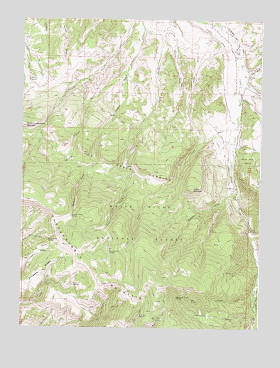
The Seven Hermits, CO USGS Topographic Map
Click on map above to begin viewing in our Map Viewer.

This topographic map contains these locations and features:
Feature Name Type Latitude Longitude GNIS ID View Map
Bear Gulch ReservoirReservoirN39.5037°W106.8012°176006View Map
Beecher GulchValleyN39.5562°W106.7630°176019View Map
Bruce CreekStreamN39.5930°W106.7620°176023View Map
Coffin MountainSummitN39.5564°W106.7867°176001View Map
East Brush CreekStreamN39.5408°W106.7553°176017View Map
Erickson RidgeRidgeN39.5228°W106.8642°202349View Map
Frost CreekStreamN39.5817°W106.7634°176020View Map
Ground Hog MineMineN39.6028°W106.7942°1684183View Map
Hardscrabble MountainSummitN39.5180°W106.8323°202347View Map
Hart SpringSpringN39.5109°W106.7859°176004View Map
Hells Hole ReservoirReservoirN39.5051°W106.8131°176007View Map
Hollingsworth and Potter DitchCanalN39.6222°W106.7686°202352View Map
Horse Mountain Uranium MinesMineN39.5889°W106.7567°1684184View Map
Horton GulchValleyN39.5115°W106.7536°176002View Map
McHatten ReservoirReservoirN39.6004°W106.8674°176027View Map
McKenzie DitchCanalN39.6167°W106.7725°176030View Map
McKenzie GulchValleyN39.5070°W106.7523°176003View Map
McKenzie Gulch SpringSpringN39.5123°W106.7936°176005View Map
Miller Gulch SpringSpringN39.5351°W106.8612°176000View Map
Peterson DitchCanalN39.5305°W106.7531°202350View Map
Peterson Ditch Number 1CanalN39.5111°W106.7523°169485View Map
Peterson DrawValleyN39.5148°W106.7509°176016View Map
Sawmill GulchValleyN39.6038°W106.8206°176028View Map
Sawmill Gulch SpringSpringN39.5452°W106.8490°176010View Map
Second GulchValleyN39.6209°W106.8019°176029View Map
Skim Milk BasinBasinN39.5686°W106.7567°176022View Map
Slow Trail RidgeRidgeN39.5275°W106.8731°202348View Map
Staton and Cissna DitchCanalN39.5667°W106.7703°176021View Map
The Seven HermitsRangeN39.5650°W106.8212°176026View Map
Third Gulch SpringSpringN39.5305°W106.8287°176009View Map
Trail GulchValleyN39.6046°W106.7582°176025View Map
West Brush CreekStreamN39.5408°W106.7553°176018View Map
Yates ReservoirReservoirN39.5174°W106.8479°176008View Map

Note: Coordinates in the location and feature list above are referenced to NAD83 datum.


Copyright (C) 2008-2024 Ryan Niemi / Sunset Dynamics ... All Rights Reserved