TopoQuest Logo
Do you find TopoQuest useful?
Help keep TopoQuest running and adding new maps/features by donating!
Bitcoin:  19c7KJd3qBynnjoSw5npx9KScwjBe4ifkT
Litecoin:  LXs6TkuXGGXo1vDsWCkWVdjQX94eUKd6ui
Home View Maps Find Maps Find Places Resources & Links


The Twins, Oregon Topographic Map

USGS Map Title: The Twins, OR
USGS Map MRC: 43121F8
DRG (GeoTIFF) Download: o43121f8.tif


Neighboring USGS Topographic Map Quads:


  Waldo Mountain, OR  
43122G1
 

  Irish Mountain, OR  
43121G8
 

  Crane Prairie Reservoir, OR  
43121G7
 

  Waldo Lake, OR  
43122F1
 

  The Twins, OR  
43121F8
 

  Davis Mountain, OR  
43121F7
 

  Willamette Pass, OR  
43122E1
 

  Odell Lake, OR  
43121E8
 

  Hamner Butte, OR  
43121E7


Map MRC Location:

N44°
W122°
N44°
W121°
H8 H7 H6 H5 H4 H3 H2 H1
G8 G7 G6 G5 G4 G3 G2 G1
F8 F7 F6 F5 F4 F3 F2 F1
E8 E7 E6 E5 E4 E3 E2 E1
D8 D7 D6 D5 D4 D3 D2 D1
C8 C7 C6 C5 C4 C3 C2 C1
B8 B7 B6 B5 B4 B3 B2 B1
A8 A7 A6 A5 A4 A3 A2 A1
N43°
W122°
N43°
W121°

The Twins, OR USGS 1:24K Topographic Map Preview:
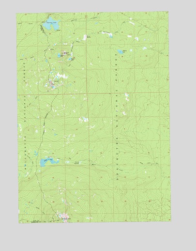
The Twins, OR USGS Topographic Map
Click on map above to begin viewing in our Map Viewer.

This topographic map contains these locations and features:
Feature Name Type Latitude Longitude GNIS ID View Map
Barren LakeLakeN43.7007°W121.9556°1156848View Map
Bobby LakeLakeN43.6627°W121.9753°1138370View Map
Charlton LakeLakeN43.7430°W121.9723°1139582View Map
Charlton Lake ShelterLocaleN43.7443°W121.9773°1155872View Map
Found LakeLakeN43.7223°W121.9574°1142347View Map
Gerdine ButteSummitN43.7256°W121.9626°1158256View Map
Grouse LakeLakeN43.6948°W121.9489°1156849View Map
Hidden LakeLakeN43.7243°W121.9664°1156847View Map
Johnny LakeLakeN43.7261°W121.9161°1144315View Map
Long MeadowFlatN43.7375°W121.9272°1145424View Map
Maiden PeakSummitN43.6271°W121.9650°1145754View Map
Moore Creek TrailTrailN43.6560°W121.9075°1146435View Map
Poverty MeadowsSwampN43.6606°W121.9500°1147955View Map
Round MeadowSwampN43.7349°W121.9450°1148775View Map
The TwinsSummitN43.7061°W121.9735°1135771View Map
Twin Peaks TrailTrailN43.6926°W121.9953°1151576View Map

Note: Coordinates in the location and feature list above are referenced to NAD83 datum.


Copyright (C) 2008-2024 Ryan Niemi / Sunset Dynamics ... All Rights Reserved