TopoQuest Logo
Do you find TopoQuest useful?
Help keep TopoQuest running and adding new maps/features by donating!
Bitcoin:  19c7KJd3qBynnjoSw5npx9KScwjBe4ifkT
Litecoin:  LXs6TkuXGGXo1vDsWCkWVdjQX94eUKd6ui
Home View Maps Find Maps Find Places Resources & Links


Blue Creek Mountain, California Topographic Map

USGS Map Title: Blue Creek Mountain, CA
USGS Map MRC: 41123D7
DRG (GeoTIFF) Download: o41123d7.tif


Neighboring USGS Topographic Map Quads:


  Klamath Glen, CA  
41123E8
 

  Summit Valley, CA  
41123E7
 

  Chimney Rock, CA  
41123E6
 

  Ah Pah Ridge, CA  
41123D8
 

  Blue Creek Mountain, CA  
41123D7
 

  Lonesome Ridge, CA  
41123D6
 

  Holter Ridge, CA  
41123C8
 

  Johnsons, CA  
41123C7
 

  Fish Lake, CA  
41123C6


Map MRC Location:

N42°
W124°
N42°
W123°
H8 H7 H6 H5 H4 H3 H2 H1
G8 G7 G6 G5 G4 G3 G2 G1
F8 F7 F6 F5 F4 F3 F2 F1
E8 E7 E6 E5 E4 E3 E2 E1
D8 D7 D6 D5 D4 D3 D2 D1
C8 C7 C6 C5 C4 C3 C2 C1
B8 B7 B6 B5 B4 B3 B2 B1
A8 A7 A6 A5 A4 A3 A2 A1
N41°
W124°
N41°
W123°

Blue Creek Mountain, CA USGS 1:24K Topographic Map Preview:
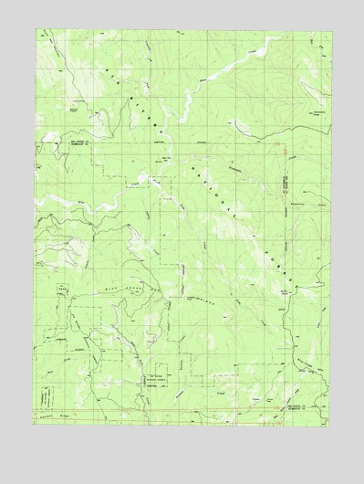
Blue Creek Mountain, CA USGS Topographic Map
Click on map above to begin viewing in our Map Viewer.

This topographic map contains these locations and features:
Feature Name Type Latitude Longitude GNIS ID View Map
Barren ButteSummitN41.4173°W123.7695°256553View Map
Bear Pen FlatFlatN41.4579°W123.8220°256694View Map
Blue Creek MountainSummitN41.3937°W123.7631°257236View Map
Blue Creek Mountain RidgeRidgeN41.4160°W123.8231°257237View Map
Buzzard CreekStreamN41.3876°W123.8115°257783View Map
Coyote CreekStreamN41.4415°W123.8506°258826View Map
Crescent City ForkStreamN41.4751°W123.8215°258907View Map
Indian CreekStreamN41.4515°W123.8312°261724View Map
Lookout PointSummitN41.4151°W123.8115°274703View Map
Nickowitz CreekStreamN41.4576°W123.8198°264089View Map
Nickowitz PeakSummitN41.4740°W123.7590°1682088View Map
Pecwan RidgeRidgeN41.3791°W123.8540°264615View Map
Slide CreekStreamN41.4510°W123.8240°266293View Map
Soapstone GulchValleyN41.4476°W123.7717°267353View Map
South Red MountainSummitN41.4976°W123.8723°1659829View Map
Stevens PrairieAreaN41.4715°W123.8570°267735View Map
Yellow Jacket CampLocaleN41.4160°W123.7662°276209View Map

Note: Coordinates in the location and feature list above are referenced to NAD83 datum.


Copyright (C) 2008-2024 Ryan Niemi / Sunset Dynamics ... All Rights Reserved