TopoQuest Logo
Do you find TopoQuest useful?
Help keep TopoQuest running and adding new maps/features by donating!
Bitcoin:  19c7KJd3qBynnjoSw5npx9KScwjBe4ifkT
Litecoin:  LXs6TkuXGGXo1vDsWCkWVdjQX94eUKd6ui
Home View Maps Find Maps Find Places Resources & Links


Thedford, Nebraska Topographic Map

USGS Map Title: Thedford, NE
USGS Map MRC: 41100H5
DRG (GeoTIFF) Download: o41100h5.tif


Neighboring USGS Topographic Map Quads:


  Duck Lake SW, NE  
42100A6
 

  Duck Lake SE, NE  
42100A5
 

  Purdum SW, NE  
42100A4
 

  Norway, NE  
41100H6
 

  Thedford, NE  
41100H5
 

  Natick, NE  
41100H4
 

  Thedford SW, NE  
41100G6
 

  Thedford SE, NE  
41100G5
 

  Halsey SW, NE  
41100G4


Map MRC Location:

N42°
W101°
N42°
W100°
H8 H7 H6 H5 H4 H3 H2 H1
G8 G7 G6 G5 G4 G3 G2 G1
F8 F7 F6 F5 F4 F3 F2 F1
E8 E7 E6 E5 E4 E3 E2 E1
D8 D7 D6 D5 D4 D3 D2 D1
C8 C7 C6 C5 C4 C3 C2 C1
B8 B7 B6 B5 B4 B3 B2 B1
A8 A7 A6 A5 A4 A3 A2 A1
N41°
W101°
N41°
W100°

Thedford, NE USGS 1:24K Topographic Map Preview:
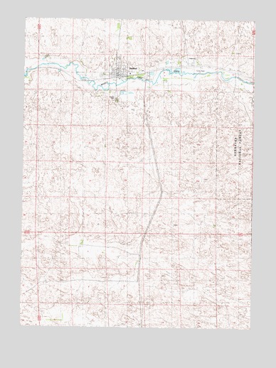
Thedford, NE USGS Topographic Map
Click on map above to begin viewing in our Map Viewer.

This topographic map contains these locations and features:
Feature Name Type Latitude Longitude GNIS ID View Map
Arrowhead CampgroundLocaleN41.9764°W100.5657°1836365View Map
Bedford Assembly of God ChurchChurchN41.9778°W100.5760°1836343View Map
Florea SchoolSchoolN41.9086°W100.5907°835565View Map
Hillcreat CemeteryCemeteryN41.9675°W100.5749°835803View Map
Saint Thomas of Canterbury ChurchChurchN41.9783°W100.5763°1836344View Map
The Sandhills Historical MarkerParkN41.9794°W100.5582°1836363View Map
ThedfordLocaleN41.9764°W100.5749°1836341View Map
ThedfordPopulated PlaceN41.9783°W100.5763°835692View Map
Thedford Election PrecinctCivilN41.9181°W100.5829°1929334View Map
Thedford Elementary SchoolSchoolN41.9783°W100.5763°1836351View Map
Thedford High SchoolSchoolN41.9783°W100.5763°1836350View Map
Thedford Police DepartmentBuildingN41.9783°W100.5763°1836353View Map
Thedford Post OfficePost OfficeN41.9778°W100.5746°1836342View Map
Thedford Volunteer Fire DepartmentBuildingN41.9771°W100.5746°1836352View Map
Thedford Volunteer Rescue SquadBuildingN41.9771°W100.5746°2553711View Map
Thomas CountyCivilN41.9135°W100.5558°835907View Map
Thomas County AirportAirportN41.9635°W100.5677°837733View Map
Thomas County CourthouseBuildingN41.9783°W100.5763°1836345View Map
Thomas County LibraryBuildingN41.9783°W100.5763°1836349View Map
Thomas County Sheriffs OfficeBuildingN41.9783°W100.5763°1836348View Map
Thomas Election PrecinctCivilN41.9135°W100.5558°2546909View Map
Trinity Lutheran ChurchChurchN41.9783°W100.5763°1836347View Map
United Church of ChristChurchN41.9783°W100.5763°1836346View Map
Village of ThedfordCivilN41.9792°W100.5747°2399968View Map

Note: Coordinates in the location and feature list above are referenced to NAD83 datum.


Copyright (C) 2008-2025 Ryan Niemi / Sunset Dynamics ... All Rights Reserved