TopoQuest Logo
Do you find TopoQuest useful?
Help keep TopoQuest running and adding new maps/features by donating!
Bitcoin:  19c7KJd3qBynnjoSw5npx9KScwjBe4ifkT
Litecoin:  LXs6TkuXGGXo1vDsWCkWVdjQX94eUKd6ui
Home View Maps Find Maps Find Places Resources & Links


Blue Diamond SE, Nevada Topographic Map

USGS Map Title: Blue Diamond SE, NV
USGS Map MRC: 36115A3
DRG (GeoTIFF) Download: o36115a3.tif


Neighboring USGS Topographic Map Quads:


  La Madre Mountain, NV  
36115B4
 

  Blue Diamond NE, NV  
36115B3
 

  Las Vegas NW, NV  
36115B2
 

  Blue Diamond, NV  
36115A4
 

  Blue Diamond SE, NV  
36115A3
 

  Las Vegas SW, NV  
36115A2
 

  Cottonwood Pass, NV  
35115H4
 

  Bird Spring, NV  
35115H3
 

  Sloan, NV  
35115H2


Map MRC Location:

N37°
W116°
N37°
W115°
H8 H7 H6 H5 H4 H3 H2 H1
G8 G7 G6 G5 G4 G3 G2 G1
F8 F7 F6 F5 F4 F3 F2 F1
E8 E7 E6 E5 E4 E3 E2 E1
D8 D7 D6 D5 D4 D3 D2 D1
C8 C7 C6 C5 C4 C3 C2 C1
B8 B7 B6 B5 B4 B3 B2 B1
A8 A7 A6 A5 A4 A3 A2 A1
N36°
W116°
N36°
W115°

Blue Diamond SE, NV USGS 1:24K Topographic Map Preview:
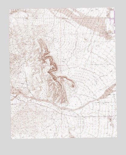
Blue Diamond SE, NV USGS Topographic Map
Click on map above to begin viewing in our Map Viewer.

This topographic map contains these locations and features:
Feature Name Type Latitude Longitude GNIS ID View Map
Arden BeaconTowerN36.0358°W115.3128°851402View Map
Arden Gypsum MineMineN36.0491°W115.3092°848420View Map
Arden Mining DistrictCivilN36.0622°W115.3406°852976View Map
Bishop Gorman High SchoolSchoolN36.0815°W115.3165°858616View Map
Calvary Chapel of Spring ValleyChurchN36.0819°W115.2528°2472839View Map
Clark County Fire Department Station 26BuildingN36.1165°W115.2875°2473030View Map
Clark County Fire Department Station 34BuildingN36.0811°W115.2809°2473034View Map
Clark County Fire Department Station 66BuildingN36.0046°W115.2646°2581366View Map
Clifford J Lawrence Junior High SchoolSchoolN36.1085°W115.2848°2085524View Map
Department of Veterans Affairs Southern Nevada Healthcare System - Southwest Primary Care ClinicHospitalN36.0567°W115.2625°2642860View Map
Desert Breeze ParkParkN36.1227°W115.2748°2473286View Map
Dignity Health Saint Rose Dominican Hospitals San Martin CampusHospitalN36.0571°W115.2720°2642846View Map
Exploration PeakSummitN36.0172°W115.2587°2062945View Map
Exploration Peak ParkPopulated PlaceN36.0149°W115.2680°2585382View Map
Faith Baptist ChurchChurchN36.1111°W115.2647°2472889View Map
Frank Kim Elementary SchoolSchoolN36.1060°W115.2554°858492View Map
Helen Meyer Community CenterBuildingN36.1066°W115.2534°2473088View Map
Kathy L Batterman Elementary SchoolSchoolN36.0822°W115.3139°2083968View Map
Keith C and Karen W Hayes Elementary SchoolSchoolN36.1233°W115.3030°2084191View Map
Kids Campus Learning CenterSchoolN36.1001°W115.3012°2088482View Map
Kids Turf AcademySchoolN36.1109°W115.2630°2088487View Map
KNUU-AM (Paradise)TowerN36.0730°W115.2522°865059View Map
Lucille S Rogers Elementary SchoolSchoolN36.0883°W115.2851°2084969View Map
Merryhill Elementary SchoolSchoolN36.0973°W115.2801°2088504View Map
Paul Meyer ParkParkN36.1067°W115.2532°2473370View Map
POE Flamingo Post OfficePost OfficeN36.1167°W115.3137°2783327View Map
Roger M Bryan Elementary SchoolSchoolN36.1196°W115.2711°2083977View Map
Sierra Vista High SchoolSchoolN36.0501°W115.2685°2086471View Map
Southern Hills Hospital and Medical CenterHospitalN36.0726°W115.2950°2473517View Map
Southwest Baptist ChurchChurchN36.1106°W115.2794°2473171View Map
Spring Valley Assembly of God ChurchChurchN36.1051°W115.2551°2473174View Map
Spring Valley Census Designated PlaceCensusN36.0987°W115.2619°2408797View Map
Spring Valley Christian AcademySchoolN36.1050°W115.2544°2088520View Map
Spring Valley High SchoolSchoolN36.1205°W115.2595°2086474View Map
Summerlin South Census Designated PlaceCensusN36.1243°W115.3325°2410017View Map
Sunday MineMineN36.0883°W115.2694°853705View Map
The Crossing ChurchChurchN36.0413°W115.2651°2473198View Map
Valley Bible Fellowship ChurchChurchN36.1152°W115.2796°2473478View Map
Victoria Fertitta Middle SchoolSchoolN36.0899°W115.3100°2085521View Map
Wayne N Tanaka Elementary SchoolSchoolN36.0618°W115.2915°2084981View Map
Westridge Post OfficePost OfficeN36.0842°W115.2637°2783336View Map

Note: Coordinates in the location and feature list above are referenced to NAD83 datum.


Copyright (C) 2008-2025 Ryan Niemi / Sunset Dynamics ... All Rights Reserved