TopoQuest Logo
Do you find TopoQuest useful?
Help keep TopoQuest running and adding new maps/features by donating!
Bitcoin:  19c7KJd3qBynnjoSw5npx9KScwjBe4ifkT
Litecoin:  LXs6TkuXGGXo1vDsWCkWVdjQX94eUKd6ui
Home View Maps Find Maps Find Places Resources & Links


Thomasboro, Illinois Topographic Map

USGS Map Title: Thomasboro, IL
USGS Map MRC: 40088B2
DRG (GeoTIFF) Download: o40088b2.tif


Neighboring USGS Topographic Map Quads:


  Fisher, IL  
40088C3
 

  Rantoul, IL  
40088C2
 

  Gifford, IL  
40088C1
 

  Rising, IL  
40088B3
 

  Thomasboro, IL  
40088B2
 

  Flatville, IL  
40088B1
 

  Bondville, IL  
40088A3
 

  Urbana, IL  
40088A2
 

  Saint Joseph, IL  
40088A1


Map MRC Location:

N41°
W89°
N41°
W88°
H8 H7 H6 H5 H4 H3 H2 H1
G8 G7 G6 G5 G4 G3 G2 G1
F8 F7 F6 F5 F4 F3 F2 F1
E8 E7 E6 E5 E4 E3 E2 E1
D8 D7 D6 D5 D4 D3 D2 D1
C8 C7 C6 C5 C4 C3 C2 C1
B8 B7 B6 B5 B4 B3 B2 B1
A8 A7 A6 A5 A4 A3 A2 A1
N40°
W89°
N40°
W88°

Thomasboro, IL USGS 1:24K Topographic Map Preview:
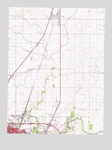
Thomasboro, IL USGS Topographic Map
Click on map above to begin viewing in our Map Viewer.

This topographic map contains these locations and features:
Feature Name Type Latitude Longitude GNIS ID View Map
AugervillePopulated PlaceN40.1398°W88.1717°403725View Map
Beardsley ParkParkN40.1253°W88.2403°404035View Map
Boneyard CreekStreamN40.1250°W88.2378°422378View Map
Busey WoodsWoodsN40.1270°W88.2134°1866584View Map
Carley ChurchChurchN40.1881°W88.1439°405593View Map
Carroll Fire Protection DistrictBuildingN40.1307°W88.1837°2682051View Map
Champaign CountyCivilN40.1401°W88.1992°424211View Map
Clements CemeteryCemeteryN40.1448°W88.1623°406241View Map
Columbia Elementary SchoolSchoolN40.1270°W88.2437°406403View Map
Eastern Prairie Fire Protection DistrictBuildingN40.1419°W88.2313°2681805View Map
Faith ChurchChurchN40.1339°W88.1781°408244View Map
Fiedler School (historical)SchoolN40.2384°W88.2123°1719960View Map
Ford-Harris ParkParkN40.1731°W88.1909°408499View Map
Frasca FieldAirportN40.1430°W88.1936°427883View Map
Frasca Field Industrial ParkLocaleN40.1409°W88.1937°1866592View Map
Hazel ParkParkN40.1275°W88.2442°1866594View Map
Illini Airport (historical)AirportN40.1445°W88.1964°1719957View Map
Interchange 182CrossingN40.1348°W88.2437°1810769View Map
Interchange 183CrossingN40.1350°W88.2198°1810770View Map
Interchange 184CrossingN40.1339°W88.1959°1810771View Map
Interchange 240CrossingN40.1814°W88.2453°1810779View Map
LeverettPopulated PlaceN40.1892°W88.2098°422910View Map
Lincoln Memorial GardensCemeteryN40.1289°W88.2184°412111View Map
Locust Grove School (historical)SchoolN40.1528°W88.1437°1719961View Map
Market Place Business & Technical CenterLocaleN40.1403°W88.2356°1866602View Map
Market Place Mall Shopping CenterLocaleN40.1423°W88.2431°1866603View Map
Market Street Industrial ParkLocaleN40.1373°W88.2375°1866604View Map
North Lincoln Industrial ParkLocaleN40.1386°W88.2250°1866607View Map
Perkins School (historical)SchoolN40.1275°W88.1989°1719958View Map
Saint Elizabeth CemeteryCemeteryN40.2259°W88.2123°417266View Map
Saline Branch Drainage DitchCanalN40.1395°W88.1567°417889View Map
Stewart School (historical)SchoolN40.1461°W88.2203°1719959View Map
ThomasboroPopulated PlaceN40.2417°W88.1842°419664View Map
Thomasboro Fire Protection DistrictBuildingN40.2392°W88.1842°2682598View Map
Thomasboro Grade SchoolSchoolN40.2406°W88.1867°1810840View Map
Thomasboro Post OfficePost OfficeN40.2442°W88.1867°2788904View Map
Thomasboro Village Police DepartmentBuildingN40.2436°W88.1860°2758845View Map
Township of SomerCivilN40.1850°W88.1805°429757View Map
University of Illinois Experimental ForestForestN40.1450°W88.1653°1810849View Map
University of Illinois Research ForestForestN40.1325°W88.1417°1810850View Map
Urbana Country ClubLocaleN40.1306°W88.2087°425591View Map
Urbana Fire Rescue Services North StationBuildingN40.1257°W88.2198°2682283View Map
Village of ThomasboroCivilN40.2438°W88.1876°2399971View Map
Wilbur HeightsPopulated PlaceN40.1425°W88.2356°421138View Map
WLTM-FM (Rantoul)TowerN40.2092°W88.2003°428287View Map
Woodlawn CemeteryCemeteryN40.1308°W88.2145°421451View Map
Yearsley CemeteryCemeteryN40.1709°W88.1592°421566View Map

Note: Coordinates in the location and feature list above are referenced to NAD83 datum.


Copyright (C) 2008-2025 Ryan Niemi / Sunset Dynamics ... All Rights Reserved