TopoQuest Logo
Do you find TopoQuest useful?
Help keep TopoQuest running and adding new maps/features by donating!
Bitcoin:  19c7KJd3qBynnjoSw5npx9KScwjBe4ifkT
Litecoin:  LXs6TkuXGGXo1vDsWCkWVdjQX94eUKd6ui
Home View Maps Find Maps Find Places Resources & Links


Thorn Creek SW, Idaho Topographic Map

USGS Map Title: Thorn Creek SW, ID
USGS Map MRC: 43114A6
DRG (GeoTIFF) Download: o43114a6.tif


Neighboring USGS Topographic Map Quads:


  Fir Grove Mountain, ID  
43114B7
 

  McHan Reservoir, ID  
43114B6
 

  Thorn Creek Reservoir, ID  
43114B5
 

  McKinney Butte, ID  
43114A7
 

  Thorn Creek SW, ID  
43114A6
 

  Thorn Creek SE, ID  
43114A5
 

  Gooding Butte, ID  
42114H7
 

  Gooding, ID  
42114H6
 

  Tunupa, ID  
42114H5


Map MRC Location:

N44°
W115°
N44°
W114°
H8 H7 H6 H5 H4 H3 H2 H1
G8 G7 G6 G5 G4 G3 G2 G1
F8 F7 F6 F5 F4 F3 F2 F1
E8 E7 E6 E5 E4 E3 E2 E1
D8 D7 D6 D5 D4 D3 D2 D1
C8 C7 C6 C5 C4 C3 C2 C1
B8 B7 B6 B5 B4 B3 B2 B1
A8 A7 A6 A5 A4 A3 A2 A1
N43°
W115°
N43°
W114°

Thorn Creek SW, ID USGS 1:24K Topographic Map Preview:
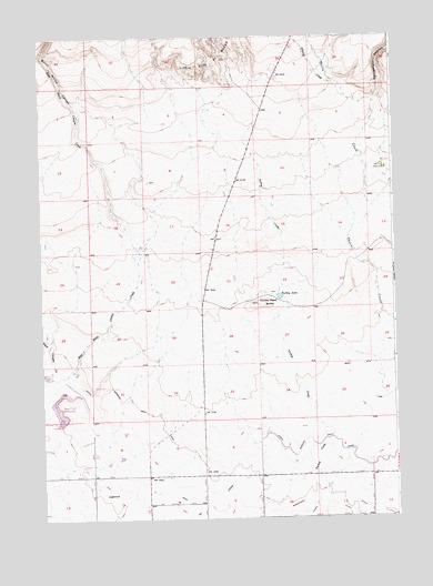
Thorn Creek SW, ID USGS Topographic Map
Click on map above to begin viewing in our Map Viewer.

This topographic map contains these locations and features:
Feature Name Type Latitude Longitude GNIS ID View Map
Burnt Willow CanyonValleyN43.1060°W114.7367°371808View Map
Dog CreekCanalN43.0323°W114.7414°2707083View Map
Dog Creek DamDamN43.0249°W114.7442°398637View Map
Dog Creek ReservoirReservoirN43.0264°W114.7420°395734View Map
Dog Creek Reservoir Public Fishing AreaLocaleN43.0338°W114.7420°401285View Map
East Black Canyon CreekStreamN43.0371°W114.7489°372540View Map
Lateral 1300CanalN43.0110°W114.6292°2709268View Map
Lateral 1310CanalN43.0074°W114.6344°2709270View Map
Lateral 1429CanalN43.0090°W114.6640°2709271View Map
Lateral 1465ACanalN43.0003°W114.6969°2709272View Map
Lateral 1566CanalN43.0130°W114.7037°2709292View Map
Lateral 1590CanalN43.0122°W114.7168°2709293View Map
Lateral 1590ACanalN43.0115°W114.7288°2709294View Map
Lateral 1660CanalN43.0275°W114.7225°2709296View Map
Little City of RocksPillarN43.1191°W114.6887°373615View Map
North Gooding Main CanalCanalN43.0141°W114.6876°374213View Map
Randolf DitchCanalN43.0041°W114.6871°2707143View Map
Randolf PipeLocaleN43.0011°W114.6910°2707144View Map
Rattlesnake CanyonValleyN43.1082°W114.6306°374584View Map
Robertson DitchCanalN43.0041°W114.6826°374710View Map
Schooler CreekStreamN43.1093°W114.6414°374923View Map
The ThornsWoodsN43.0910°W114.6295°401662View Map
Turkey CreekStreamN43.0063°W114.6534°375601View Map
Turkey Head ButteSummitN43.0555°W114.6734°398267View Map
Turkey LakeReservoirN43.0575°W114.6660°392455View Map
Union DitchCanalN43.0032°W114.6512°375660View Map
Union SpillwayCanalN43.0017°W114.6534°2707147View Map

Note: Coordinates in the location and feature list above are referenced to NAD83 datum.


Copyright (C) 2008-2024 Ryan Niemi / Sunset Dynamics ... All Rights Reserved